Jelep La
This article needs additional citations for verification. (December 2015) |
| Jelep La | |
|---|---|
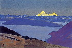 Jelep La Tibetan Frontier by Nicholas Roerich | |
| Elevation | 4,270 m (14,009 ft) |
| Location | India (Sikkim) – China (Tibet Autonomous Region) |
| Range | Himalaya |
| Coordinates | 27°22′02″N 88°51′57″E / 27.367194°N 88.865747°ECoordinates: 27°22′02″N 88°51′57″E / 27.367194°N 88.865747°E |
 | |


| Jelep La | |||
|---|---|---|---|
| Traditional Chinese | 則里拉山口 | ||
| Simplified Chinese | 则里拉山口 | ||
| |||
Jelep La or Jelap La (Tibetan: རྫི་ལི་ལ, Wylie: rdzi li la),[1] elevation 4,267 m or 13,999 ft, is a high mountain pass between East Sikkim District, Sikkim, India and Tibet Autonomous Region, China. It is on a route that connects Lhasa to India. The pass is about 4 km (2.5 mi) south of Nathu La and is slightly higher. It was frequently used for trade between Tibet and India during the British Raj, with Kalimpong serving as the contact point. The Menmecho Lake lies below the Jelep La.
Name[]
According to the Bengal District Gazetteer, Jelep-la, a Tibetan name, means "The lovely level pass, so called because it is the easiest and most level of all the passes between Tibet and Sikkim."[2]
According to scholar Alex Mckay, the Tibetan name is actually Wylie: rdzi-li-la,[1] which would mean a "shepherd's bronze pass".[3]
Geography[]

On the Indian side there are two routes to Jelep La, one through Gangtok and the other through Kalimpong.
The Kalimpong route is an ancient one[citation needed] which was responsible for the boost in the local economy due to the trading of wool and furs early last century. It passes through the towns of Rongli, Rhenock, Pedong, Algarah, in Sikkim and northern West Bengal.
The route from Gangtok passes through the towns of Sherathang, nearby Changu lake and alongside Nathu La and through Kupup.
The route is scenic with forests of rhododendrons blooming in spring. Numerous hamlets are scattered in the surrounding area. On the Tibetan side the pass leads to the Chumbi Valley of the Tibetan Plateau.
History[]
17th century[]
In the 17th century, Jelep La might have been under the control of an eastern Sikkimese kingdom called Damsang (Wylie: dam bzang rdzong) ruled by Gyalpo Ajok (Wylie: rgyal po A lcog; Lepcha: Gyabo Achuk). The Gyalpo was allied with Tibet under the 5th Dalai Lama and was rivalled by Bhutan. In a war fought by Tibet and Damsang against Bhutan during 1675–79, Gyalpo Ajok captured a Bhutanese outpost at Dalingkha (Wylie: Brda gling kha). The Bhutanese recaptured the post and executed Ajok.[4]
British Raj period[]
After the appropriation of Kalimpong by the British, they started to construct roads into Sikkim around 1884.[5] This was viewed with some apprehension among the Tibetans and in 1886 a small Tibetan militia occupied the region around the pass. In May 1888, they attacked the British but were warded off by a British Expeditionary Force. Later in September the same year the British regained control of the area around the pass.
With the growing Russian influence in Tibet, a British expedition was sent via Jelep La to Lhasa in 1904 led by Colonel Francis Younghusband. This expedition was met by hostile Tibetan forces which were defeated by the British. A trade agreement was then forced on the Tibetans in the absence of the 13th Dalai Lama, who had fled to Mongolia.
In 1910, to escape a Chinese invasion, the 13th Dalai Lama "accompanied by six ministers and a small escort" which included his close aide, diplomat and military figure Tsarong Dzasa, fled via Jelep La[6] to Sikkim and Darjeeling, where they stayed almost two years. During this period he was invited to Calcutta by the Viceroy, Lord Minto, which helped restore relations with the British.[7]
Modern period[]
After India's independence in 1947, Sikkim, which was then a monarchy, agreed to a special protectorate status and gave India the status of a suzerain nation and its defence and foreign affairs were managed by India. After the Chinese invasion of Tibet in 1950 and suppression of the Tibetan uprising in 1959, the passes into Sikkim became a conduit for refugees from Tibet before being closed by the Chinese. During the 1962 Sino-Indian War, there were border skirmishes between the Indian and Chinese armed forces in and around the passes of Jelep La and Nathu La - this was despite Sikkim still being a separate Kingdom at that stage. After the war the two passes were closed.[8][9]
Sikkim became a part of India in early 1975 following a referendum. With the recent thawing in relations between India and China, plans are afoot to reopen the Jelep La (following the July 6, 2006 reopening of the Nathu La) which is projected to result in an economic boom for the region.
References[]
- ^ Jump up to: a b McKay, Alex (2013), Pilgrimage in Tibet, Taylor & Francis, p. 75, ISBN 978-1-136-80716-9
- ^ O'Malley, L. S. S. (1907). Bengal District Gazetteer : Darjeeling. Concept Publishing Company. p. 215. ISBN 978-81-7268-018-3.
- ^ THL Tibetan to English Translation Tool: rdzi li la, The Tibetan & Himalayan Library, retrieved 1 August 2021.
- ^ Mullard, Opening the Hidden Land (2011), pp. 148–149.
- ^ Paget, William Henry (1907). Frontier and overseas expeditions from India. Indian Army Intelligence Branch. p. 42.
- ^ The Thirteenth Dalai Lama, Thupten Gyatso Archived 2012-09-12 at WebCite, dalailama.com
- ^ Chapman, F. Spencer (1940), Lhasa – The Holy City, London: Readers Union Ltd. – via archive.org
- ^ "Business News Today: Read Latest Business news, India Business News Live, Share Market & Economy News".
- ^ "Will India and China fight a war again?". 26 September 2012.
Bibliography[]
- Harris, Tina (2013). Geographical Diversions: Tibetan Trade, Global Transactions. University of Georgia Press, United States. ISBN 0820345733.
- Mullard, Saul (2011), Opening the Hidden Land: State Formation and the Construction of Sikkimese History, BRILL, ISBN 90-04-20895-X
External links[]
- Indian Road from Kalimpong to Kupup (close to Jelep La), OpenStreetMap, retrieved 5 July 2021.
- China's Azul Road from Jelep La to the Chumbi Valley, OpenStreetMap, retrieved 5 July 2021.
| show Mountain passes of China |
|---|
- Mountain passes of Sikkim
- Mountain passes of Tibet
- China–India border crossings
- Yadong County
- Mountain passes of the Himalayas
- East Sikkim district