Jeongeup
Jeongeup
정읍시 | |
|---|---|
Municipal City | |
| Korean transcription(s) | |
| • Hangul | 정읍시 |
| • Hanja | 井邑市 |
| • Revised Romanization | Jeongeup-si |
| • McCune-Reischauer | Chŏngŭp-si |
 Jeongeup seen from Seonghwangsan | |
 Flag Emblem of Jeongeup | |
 Location in South Korea | |
| Coordinates: 35°34′N 126°51′E / 35.567°N 126.850°ECoordinates: 35°34′N 126°51′E / 35.567°N 126.850°E | |
| Country | South Korea |
| Region | Honam |
| Province | North Jeolla |
| Administrative divisions | 1 eup, 14 myeon, 12 dong |
| Area | |
| • Total | 692.66 km2 (267.44 sq mi) |
| Population (2015) | |
| • Total | 110,194 |
| • Density | 1=159.1/km2 (0/sq mi) |
| • Dialect | Jeolla |

Jeongeup (Korean pronunciation: [tsʌŋ.ɯp̚]), also known as Jeongeup-si, is a city in North Jeolla Province, South Korea. The city limits include Naejang-san National Park, a popular destination particularly in autumn due to its foliage. Jeongeup is on the Honam Expressway and Honam Line, with the Seohaean Expressway also within easy reach, providing links to Seoul and Mokpo.
Demographics[]
Jeongeup's population is in decline, with an average of 56 people moving to the city every day but 91 leaving, with the birth and death rates being equal. The divorce rate currently runs at 50%.[1]
Geography[]
The main hills in Jeongeup are Naejang-san National Park and Ibamsan, though there are also several smaller hills in the city. It is the east of the city which is more mountainous, the west being a plain around the Dongjin River. There are several streams in Jeongeup, most notably the Jeongeupcheon, a tributary of the Dongjin. This over went a makeover by the city council in December 2009.
Attractions[]
Jeongeup, like many cities in Korea, had a hyanggyo, or Confucian school, where people were trained in Confucian ways. This building is a tourist attraction today, but is not open to the public.
Jeongeup is known for a traditional song from the Baekje Kingdom era, known as Jeongeup-ga. The song tells the tale of the lamenting heart of a woman waiting for her peddler husband's return.
Naejangsa Temple: first erected in 636, but most of its current buildings were built after the Japanese invasions of Korea in 1597 and the Korean War.[2] On 31 October 2012, the temple was destroyed in a fire that broke out.[3]
Festivals[]
A maple festival around Naejang-san is held annually. The maple leaves here are widely regarded as some of the most beautiful in the country. The festival was abolished in 2002 but was revived in 2007.[4][full citation needed] This festival includes several events regarding the chrysanthemum love.
Additionally, a century ago, Jeongeup was the site of a revolution by the religious movement of Cheondoism. A lot of peasants joined the movement against the Japanese invaders. For this, Jeongeup holds an annual ceremony to commemorate the event.[5]
Notable people[]
- Seung Hwan Oh, professional baseball player, Olympic gold medalist
- Song Dae-kwan, singer
- Yu Sung-yup, politician
Twin towns – sister cities[]
This section does not cite any sources. (July 2018) |
Jeongeup is twinned with:
 Jongno-gu, Seoul
- Sacheon, South Gyeongsang
- Sokcho, Gangwon
- Suseong-gu, Daegu
 Xuzhou, Jiangsu, China
 Narita, Chiba, Japan
Climate[]
Jeongeup has a cooler version of a humid subtropical climate (Köppen climate classification Cfa).
| hideClimate data for Jeongeup (1981–2010, extremes 1969–present) | |||||||||||||
|---|---|---|---|---|---|---|---|---|---|---|---|---|---|
| Month | Jan | Feb | Mar | Apr | May | Jun | Jul | Aug | Sep | Oct | Nov | Dec | Year |
| Record high °C (°F) | 18.5 (65.3) |
21.5 (70.7) |
27.3 (81.1) |
31.0 (87.8) |
34.1 (93.4) |
34.2 (93.6) |
37.3 (99.1) |
37.8 (100.0) |
35.0 (95.0) |
30.5 (86.9) |
27.6 (81.7) |
19.6 (67.3) |
37.8 (100.0) |
| Average high °C (°F) | 4.3 (39.7) |
6.7 (44.1) |
12.3 (54.1) |
19.4 (66.9) |
24.3 (75.7) |
27.8 (82.0) |
30.2 (86.4) |
31.1 (88.0) |
26.9 (80.4) |
21.4 (70.5) |
14.0 (57.2) |
7.2 (45.0) |
18.8 (65.8) |
| Daily mean °C (°F) | −0.5 (31.1) |
1.3 (34.3) |
6.0 (42.8) |
12.3 (54.1) |
17.8 (64.0) |
22.0 (71.6) |
25.5 (77.9) |
25.9 (78.6) |
21.2 (70.2) |
14.9 (58.8) |
8.2 (46.8) |
2.1 (35.8) |
13.1 (55.6) |
| Average low °C (°F) | −4.8 (23.4) |
−3.3 (26.1) |
0.6 (33.1) |
6.0 (42.8) |
11.8 (53.2) |
17.1 (62.8) |
21.8 (71.2) |
21.9 (71.4) |
16.6 (61.9) |
9.4 (48.9) |
3.2 (37.8) |
−2.3 (27.9) |
8.2 (46.8) |
| Record low °C (°F) | −19.8 (−3.6) |
−20.0 (−4.0) |
−10.9 (12.4) |
−4.2 (24.4) |
2.4 (36.3) |
8.5 (47.3) |
13.1 (55.6) |
11.6 (52.9) |
5.6 (42.1) |
−1.5 (29.3) |
−10.4 (13.3) |
−15.2 (4.6) |
−20.0 (−4.0) |
| Average precipitation mm (inches) | 40.2 (1.58) |
41.3 (1.63) |
55.2 (2.17) |
75.3 (2.96) |
94.6 (3.72) |
156.1 (6.15) |
279.7 (11.01) |
270.3 (10.64) |
151.0 (5.94) |
54.3 (2.14) |
57.8 (2.28) |
41.6 (1.64) |
1,317.3 (51.86) |
| Average precipitation days (≥ 0.1 mm) | 10.1 | 8.0 | 8.9 | 7.4 | 8.2 | 9.1 | 13.7 | 14.1 | 8.9 | 6.4 | 8.6 | 9.9 | 113.3 |
| Average snowy days | 9.4 | 6.0 | 2.5 | 0.1 | 0.0 | 0.0 | 0.0 | 0.0 | 0.0 | 0.0 | 2.2 | 7.1 | 27.4 |
| Average relative humidity (%) | 74.4 | 70.7 | 66.3 | 62.7 | 65.5 | 71.4 | 77.3 | 76.6 | 75.5 | 71.8 | 72.2 | 74.4 | 71.6 |
| Mean monthly sunshine hours | 149.0 | 161.0 | 195.7 | 225.4 | 235.8 | 193.5 | 174.6 | 195.6 | 191.0 | 206.3 | 157.2 | 141.5 | 2,229 |
| Percent possible sunshine | 47.8 | 52.4 | 52.8 | 57.4 | 54.2 | 44.4 | 39.4 | 46.8 | 51.3 | 58.9 | 50.8 | 46.5 | 50.1 |
| Source: Korea Meteorological Administration[6][7][8] (percent sunshine and snowy days)[9] | |||||||||||||
Gallery[]

Looking downstream along the Jeongeupcheon from Chosangyo
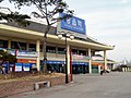
Jeongeup Station
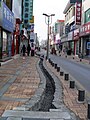
Street in central Jeongeup

Hyanggyo

Chungryeolsa
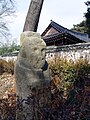
Statue guarding Chungryeolsa

Memorial to those who fell defending South Korea


See also[]
- Naejang-san
- List of cities in South Korea
References[]
- ^ 녹두꽃피고 파랑새나는 정읍 만들기. Jeongeup City Council. Archived from the original on 15 February 2005. Retrieved 5 February 2009.
- ^ Cin, Woo Lee (10 February 2012). "Simply stunning: 33 incredible Korean temples". CNN Travel. Retrieved 12 April 2012.
- ^ "Temple lost to fire". The Hankyoreh. 1 November 2012. Retrieved 25 February 2013.
- ^ [Wonderful maple of Naejang mountain] 내장산 단풍… 마냥 고와서 문득 서러워라 국민일보2007.11.01
- ^ ""Welcome to honam Udo nongak"". Archived from the original on 10 January 2005. Retrieved 26 January 2008.
- ^ 평년값자료(1981–2010) 정읍(245) (in Korean). Korea Meteorological Administration. Retrieved 4 May 2011.
- ^ 기후자료 극값(최대값) 전체년도 일최고기온 (℃) 최고순위, 정읍(245) (in Korean). Korea Meteorological Administration. Retrieved 25 February 2017.
- ^ 기후자료 극값(최대값) 전체년도 일최저기온 (℃) 최고순위, 정읍(245) (in Korean). Korea Meteorological Administration. Retrieved 25 February 2017.
- ^ "Climatological Normals of Korea" (PDF). Korea Meteorological Administration. 2011. p. 499 and 649. Archived from the original (PDF) on 7 December 2016. Retrieved 25 February 2017.
External links[]
| Wikivoyage has a travel guide for Jeongeup. |

| Authority control |
|
|---|
- Jeongeup
- Cities in North Jeolla Province