Jerangle
| Jerangle New South Wales | |||||||||||||||
|---|---|---|---|---|---|---|---|---|---|---|---|---|---|---|---|
 Jerangle Public School | |||||||||||||||
 Jerangle | |||||||||||||||
| Coordinates | 35°52′13″S 149°21′54″E / 35.87028°S 149.36500°ECoordinates: 35°52′13″S 149°21′54″E / 35.87028°S 149.36500°E | ||||||||||||||
| Population | 96 (2016 census)[1] | ||||||||||||||
| Postcode(s) | 2630 | ||||||||||||||
| Elevation | 1,120 m (3,675 ft) | ||||||||||||||
| Location | |||||||||||||||
| LGA(s) | Snowy Monaro Regional Council | ||||||||||||||
| State electorate(s) | Monaro | ||||||||||||||
| Federal Division(s) | Eden-Monaro | ||||||||||||||
| |||||||||||||||

Jerangle is a locality in New South Wales, Australia.[2][3] The locality is in the Snowy Monaro Regional Council local government area, 366 kilometres (227 mi) south of the state capital, Sydney and 112 kilometres (70 mi) south east of the national capital, Canberra.[4] At the 2016 census, Jerangle had a population of 96.[1]
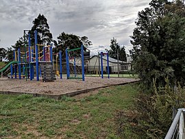
Jerangle has a cemetery, two churches, a school, a Country Women's Association hall and phone box.[citation needed] The main location is the school; Jerangle Public School. This school has had small numbers of students that range from 6–20.[citation needed] The school was established as a "house to house" school in 1884, but has operated at a permanent location since 1892, although generally as a "half-time" school until 1923.[5]
References[]
- ^ Jump up to: a b Australian Bureau of Statistics (27 June 2017). "Jerangle (State Suburb)". 2016 Census QuickStats. Retrieved 7 July 2017.

- ^ "Jerangle". Geographical Names Register (GNR) of NSW. Geographical Names Board of New South Wales. Retrieved 16 August 2017.
- ^ "Jerangle". OpenStreetMap. Retrieved 16 August 2017.
- ^ "Jerangle". Cooma-Monaro Shire Council. 17 September 2011.
- ^ "Jerangle Public School in the School history database search". New South Wales Department of Education. Retrieved 25 December 2017.
This New South Wales geography article is a stub. You can help Wikipedia by . |
- Towns in New South Wales
- New South Wales geography stubs