John Speed
John Speed | |
|---|---|
 Memorial to John Speed, St Giles-without-Cripplegate | |
| Born | 1551 or 1552 Farndon, Cheshire |
| Died | 1629 (aged 76–77) St Giles-without-Cripplegate, Cripplegate, London |
| Nationality | English |
| Scientific career | |
| Fields | Cartography, history |
John Speed (1551 or 1552 – 28 July 1629) was an English cartographer and historian.[1][2][3] He is, alongside Christopher Saxton, one of the best known English mapmakers of the early modern period.[4][5][6]
Life[]
Speed was born in the Cheshire village of Farndon and went into his father John Speed's tailoring business later in life.[7][8][9]
While working in London, Speed was a tailor and member of a corresponding guild, and came to the attention of "learned" individuals.[10] These individuals included Sir Fulke Greville, who subsequently made him an allowance to enable him to devote his whole attention to research. By 1598 he had enough patronage to leave his manual labour job and "engage in full-time scholarship".[10] As a reward for his earlier efforts, Queen Elizabeth granted Speed the use of a room in the Custom House. Speed, was, by this point, a "tailor turned scholar" who had a highly developed "pictorial sense".[11]
In 1575, Speed married a woman named Susanna Draper in London, later having children with her. These children definitely included a son named John Speed, later a "learned" man with a doctorate, and an unknown number of others, since chroniclers and historians cannot agree on how many children they raised.[2][12][13][14][15] Regardless, there is no doubt that the Speed family was relatively well-off.[16]
By 1595, Speed published a map of biblical Canaan, in 1598 he presented his maps to Queen Elizabeth, and in 1611–1612 he published maps of Great Britain, with his son perhaps assisting Speed in surveys of English towns.[17][18][19]
At the age of 77 or 78, in July 1629, Speed died.[9] He was buried alongside his wife in London's St Giles-without-Cripplegate church on Fore Street.[12][20][21] Later on, a memorial to John Speed was also erected behind the altar of the church.[12] According to the church's website, "[His was] one of the few memorials [in the church] that survived the bombing" of London during The Blitz of 1940–1941 ... The website also notes that "[t]he cast for the niche in which the bust is placed was provided by the Merchant Taylors' Company, of which John Speed was a member". His memorial brass is now on display in the Burrell Collection near Glasgow.
Works[]
Speed drew historical maps in 1601 and 1627 depicting the invasion of England and Ireland, depictions of the English Middle Ages, along with those depicting the current time, with rough originals but appealing, colourful final versions of his maps.[22][23]
It was with the encouragement of William Camden that Speed began his Historie of Great Britaine, which was published in 1611.[24][25] Although he probably had access to historical sources that are now lost to us (he certainly used the work of Saxton and Norden), his work as a historian is now considered secondary in importance to his map-making, of which his most important contribution is probably his town plans, many of which provide the first visual record of the British towns they depict.[26] In the years leading up to this point, while his atlas was being compiled, he sent letters to Sir Robert Cotton to ask for assistance in gathering necessary materials.[27]
Speed's atlas The Theatre of the Empire of Great Britaine was published in 1611 and 1612, and contained the first set of individual county maps of England and Wales besides maps of Ireland and a general map of Scotland.[28][29][30] Tacked onto these maps was an introduction at the beginning when he addressed his "well affected and favourable reader", which had numerous Christian and religious undertones, admitting that there may be errors, but he had made it the best he could, and stated his purpose for the atlas:[31]
my purpose...is to shew the situation of every Citie and Shire-town only [within Great Britain]...I have separated...[with] help of the tables...any Citie, Towne, Borough, Hamlet, or Place of Note...[it] may be affirmed, that there is not any one Kingdome in the world so exactly described...as is...Great Britaine...In shewing these things, I have chiefly sought to give satisfaction to all.
With maps as "proof impressions" and printed from copper plates, detail was engraved in reverse with writing having to be put on the map the correct way, while speed "copied, adapted and compiled the work of others", not doing much of the survey work on his own, which he acknowledged.[12][32][33] The atlas was not above projections of his political opinions" Speed represented King James I as one who unified the "Kingdoms of the British isles".[34] In 2016, the British Library published a book, introduced by former MP Nigel Nicolson and accompanied by commentaries by late medieval and early modern historian Alasdair Hawkyard, which reprinted this collection of maps on the British Isles, showing that Speed had drawn maps of areas ranging from Bedfordshire to Norfolk and Wales.[35]
Most, but not all, of the county maps have town plans on them; those showing a Scale of Passes being the places he had mapped himself. In 1627, two years before his death, Speed published Prospect of the Most Famous Parts of the World which was the first world atlas produced by an Englishman, costing 40 shillings, meaning that its circulation was limited to "richer customers and libraries", where many survive to this day.[36][37]
There is a text describing the areas shown on the back of the maps in English, although a rare edition of 1616 of the British maps has a Latin text – this is believed to have been produced for the Continental market. Much of the engraving was done in Amsterdam at the workshop of a Flemish man named Jodocus Hondius, with whom he collaborated with from 1598 until 1612, with Hondius's sudden death, a time period of 14 years.[36] His maps of English and Welsh counties, often bordered with costumed figures ranging from nobility to country folk, are often found framed in homes throughout the United Kingdom.[38]
In 1611, he also published The genealogies recorded in the Sacred Scriptures according to euery family and tribe with the line of Our Sauior Jesus Christ obserued from Adam to the Blessed Virgin Mary, a biblical genealogy, reprinted several times during the 17th century. He also drew maps of the Channel Islands, Poland, and the Americas, the latter published only a few years before his death.[39][40][41][42] On the year of his death, yet another collection of maps of Great Britain he had drawn the year before were published.[43][44]
Described as a "Protestant historian", "Puritan historian" or "Protestant propagandist" by some, Speed wrote about William Shakespeare, whom he called a "Superlative Monster" because of certain plays, Roman conquest, history of Chester, and explored "early modern concepts of national identity".[clarification needed][45][46][47][48][49][self-published source][50][51][52] As these writings indicate, he possibly saw Wales as English and not an independent entity. More concretely, there is evidence that Speed, in his chronicling of history, uses "theatrical metaphors" and his developed "historiographic skill" to work while he repeats myths from medieval times as part of his story.[53]
Legacy[]
Since his maps were used in many circles, Speed's legacy has been long-reaching. After his death, in 1673 and 1676, some of his other maps on the British isles, the Chesapeake Bay region, specifically of Virginia and Maryland, the East Indies, the Russian Empire then ruled by Peter the Great, Jamaica, and Barbados, among other locations.[clarification needed][54][55][56][57][58][59][60][61][62][63][64] With these printings and others, Speed's maps became the basis for world maps until at least the mid-eighteenth century, with his maps reprinted many times, and served as a major contribution to British topography for years to come.[17]
In later years, Speed would be called "our English Mercator", a person of "extraordinary industry and attainments in the study of antiques", an "honest and impartial historian", a "faithful Chronologer", and "our Cheshire historian...a scholar...a distinguished writer on history".[65][66][67][68][69] He was also called a "celebrated chronologer and histographer", "cartographer", and much more.[70]
Even today, prints of his "beautiful maps" are in high demand.[71] Additionally, some use John Speed's maps, and connected commentary, to interpret William Shakespeare's plays; however, Speed did not like Shakespeare in the slightest, and called him a "papist".[50][72][73][74]
Maps[]

Speed's 1610 map of Wales

An example of an insert from Speed's 1610 map of Wales

The Countie Pallatine of Lancaster described and divided into hundreds, 1610
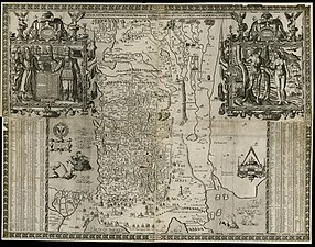
4 Page wall map of Canaan, 1595

Wilshire, 1610 with a townplan of Salisbury and a view of Stonehenge

Northamptonshire, 1610

A New Mape of Ye XVII Provinces, 1626 (The Netherlands)

The Kingdome of China, 1626
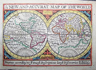
A New And Accvrat Map of the World, 1646 miniature edition

Jamaica, 1676

James VI, depicted in Speed's 1610 Royal Map of Scotland.
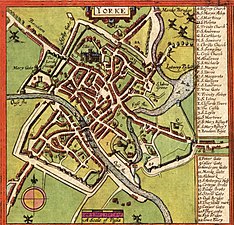
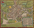
Speed's 1611 map of York


Town inserts[]

Bedforde, 1611

Dubline, 1610; an 1896 reprint

Monmouth, 1610
Oxford, 1610

Redding, 1610

Bangor, 1610

Brecon, 1610

Cardiff, 1610

Montgomery, 1610

St David's ,1610


Published works[]
- History of Great Britaine Under the Conquests of Romans, Saxons, Danes, and Normans (London, 1611)
- The genealogies recorded in the Sacred Scriptures according to euery family and tribe with the line of Our Sauior Jesus Christ obserued from Adam to the Blessed Virgin Mary (London, 1611)
- The Theatre of The Empire of Great Britaine, Presenting an exact geography of England, Scotland, and Ireland (London, 1611–12)
- Theatrum Imperii Magnae Britaine (London, 1616)
- England, Wales, Scotland and Ireland: Described and Abridged with Ye Historic Relation of Things Worthy Memory: from a Farr Larger Voulume (London, 1627) The "Farr Larger Volume" is The Theatre of The Empire of Great Britaine.
- A Prospect of the Most Famous Parts of the World (London, 1627)
References[]
- ^ Baynton-Williams, Ashley. "John Speed". MapForum.Com. Retrieved 17 September 2012.
- ^ Jump up to: a b "Life of John Speed", The Hibernian Magazine, Or, Compendium of Entertaining Knowledge, July 1782, p. 348
- ^ John Speed, Nigel Nicolson (introduction), The Counties of Britain: A Tudor Atlas, Thames & Hudson (1989): ISBN 0-500-25104-5; Pavilion Books (1992): ISBN 1-85145-131-5 (pbk, 1995): ISBN 1-85793-612-4.
- ^ "Maps by John Speed". Jonathan Potter Limited. Archived from the original on 3 March 2012. Retrieved 17 September 2012.
- ^ Intriguing History, "John Speed Maps Online", 2017.
- ^ Hewitt, Rachel (2010). Map of a Nation. London: Granta Publications. pp. xxvi. ISBN 978-1-84708-254-1.
- ^ Palmer, Alfred Neobard (1907). "The Town of Holt, in County Denbigh". Archaeologia Cambrensis. 6th ser. 7: 389–434 (425).
- ^ William West, The history, topography and directory of Warwickshire (Birmingham, R. Wrightson, 1830), pp. 36–37.
- ^ Jump up to: a b "Smith, Philip (1817–1885)", Oxford Dictionary of National Biography, Oxford University Press, 6 February 2018, retrieved 27 July 2021
- ^ Jump up to: a b Walter Goffart, Historical Atlases: The First Three Hundred Years, 1570–1870 (Chicago: University of Chicago Press, 2003),54.
- ^ Walter Goffart, "The First Venture into 'Medieval Cartography'", Alfred the Wise: Studies in Honour of Janet Bately on the Occasion of Her Sixty-Fifth Birthday, ed. Jane Annette Roberts, Janet Laughland Nelson, and Malcolm Godden (Woodbridge, UK: D.S. Brewer, 1997), 57–58.
- ^ Jump up to: a b c d Anne Taylor, "A Theatre of Treasures", Cambridge University Library Special Collections, 11 October 2016.
- ^ Miscellanea Genealogica Et Heraldica, ed. Joseph Jackson Howard, Vol. II (London: Mitchell and Hughes, 1898), pp. 18–25. While this genealogy says he was born in 1542 and has other dates that conflict with existing records, it does list names of his children: Samuel Speed (later married to a woman named Joan, had a child also named Samuel Speed who died in 1633), Nathan Speed, Joan Speed (later married to John Hayley), Sarah Speed (later married to Edward Black), Anne Speed (later married to Benjamin Wesley), and later Dr. John Speed (later married to a woman named Margaret, had one child named Samuel Speed, died in 1640) Taylor says that Speed and Susanna had 18 children, while Hibernian Magazine says they had 12 sons and six daughters, with a total of 21 children, neither of which can be independently confirmed, making it seem that they only had 6 or 7 children. Susanna was also reportedly the daughter of Thomas Draper.
- ^ Kell, E. (1865). "On the Castle and Other Ancient Remains at Southampton". Journal of the British Archaeological Association. 21: 289–290.
- ^ Richard Gough, Anecdotes of British Topography: Or, an Historical Account of What Has Been Done For Illustrating The Topographical Antiquities of Great Britain and Ireland (London: W. Richardson and S. Clark, 1768, reprinted in 2014), 184, 448.
- ^ Palmer, "The Town of Holt", 421, 425, 429.
- ^ Jump up to: a b The Maps of John Speed Archived 12 April 2016 at the Wayback Machine, Shakespeare's England, 10 August 2010.
- ^ The King James Version at 400: Assessing Its Genius as Bible Translation and Its Literary Influence, ed. David G. Burke, John F. Kutsko, and Philip H. Towner (Atlanta: Society of Biblical Literature, 2013), vi, 102, 104–119, 121, 159, 182.
- ^ Tiffany J. Werth, The Fabulous Dark Cloister: Romance in England after the Reformation (Baltimore: Johns Hopkins University Press, 2011), 49.
- ^ "Heritage". St Giles' without Cripplegate. Retrieved 17 September 2012.
- ^ Hibbert, Christopher; Ben Weinreb; John Keay; Julia Keay (2010). The London Encyclopaedia. London: Pan Macmillan. p. 762. ISBN 978-0-230-73878-2.
- ^ Goffart, Historical Atlases, pp. xi, 38, 54, 80–81, 83, 105, 112, 123, 201, 203, 443, 471.
- ^ Gough, Anecdotes of British Topography, 595, 608.
- ^ . Dictionary of National Biography. London: Smith, Elder & Co. 1885–1900.
- ^ John Speed proof maps, Cambridge University, Accessed 5 April 2017.
- ^ Nigel Nicolson, "Introduction" within John Speed, Britain's Tudor Maps: County by County (London: British Library, reprint, 2016, originally published in 1988), pp. 7–15.
- ^ Henry Ellis, Original Letters of Eminent Literary Men (London: Camden Society, 1843), 104, 108–113.
- ^ Speed, Britain's Tudor Maps, pp. 9–10, 13, 15–16. Nicolson's introduction goes from pages 7 to 15. Speed took a number of existing maps as his models, crediting five of the maps to Christopher Saxton, five to John Horden, two to William Smith, one to Philip Symonson and others to John Harington, William White, Thomas Durham, James Burrell, and Geradus Mercator. For these maps, his engraver was a Flemish man by the name of Jodocus Hondius, major engraver at the time, his printers were William Hall and John Beale, and his map-sellers were John Sudbury and George Humble.
- ^ Andrew, "Speed maps now in the Cambridge Digital Library", Cambridge University Library Special Collections, 23 March 2015.
- ^ Gough, Anecdotes of British Topography, 42.
- ^ West, "Speed's Address to His Readers", The history, topography and directory of Warwickshire, pp. 38–41.
- ^ Andrew McRae, God Speed the Plough: The Representation of Agrarian England, 1500–1660 (Cambridge, UK: Cambridge University Press, 2002, reprint), pp. xi, 231–232, 238.
- ^ Nicholas Canny, "The Origins of Empire: An Introduction", The Oxford History of the British Empire series, The Origins of Empire: British Overseas Enterprise to the Close of the Seventeenth Century, Vol. I, ed. Nicholas Canny (New York: Oxford University Press, 2005, reprint), 1. Speed was the one to use the phrase "the Empire of Great Britaine" which differed from another phrase used, by Thomas Blennerhasset, at the time: "great Brittaines imperial crowne".
- ^ British Identities and English Renaissance Literature, ed. David J. Baker and Willy Maley (Cambridge, UK: Cambridge University Press, 2002), ix, 135, 138, 141, 150, 162, 248.
- ^ Speed, Britain's Tudor Maps, pp. 6–152. Speed's maps were of areas including the British Isles, England, the Saxon Heptarchy, Berkshire, Buckinghamshire, Cambridgeshire, Cheshire, Cornwall, Cumberland, Derbyshire, Devonshire, Dorset, Durham, Essex, Gloucestershire, Hampshire, Isle of Wight, Herefordshire, Hertfordshire, Huntingtonshire, Kent, Lancashire, Leicestershire, Lincolnshire, Middlesex, Monmouthshire, Northamptonshire, Northumberland, Oxfordshire, Rutland, Shropshire, Somerset, Staffordshire, Suffolk, Surrey, Sussex, Warwickshire, Westmoreland, Wiltshire, Worcestershire, Yorkshire (different parts), Holy Island, the Farne Islands, the Channel Islands, Isle of Man, Wales, Anglesey, Breconshire, Caernarfonshire, Cardiganshire, Carmarthenshire, Denbighshire, Flintshire, Glamorganshire, Merionethshire, Montgomeryshire, Pembrokeshire, Radnorshire, Scotland, Ireland, Connaught, Leinster, Munster, and Ulster.
- ^ Jump up to: a b Nigel Nicolson, "Introduction" within Speed, Britain's Tudor Maps, p. 15.
- ^ Marion Wynne-Davies, Sidney to Milton, 1580–1660 (New York: Palgrave Macmillan, 2003), pp. 138–141, 171, 179–180, 197.
- ^ Speed, Britain's Tudor Maps, pp. 18–21.
- ^ Library of Congress, America with those known parts in that unknowne worlde both people and manner of buildings, 1626.
- ^ Library of Congress catalog, The ilands, London. Are to be solde in Popes Heade Alley by Iohn Sudb. and G. Humbell, 1610.
- ^ Library of Congress catalog, newe mape of Poland, 1611.
- ^ Francis J. Bremer, John Winthrop: America's Forgotten Founding Father (New York: Oxford University Press, 2013), 206.
- ^ Library of Congress catalog,A prospect of the most famovs parts of the vvorld, London, Printed by John Dawson for G. Humble, 1627.
- ^ Thomas Suarez, Early Mapping of Southeast Asia: The Epic Story of Seafarers, Adventurers, and Cartographers Who First Mapped the Regions Between China and India (London: Tuttle Publishing, 2012), 512.
- ^ Herbert Jack Heller, [Penitent Brothellers: Grace, Sexuality, and Genre in Thomas Middleton's City Comedies](https://books.google.com/books?id=osKRuBKU344C) (Newark: University of Delaware Press, 2000), 181.
- ^ Boudica: Historical Commentaries, Poetry, and Plays, ed. Charles Aleks Matza Jr. (USA: XLibris, 2010), pp. 83–90.
- ^ Christopher Ivic, "'bastard Normans, Norman bastards': Anomalous Identities in The Life of Henry the Fift", Shakespeare and Wales: From the Marches to the Assembly, ed. Philip Schwyzer and Willy Maley (Burlington, VT: Ashgate Publishing Company, 2010), pp. 75–82.
- ^ Charles Hulbert, Cheshire antiquities, Roman, baronial, and monastic: a re-publication of genuine copper plates (Schrewsbury and Providence Grove: C. Hulbert, 1838), pp. iii–iv, 56–61.
- ^ John Waterfield, The Heart of His Mystery: Shakespeare and the Catholic Faith in England Under Elizabeth and James (New York: iUniverse, 2009), 4, 643.[self-published source]
- ^ Jump up to: a b Theatre and Religion: Lancastrian Shakespeare, ed. Richard Dutton, Alison Gail Findlay, and Richard Wilson (Oxford, UK: Manchester University Press, 2003), 116, 127, 128, 236.
- ^ English Comedy, ed. Michael Cordner, Peter Holland, and John Kerrigan (Cambridge, UK: Cambridge University Press, 2006 reprint), 85, 98.
- ^ Richard Hingley, The Recovery of Roman Britain 1586–1906: A Colony So Fertile (New York: Oxford University Press, 2008), pp. 17, 21, 23, 36, 40, 44–53.
- ^ Igor Djordjevic, King John (Mis)Remembered: The Dunmow Chronicle, the Lord Admiral's Men, and the Formation of Cultural Memory (New York: Routledge, 2016), pp. 43, 61, 86, 117, 122.
- ^ Gough, Anecdotes of British Topography, 43.
- ^ 1676 John Speed and F. Lamb Map of Virginia and Maryland (Chesapeake Bay), Geographicus Rare Antique Maps, 2017.
- ^ Antique Maps Online, John Speed Maps – Antique 17th Century, 2017.
- ^ Heritage Publishing, "John Speed Maps", 2017.
- ^ Welland Antique Maps & Prints, "[Published in John Speed's 'Theatre of the Empire of Great Britaine' between 1611 & 1676 and Henry Overton's 'England Described' from c.1713 to c.1756](http://wellandantiquemaps.co.uk/catalog/john-speed-maps)", 2014.
- ^ Mapseeker, John Speed County Maps Archived 6 April 2017 at the Wayback Machine, 2014.
- ^ Ebth, "John Speed Original 1676 Map "The Province of Mounster"", 2013–2017.
- ^ Baumann Rare Books, "Map of Huntington both Shire and Shire Towne", 2017.
- ^ Charles Edwin Puckett, ""A Map of Russia", c.1676 – John Speed", 1676.
- ^ Library of Congress catalog, An epitome of Mr. John Speed's Theatre of the Empire of Great Britain, London, Printed for T. Basset, and R. Chiswell, 1676.
- ^ Library of Congress catalog, An epitome of Mr. John Speed's Theatre of the empire of Great Britain, London : Printed for Tho. Basset ... and Ric. Chiswell ..., 1676.
- ^ Thomas Park, "Edward, Long Montague", A Catalogue of the Royal and Noble Authors of England, Scotland, and Ireland, Vol. 3 (London: John Scott, 1806), 265.
- ^ A new and general biographical dictionary, Vol. 10 (London: Printed for multiple individuals, 1762), pp. 454–455.
- ^ Stephen Hyde Cassan, The Lives of the Bishops of Winchester from Birmius, Vol. 1 (London, C. and J. Rivington, 1827), 513.
- ^ T.B. Howell, A Complete Collection of State Trials and Proceedings for High Treason and Other Misdemeanors, Vol. 5 (London: T.C. Hansard, 1816), 827.
- ^ Charles Hulbert, "The Memoir of John Speed", Cheshire antiquities, pp. 62–65.
- ^ John Entick, A new and accurate history and survey of London, Westminster, Southwark, and Places Adjacent (London: Edward and Charles Dilly, 1766), 139.
- ^ Steven Morris, John Speed's atlas could take auctioneer into uncharted territory, The Guardian, 19 July 2011.
- ^ Velma Bourgeois Richmond, Shakespeare, Catholicism, and Romance (New York: Bloombury Publishing, 2015), 13.
- ^ Graham Holderness, The Faith of William Shakespeare (UK: British Library, 2016), 47.
- ^ Harold Bloom, William Shakespeare's Romeo and Juliet (New York: Infobase Publishing, 2009), 75.
External links[]
| Wikisource has original works written by or about: John Speed |
| Wikimedia Commons has media related to John Speed. |
- Zoomable digital reproduction of a 1611/12 proof of Speed's atlas The theatre of the empire of Great Britaine, held by Cambridge University Library.
- John Speed Online maps from Occidental College, Los Angeles.
- Information about John Speed and his maps from Antique Maps.
- John Speed and John Ogilby, 15-16th century cartographers, a guide to Speed and John Ogilby, with a focus on their cartographic works available at Stanford University.
- The entry for John Speed at the Find A Grave website.
| hide Authority control | |
|---|---|
| General |
|
| National libraries | |
| Art research institutes | |
| Biographical dictionaries | |
| Other |
|
- 1542 births
- 1629 deaths
- English cartographers
- 16th-century cartographers
- 17th-century cartographers
- Burials at St Giles-without-Cripplegate
- People from Cheshire
- 16th-century English writers
- 16th-century male writers
- English historians
- 16th-century historians
- 17th-century historians
- 17th-century English writers
- 17th-century English male writers
- English male non-fiction writers