Juniata Township, Huntingdon County, Pennsylvania
Juniata Township, Huntingdon County, Pennsylvania | |
|---|---|
 The dam for Raystown Lake | |
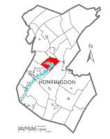 Map of Huntingdon County, Pennsylvania Highlighting Juniata Township | |
 Map of Huntingdon County, Pennsylvania | |
| Country | United States |
| State | Pennsylvania |
| County | Huntingdon |
| Area | |
| • Total | 20.17 sq mi (52.24 km2) |
| • Land | 16.72 sq mi (43.31 km2) |
| • Water | 3.45 sq mi (8.94 km2) |
| Population (2010) | |
| • Total | 554 |
| • Estimate (2016)[2] | 548 |
| • Density | 32.78/sq mi (12.65/km2) |
| Time zone | UTC-5 (Eastern (EST)) |
| • Summer (DST) | UTC-4 (EDT) |
| Zip code | 16652 |
| Area code(s) | 814 |
| FIPS code | 42-061-38608 |
| Local phone exchanges: 641, 643, 644 | |
Juniata Township is a township in Huntingdon County, Pennsylvania, United States. The population was 554 at the 2010 census.
Geography[]
According to the United States Census Bureau, the township has a total area of 20.1 square miles (52 km2), of which, 16.5 square miles (43 km2) of it is land and 3.6 square miles (9.3 km2) of it (17.85%) is water.
Adjacent Municipalities[]
All municipalities are located in Huntingdon County unless otherwise noted.
Demographics[]
| Historical population | |||
|---|---|---|---|
| Census | Pop. | %± | |
| 2000 | 553 | — | |
| 2010 | 554 | 0.2% | |
| 2016 (est.) | 548 | [2] | −1.1% |
| U.S. Decennial Census[3] | |||
At the 2010 census there were 554 people and 235 households within the township. The population density was 33.6 people per square mile (13.0/km2). There were 451 housing units at an average density of 21.3/sq mi (8.2/km2). The racial makeup of the township was 99.46% White, 0.18% African American, 0.18% Asian, and 0.18% from two or more races. Hispanic or Latino of any race were 0.18%.[4]
There were 235 households, 26.0% had children under the age of 18 living with them, 67.0% were married couples living together, 3.6% had a female householder with no husband present, and 26.8% were non-families. 23.2% of households were made up of individuals, and 9.8% were one person aged 65 or older. The average household size was 2.46 and the average family size was 2.87.
The age distribution was 18.4% under the age of 18, 2.2% from 18 to 19, 5.4% from 20 to 24, 6.9% from 25 to 34, 19.9% from 35 to 49, 25.3% from 50 to 64, and 22.0% 65 or older. The median age was 40 years. The population was 49.10% male, and 50.90% female.
References[]
- ^ "2016 U.S. Gazetteer Files". United States Census Bureau. Retrieved Aug 14, 2017.
- ^ a b "Population and Housing Unit Estimates". Retrieved June 9, 2017.
- ^ "Census of Population and Housing". Census.gov. Retrieved June 4, 2016.
- ^ "U.S. Census website". United States Census Bureau. Retrieved 2008-01-31.
Municipalities and communities of Huntingdon County, Pennsylvania, United States | ||
|---|---|---|
| Boroughs |  | |
| Townships | ||
| CDPs | ||
| Unincorporated communities | ||
| Ghost town | ||
| Footnotes | ‡This populated place also has portions in an adjacent county or counties | |
| ||
Coordinates: 40°25′00″N 78°02′59″W / 40.41667°N 78.04972°W

- Townships in Huntingdon County, Pennsylvania
- Townships in Pennsylvania