Oneida Township, Huntingdon County, Pennsylvania
Oneida Township, Pennsylvania | |
|---|---|
 United Methodist Church in Donation | |
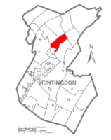 Map of Huntingdon County, Pennsylvania Highlighting Oneida Township | |
 Map of Huntingdon County, Pennsylvania | |
| Country | United States |
| State | Pennsylvania |
| County | Huntingdon |
| Area | |
| • Total | 17.57 sq mi (45.51 km2) |
| • Land | 17.55 sq mi (45.44 km2) |
| • Water | 0.03 sq mi (0.06 km2) |
| Population (2020) | |
| • Total | 1,012 |
| • Density | 61.15/sq mi (22.27/km2) |
| Time zone | UTC-5 (Eastern (EST)) |
| • Summer (DST) | UTC-4 (EDT) |
| Zip code | 16652 |
| Area code(s) | 814 |
| FIPS code | 42-061-56808 |
| Local phone exchanges: 641, 643, 644, 667 | |
Oneida Township is a township in Huntingdon County, Pennsylvania, United States. The population was 1,077 at the 2010 census.[2] The township includes the villages of Donation, Center Union, and Cold Springs.
Geography[]
According to the United States Census Bureau, the township has a total area of 17.6 square miles (45.7 km2), of which, 17.6 square miles (45.6 km2) of it is land and 0.04 square miles (0.1 km2) of it (0.17%) is water.
Municipal Building[]
Oneida Township Municipal Building
9784 Standing Stone Rd, Huntingdon, PA 16652
Phone:(814) 643-3116

Municipal Building

Adjacent municipalities[]
All municipalities are located in Huntingdon County unless otherwise noted.
- Huntingdon borough
- Henderson Township
- Miller Township
- Barree Township
- West Township
- Logan Township
- Porter Township
- Smithfield Township
Demographics[]
| Historical population | |||
|---|---|---|---|
| Census | Pop. | %± | |
| 1990 | 1,085 | — | |
| 2000 | 1,129 | 4.1% | |
| 2010 | 1,077 | −4.6% | |
| 2020 | 1,012 | −6.0% | |
| U.S. Decennial Census[3] | |||
As of the census[4] of 2000, there were 1,129 people, 466 households, and 358 families residing in the township. The population density was 64.1 people per square mile (24.7/km2). There were 511 housing units at an average density of 29.0/sq mi (11.2/km2). The racial makeup of the township was 98.32% White, 0.71% African American, 0.09% Native American, 0.80% Asian, and 0.09% from two or more races. Hispanic or Latino of any race were 0.09% of the population.
There were 466 households, out of which 28.8% had children under the age of 18 living with them, 66.3% were married couples living together, 7.5% had a female householder with no husband present, and 23.0% were non-families. 19.7% of all households were made up of individuals, and 7.9% had someone living alone who was 65 years of age or older. The average household size was 2.42 and the average family size was 2.78.
In the township the population was spread out, with 22.1% under the age of 18, 5.0% from 18 to 24, 26.4% from 25 to 44, 29.2% from 45 to 64, and 17.4% who were 65 years of age or older. The median age was 44 years. For every 100 females there were 98.1 males. For every 100 females age 18 and over, there were 96.4 males.
The median income for a household in the township was $41,438, and the median income for a family was $45,284. Males had a median income of $37,614 versus $25,208 for females. The per capita income for the township was $19,729. About 3.5% of families and 7.9% of the population were below the poverty line, including 14.5% of those under age 18 and 6.6% of those age 65 or over.
References[]
- ^ "2016 U.S. Gazetteer Files". United States Census Bureau. Retrieved Aug 14, 2017.
- ^ "U.S. Census website". United States Census Bureau. Retrieved 2017-03-04.
- ^ "Census of Population and Housing". Census.gov. Retrieved June 4, 2016.
- ^ "U.S. Census website". United States Census Bureau. Retrieved 2008-01-31.
Municipalities and communities of Huntingdon County, Pennsylvania, United States | ||
|---|---|---|
| Boroughs |  | |
| Townships | ||
| CDPs | ||
| Unincorporated communities | ||
| Ghost town | ||
| Footnotes | ‡This populated place also has portions in an adjacent county or counties | |
| ||
Coordinates: 40°29′30″N 77°59′29″W / 40.49167°N 77.99139°W

- Townships in Huntingdon County, Pennsylvania