Karakum Desert
| Karakum (Desert) | |
|---|---|
 Sand dunes in the desert, in Turkmenistan | |
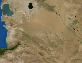 The Karakum Desert by NASA World Wind | |
| Area | 350,000 km2 (140,000 sq mi) |
| Geography | |
| Country | Turkmenistan, Kazakhstan |
| State/Province | Central Asia |
| Coordinates | 39°N 60°E / 39°N 60°E |

The Karakum Desert, also spelled Kara-Kum and Gara-Gum (Turkmen: Garagum, pronounced [ɡɑɾɑˈɡʊm]; Russian: Караку́мы, tr. Karakumy, IPA: [kərɐˈkumɨ]), is a desert in Central Asia. Its second word means sand; its first is a contraction of garaňky: "dark" or may pre-date that (be a derivation from a likely broader meaning which the word for black bore: gara) in this language family.[a] This refers to the shale-rich sand generally beneath the sand of much of the desert.[1] It occupies about 70 percent, 350,000 km2, of Turkmenistan.
The population is sparse, with an average of one person per 6.5 km2 (2.5 square miles). Rainfall is also rare, ranging from 70 to 150 mm per year.[2]
Geography[]
The desert covers most of Turkmenistan, a long east–west swath. It widely reaches dune crests, underlain by rock, a few hundred metres above sea level. It sits east of the Caspian Sea which has a steep east bank. It adjoins, to north, the long delta feeding the South Aral Sea further north, another endorheic lake, about 58 metres higher than the Caspian Sea. The delta is that of the Amu Dar'ya river to the northeast demarcating the long border with the Kyzyl Kum desert, of Uzbekistan. In decades since the early 1980s, the relatively small desert extension the "Aral Karakum" occupies most of the former seabed of the Aral Sea, about 15,440 sq mi/40,000 km2. The sea has fluctuated over millennia. Its majority loss during Soviet Union existence coinciding with great irrigation projects. The North Aral Sea was restoring to a status in 2009 but the South Aral Sea ebbed to a small-size stasis at its river mouth.[3]

Within the north-west edge of the desert used to be a river. In the late Pleistocene, the Amu Dar'ya used to flow beyond the Aral Basin to Sarykamysh Lake then to the Caspian Sea. Sedimentation and floods during a pluvial period led to overflow to the Zeravshan River valley to the east. The two flows merged and formed or expanded Horezm Lake. As the latter, which had been formed by the earlier Khvalinian period, overflowed northwards it carved its link with the Aral Sea along the Akcha Dar'ya population corridor of that low, gentle valley (a remote community of Western Uzbekistan and north-east Turkmenistan).[4]
Environment[]
The sands of the Aral Karakum are made up of a salt-marsh consisting of finely-dispersed evaporites and remnants of alkaline mineral deposits, washed into the basin from irrigated fields.
Geology[]
The Karakum Desert is home to the Darvaza Gas Crater.
The area has significant oil and natural gas deposits.[citation needed]
Hydrography[]
To the south the Murghab and Tejen rivers flow out of the Hindu Kush Mountains, flow west, and empty into the desert, providing water for irrigation.
The desert is crossed by the second largest irrigation canal in the world, the Karakum Canal, which brings water from the Amu Darya to southern regions of the desert.[1] Construction on the canal was started in 1954 and completed in 1958.[1] It is 1,375 km in length, and carries 13-20 km³ of water annually.[1]
Archaeology[]
Within the Karakum are the Uly Balkan, a mountain range in which archaeologists have found human remains dating back to the Stone Age.
Economy and resources[]
The oases of Mary and Tejen are noted for cotton growing.
Features[]

The Darvaza gas crater, also called the "Door to Hell" or the "Gates of Hell" by locals, a crater of natural gas that has been burning since 1971, is located in the Karakum Desert. The crater is a major tourist attraction, with hundreds of visitors arriving each year.[5]
Transport[]
The desert is crossed by the Trans-Caspian Railway.
See also[]
Notes and References[]
- Footnotes
- ^ An illustration of the breadth of the meaning of this word is the lake to the west, a saline lagoon of the Caspian Sea, the Garabogazköl; it can mean mighty as well as, in abbreviated form from blackish, dark. Most Turkic languages have this term and many derivations, in very recognisably cognate forms.
- References
- ^ Jump up to: a b c d Scheffel, Richard L.; Wernet, Susan J., eds. (1980). Natural Wonders of the World. United States of America: Reader's Digest Association, Inc. pp. 199. ISBN 0-89577-087-3.
- ^ "Karakum Desert -- Britannica Online Encyclopedia". www.britannica.com. Retrieved 2008-02-22.
- ^ Aral Sea Archived 2009-03-16 at the Wayback Machine
- ^ Razakov, RM (1996). The Aral Sea Basin. Springer. ISBN 978-3-642-64736-9. Retrieved 27 March 2019.
- ^ Geiling, Natasha. "This Hellish Desert Pit Has Been On Fire for More Than 40 Years". Smithsonian. Retrieved 2017-06-19.
External links[]
| Wikimedia Commons has media related to Karakum. |
| Wikivoyage has a travel guide for Karakum. |
- Gonur Depe site in the Karakum Desert
- photos and about the Karakum Desert
- TravelBlog Darvasa Craters: Entrance to Hell
Coordinates: 40°30′N 60°00′E / 40.500°N 60.000°E
| Authority control |
|---|
- Deserts of Central Asia
- Deserts of Kazakhstan
- Deserts of Turkmenistan
- Deserts of Uzbekistan
- Ergs