Mu Us Desert
| Mu Us Desert | |
|---|---|
 Mu-Us Desert satellite image by NASA World Wind | |
| Floor elevation | 950 to 1,600 m (3,120 to 5,250 ft) |
| Length | 380 km (240 mi) |
| Width | 290 km (180 mi) |
| Area | 48,288 km2 (18,644 sq mi) |
| Naming | |
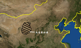
| Native name | Му-Ус 毛乌素沙漠 |
| Geography | |
| Country | People's Republic of China |
| States | Shaanxi, Inner Mongolia and Ningxia |
| Coordinates | Coordinates: 38°45′00″N 109°09′58″E / 38.7500°N 109.1660°E |
The Mu Us Desert (also known as the Maowusu Desert; simplified Chinese: 毛乌素沙漠 (沙地); traditional Chinese: 毛烏素沙漠 (沙地); pinyin: Máowūsù Shāmò (Shādì)) is a desert in northern China.[1] Its south-eastern end is crossed by the Great Wall of China. The Mu Us forms the southern portion of the Ordos Desert[2] and part of the Ordos Loop. The Wuding River drains the area, and then flows into the Yellow River.[3][4]
Delineation[]
Confusion exists about where the Ordos Desert begins and where the Mu Us Desert ends. The Ordos comprises two sub-deserts: the Kubuqi Desert in the north east; and the Mu Us Desert in the south. The northern portion goes by another name—for example, a map in Julia Lovell's book The Great Wall: China Against the World 1000 BC–2000 AD shows the Ordos Desert only in the portion of Inner Mongolia which lies south of the Yellow River. Several research papers cited below claim that the Mu Us Desert includes part of Shaanxi and Gansu. A clear delineation of the area is still needed here, based on multiple sources.[4]
The Mu Us Desert of north central China lies at 37°30'–39°20'N,107°20'–111°30'E and covers 48,288 km2.[5] As part of the Ordos Plateau, the elevation ranges from 1,000m to 1,300m (as low as 950m in some south-eastern valleys, and reaching between 1,400m to 1,600m in the north-western area). It is the only one of China's twelve sandy zones that is in the transition between a typical steppe and desert climate. The semi-arid continental climate subjects the soil to wind erosion.[6][7]
Geography[]
Geology[]
As noted above, the Mu Us Desert forms part of Ordos Plateau and includes part of the Loess Plateau alluvial plain with a concave floor. Exposed sands in the area come from Cretaceous red and grey sandstone. Quaternary sediments include a variety of sand types which are easily moved by the wind. In the south of the Great Wall (see below), sand dunes become more frequent due to damaged vegetation caused mostly by moving sand.[7] Groundwater is present at relatively shallow depth of between 1 and 3 meter below ground level in area between dunes.[8]
Climate[]
The annual mean temperature is between 6.0 to 8.5 °C. The mean annual precipitation is between 250–400 mm of which the majority falls in summer.[9]
History[]
Research in the Salawusu River Area in 1978 delineated the strata of the Salawusu River in the area of the Mu Us Desert. This suggests that the prehistoric climate was mild and wet with numerous rivers and lakes, yet limited plant life and wildlife in the early stage of the Late Pleistocene age. The climate became dry and cold while eolian sand began to accumulate in the later stage of the Late Pleistocene age. The climate changed again to mild and wet early in the Holocene Epoch as lakes with marsh sediments formed. Later, the climate changed back to dry and cold, allowing a semi-arid steppe landscape to form. These climatic fluctuations were caused by the glacial and interglacial periods of the Northern Hemisphere. The Mu Us Desert underwent a series of changes, including the formation shifting sands as well as the fixation and reduction of dunes.[10]
As early as 218 BC, grazing was the main way of life for local people.[11] The Mu Us Desert lies in a transition zone where areas of both pastoral land and farmland co-exist.[4]
Based on remote sensing data, rangeland has experienced an increase in both total biomass and number of grazing animals. Active measures which have been taken to limit desertification have resulted in increased vegetation cover and lowered potential for wind erosion. The increase in biomass resulted in an increase in both grazing and farmland production. The area under cultivation increased fivefold from 1978 to 1996. The grasslands seem to be thriving under the current high levels of grazing pressure.[12]
Desertification[]
During a 35-year period from the 1950s to the 1990s, its landscapes changed significantly. In most of the desert, desertification developed rapidly, swallowing grassland, while marginal areas in the east and south were restored to some extent. By the late 1990s, shifting and semi-fixed deserts covered 45% and 21% of the Mu Us Desert, while fixed desert decreased by 7.2% of the entire desert. Desertification was much more severe in the middle and north-west pasture land areas than in the eastern and southern areas of farmland and pasture. Overuse, overgrazing, and overcutting have been the main causes of desertification.[13] Meanwhile, woodland area increased between 1965 and 2010. As a result of the Grain for Green policy, after 2000, the area of cultivated land was decreased.[14]
Ecological Restoration[]


To rehabilitate desertified land, Dong, et al.[10] recommended abandoning unsustainable land management practices in 1982, referring to them as "the current irrational human activities" and gaining a better understanding of how climatic change affects the natural environment. Those writers suggested that the human activities must be carefully managed to meet both human and environmental needs.
After 1949, the Chinese government carried out a variety of ecological restoration projects including sand stabilization, irrigation development, afforestation, soil improvement, and transformation of the desert with remarkable results.[7]
A 2017 study marked that desertification was controlled, but that the area was still at risk for new desertification in the future, as a result of grassland reclamation and groundwater consumption.[14]
The Great Wall[]
As early as 453 BC, the Yiju people built a double wall in the southern region of the Mu Us Desert to protect themselves against the northernmost Chinese states. Of these states, the Qin were especially threatening, although the Qin Dynasty also are reported to have done wall building in the area. Later in history, the Qin dominated all of this area and built walls. In 129 BC, the Han Dynasty gained control of the area and strengthened the walls although they were still fighting to maintain control in AD 45. Much later, the Ming Dynasty portion of the Great Wall crossed the area.[4][11]
References[]
- ^ Donovan Webster. 2002. China's Unknown Gobi Alashan. National Geographic 201(1):48-75
- ^ Yan, Changzhen; Wang, Tao; Han, Zhiwen. 2005. Using MODIS data to access land desertification in Ordos Plateau -- Mu Us Desert case study. Geoscience and Remote Sensing Symposium, 2005. IGARSS '05. Proceedings. 2005 IEEE International (Volume:4). DOI: 10.1109/IGARSS.2005.1525454
- ^ Reader's Digest Assoc., Inc. 2004. Reader's Digest Illustrated World Atlas. Pleasantville, N. Y., USA
- ^ Jump up to: a b c d Lovell, Julia. 2006. The Great Wall, China Against the World, 1000 BCE-AD 2000. Grove Press. New York, USA.
- ^ Li, Sen; Wang, Tao; Yan, Changzhen (2017-07-03). "Assessing the Role of Policies on Land-Use/Cover Change from 1965 to 2015 in the Mu Us Sandy Land, Northern China". Sustainability. 9 (7): 1164. doi:10.3390/su9071164. ISSN 2071-1050.
- ^ Chen, Yu Fu; Yu, Fei Hai; Dong, Ming. 2002. Scale-dependent spatial heterogeneity of vegetation in Mu Us Desert: a semi-arid area of China. Plant Ecology 162:135-142.
- ^ Jump up to: a b c (in Chinese)Xin Xinhua (in Chinese as 新華网):毛乌素沙地簡介 Archived 2012-05-07 at the Wayback Machine
- ^ Karnieli, Arnon; Qin, Zhihao; Wu, Bo; Panov, Natalya; Yan, Feng (2014-09-29). "Spatio-Temporal Dynamics of Land-Use and Land-Cover in the Mu Us Sandy Land, China, Using the Change Vector Analysis Technique". Remote Sensing. 6 (10): 9316–9339. doi:10.3390/rs6109316. ISSN 2072-4292.
- ^ Li, N.; Yan, C.Z.; Xie, J.L. (January 2015). "Remote sensing monitoring recent rapid increase of coal mining activity of an important energy base in northern China, a case study of Mu Us Sandy Land". Resources, Conservation and Recycling. 94: 129–135. doi:10.1016/j.resconrec.2014.11.010. ISSN 0921-3449.
- ^ Jump up to: a b Dong, Guangrong; Li, Baoshen: Gao, Shangyu. 1882. The Case Study of the Vicissitude of Mu Us Desert Since the Late Pleistocene According to the Selesus River Strata. Journal of Desert Research. Vol. 3, No. 2. Page numbers not available on the internet.
- ^ Jump up to: a b Keay, John. 2009. China, a History. Basic Books. Philadelphia, Pennsylvania, USA.
- ^ Runnström, M. C. Rangeland. 2002. Rangeland development of the Mu Us Desert in semiarid China: an analysis using Landsat and NOAA remote sensing data. Land Degradation & Development 14(2):189-202.
- ^ Wu, Bo; Ci, Long J. 2002. Landscape change and desertification development in the Mu Us Sandyland, Northern China. Journal of Arid Environments 50(3):429-444
- ^ Jump up to: a b Li, Sen; Wang, Tao; Yan, Changzhen (2017-07-03). "Assessing the Role of Policies on Land-Use/Cover Change from 1965 to 2015 in the Mu Us Sandy Land, Northern China". Sustainability. 9 (7): 1164. doi:10.3390/su9071164. ISSN 2071-1050.
- Deserts of China
- Geography of Inner Mongolia
- Geography of Shaanxi
- Geography of Gansu
- Geography of Ningxia
- Ecoregions of China
- Ergs