Karoro, New Zealand
Karoro | |
|---|---|
Suburb of Greymouth | |
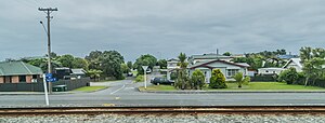 Warburton Street | |
 | |
| Country | New Zealand |
| City | Greymouth |
| Electoral ward | Central |
| Population (2018) | |
| • Total | 1,017 |
| Blaketown | Greymouth centre | |
| (Tasman Sea) |
|
|
| Paroa |
Karoro is a suburb to the south-west of Greymouth on the West Coast of New Zealand.[1][2]
Demographics[]
| Year | Pop. | ±% p.a. |
|---|---|---|
| 2006 | 1,008 | — |
| 2013 | 1,053 | +0.63% |
| 2018 | 1,017 | −0.69% |
| Source: [3] | ||
Karoro had a population of 1,017 at the 2018 New Zealand census, a decrease of 36 people (-3.4%) since the 2013 census, and an increase of 9 people (0.9%) since the 2006 census. There were 408 households. There were 510 males and 507 females, giving a sex ratio of 1.01 males per female. The median age was 47.1 years (compared with 37.4 years nationally), with 177 people (17.4%) aged under 15 years, 138 (13.6%) aged 15 to 29, 480 (47.2%) aged 30 to 64, and 225 (22.1%) aged 65 or older.
Ethnicities were 92.6% European/Pākehā, 6.8% Māori, 0.6% Pacific peoples, 2.7% Asian, and 2.4% other ethnicities (totals add to more than 100% since people could identify with multiple ethnicities).
The proportion of people born overseas was 11.8%, compared with 27.1% nationally.
Although some people objected to giving their religion, 46.6% had no religion, 43.7% were Christian, 0.9% were Hindu, 0.3% were Buddhist and 1.2% had other religions.
Of those at least 15 years old, 123 (14.6%) people had a bachelor or higher degree, and 186 (22.1%) people had no formal qualifications. The median income was $37,000, compared with $31,800 nationally. The employment status of those at least 15 was that 468 (55.7%) people were employed full-time, 120 (14.3%) were part-time, and 15 (1.8%) were unemployed.[3]
Education[]
Karoro School is a coeducational full primary (years 1–8) school with a roll of 179 students as of November 2021.[4][5] The school celebrated its 50th jubilee in 2008.[6]
References[]
- ^ Peter Dowling (editor) (2004). Reed New Zealand Atlas. Reed Books. pp. map 69. ISBN 0-7900-0952-8.CS1 maint: extra text: authors list (link)
- ^ Roger Smith, GeographX (2005). The Geographic Atlas of New Zealand. Robbie Burton. pp. map 156. ISBN 1-877333-20-4.
- ^ a b "Statistical area 1 dataset for 2018 Census". Statistics New Zealand. March 2020. Karoro (310600). 2018 Census place summary: Karoro
- ^ "New Zealand Schools Directory". New Zealand Ministry of Education. Retrieved 22 December 2021.
- ^ Education Counts: Karoro School
- ^ "Jubilees & reunions: Karoro School, Greymouth 50th Jubilee" (– Scholar search). Education Gazette New Zealand. 86 (9). 4 June 2007.[dead link]
Coordinates: 42°28′24″S 171°11′13″E / 42.473466°S 171.186966°E

- Grey District
- Suburbs of Greymouth
- Populated places in the West Coast, New Zealand