Kinglake West, Victoria
| Kinglake West Victoria | |||||||||||||||
|---|---|---|---|---|---|---|---|---|---|---|---|---|---|---|---|
 Uniting church | |||||||||||||||
 Kinglake West | |||||||||||||||
| Coordinates | 37°28′S 145°14′E / 37.467°S 145.233°ECoordinates: 37°28′S 145°14′E / 37.467°S 145.233°E | ||||||||||||||
| Population | 1,166 (2016 census)[1] | ||||||||||||||
| Postcode(s) | 3757 | ||||||||||||||
| Location | 48 km (30 mi) N of Melbourne | ||||||||||||||
| LGA(s) | |||||||||||||||
| State electorate(s) | |||||||||||||||
| Federal division(s) | |||||||||||||||
| |||||||||||||||

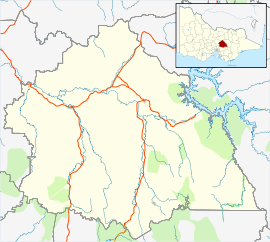
Kinglake West is a town in central Victoria, Australia. The town is located 56 kilometres (35 mi) north-east of the state capital, Melbourne. Its local government area is the City of Whittlesea and the Shires of Murrindindi and Nillumbik. At the 2016 Census, Kinglake West had a population of 1,166.
The town was substantially damaged in the Black Saturday bushfires, including 10 fatalities.[2]
History[]
Kinglake West Post Office opened around 1902 and burnt down on 7 February 2009.[3]
Kinglake West is situated north-east of Whittlesea in the Kinglake Ranges, part of the Great Dividing Range. Only Kinglake West is in the City of Whittlesea. The area was named after the surveyor Alexander Kinglake, who marked out a track over the ranges in 1878.[4]
Gold was first discovered in the area in 1861. The area was later cleared for timber and farming. Timber milling had a relatively long life. There were tramways for transporting timber from the Kinglake area to the Whittlesea railway station (1911–26). Some mill workers also took up farming as the mills closed.[4]
The deep soil yielded good crops of stone fruit, some fruit and berries. Due to competition from Tasmania, there was a decline in berry farming. By the 1940s the predominant crop in the area was potatoes.[4]
Kinglake West 'Prisoner of War' Camp[]
Soon after the outbreak of war in February 1940, 14,000 Victorians were registered as 'aliens'. With the escalation of the war, 343 of these were interned.[5]
Population[]
In the 2016 Census, there were 1,166 people in Kinglake West. 79.9% of people were born in Australia and 85.3% of people spoke only English at home. The most common responses for religion were No Religion 39.2% and Catholic 23.2%.[1]
References[]
| Wikimedia Commons has media related to Kinglake West, Victoria. |
- ^ a b Australian Bureau of Statistics (27 June 2017). "Kinglake West (State Suburb)". 2016 Census QuickStats. Retrieved 3 July 2017.

- ^ "Wiped out: Towns destroyed by killer fires". ABC News. Australian Broadcasting Corporation. Retrieved 7 February 2009.
- ^ Premier Postal History. "Post Office List". Retrieved 11 April 2008.
- ^ a b c Council, Whittlesea. "Place Snapshot: Kinglake West". www.whittlesea.vic.gov.au. Retrieved 3 May 2019.
- ^ Kinglake : a collected history of the Kinglake district 1861 - 2011. Hawkins, Deidre G.,, Kinglake Historical Society (Vic.), Victorian Bushfire Appeal Fund. Kinglake, [Victoria]. 2013. ISBN 9780987121738. OCLC 886361877.CS1 maint: others (link)
- Towns in Victoria (Australia)
- Towns in Lower Hume
- Shire of Murrindindi