Kirk, Colorado
Kirk, Colorado | |
|---|---|
 The Kirk post office in February 2017. | |
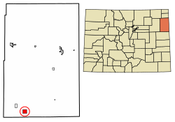 Location of the Kirk CDP in Yuma County, Colorado. | |
 Kirk Location of the Kirk CDP in the United States. | |
| Coordinates: 39°36′46″N 102°35′31″W / 39.6126887°N 102.5919946°WCoordinates: 39°36′46″N 102°35′31″W / 39.6126887°N 102.5919946°W[1] | |
| Country | |
| State | |
| County | Yuma County |
| Government | |
| • Type | unincorporated town |
| Area | |
| • Total | 4.101 sq mi (10.622 km2) |
| • Land | 4.101 sq mi (10.622 km2) |
| • Water | 0.000 sq mi (0.000 km2) |
| Elevation | 4,203 ft (1,281 m) |
| Population (2010) | |
| • Total | 59 |
| • Density | 14/sq mi (6/km2) |
| Time zone | UTC-7 (MST) |
| • Summer (DST) | UTC-6 (MDT) |
| ZIP Code[3] | 80824 |
| Area code(s) | 970 |
| GNIS feature[2] | Kirk CDP |

Kirk is an unincorporated town, a post office, and a census-designated place (CDP) located in and governed by Yuma County, Colorado, United States. The Kirk post office has the ZIP Code 80106.[3] At the United States Census 2010, the population of the Kirk CDP was 59, while the population of the 80106 ZIP Code Tabulation Area was 207 including adjacent areas.[4]
Etymology[]
"Kirk" is the Scots language word for "church".
Description[]
Kirk is home to a grain elevator, meat processing plant, bank, grocery, and the post office.
History[]
The Kirk post office has been in operation since 1887, with an original name of Kim.[5] The community was established by A. Newkirk, and named for him.[6]
Geography[]
The Kirk CDP has an area of 2,625 acres (10.622 km2), all land.[1]
Demographics[]
The United States Census Bureau initially defined the Kirk CDP for the United States Census 2010.
| Year | Pop. | ±% |
|---|---|---|
| 2010 | 59 | — |
| 2020 | — | |
| Source: United States Census Bureau | ||
See also[]
- Outline of Colorado
- State of Colorado
- Colorado cities and towns
- Colorado census designated places
- Colorado counties
- Colorado cities and towns
References[]
- ^ Jump up to: a b c "State of Colorado Census Designated Places - BAS20 - Data as of January 1, 2020". United States Census Bureau. Retrieved December 28, 2020.
- ^ Jump up to: a b c "U.S. Board on Geographic Names: Domestic Names". United States Geological Survey. Retrieved December 28, 2020.
- ^ Jump up to: a b "Look Up a ZIP Code". United States Postal Service. Retrieved December 28, 2020.
- ^ "2010: DEC Summary File 1". United States Census Bureau. Retrieved December 28, 2020.
- ^ Dawson, John Frank. Place names in Colorado: why 700 communities were so named, 150 of Spanish or Indian origin. Denver, CO: The J. Frank Dawson Publishing Co. p. 29.
- ^ "Post offices". Jim Forte Postal History. Retrieved 29 June 2016.
External links[]
 Definitions from Wiktionary
 Media from Wikimedia Commons
 News from Wikinews
 Quotations from Wikiquote
 Texts from Wikisource
 Textbooks from Wikibooks
 Resources from Wikiversity

- Census-designated places in Yuma County, Colorado
- Census-designated places in Colorado