Kozlany (Vyškov District)
Kozlany | |
|---|---|
Municipality | |
 | |
 Flag  Coat of arms | |
 Kozlany | |
| Coordinates: 49°12′14″N 17°2′9″E / 49.20389°N 17.03583°ECoordinates: 49°12′14″N 17°2′9″E / 49.20389°N 17.03583°E | |
| Country | |
| Region | South Moravian |
| District | Vyškov |
| Area | |
| • Total | 7.58 km2 (2.93 sq mi) |
| Elevation | 315 m (1,033 ft) |
| Population (1.1.2012) | |
| • Total | 322 |
| • Density | 42/km2 (110/sq mi) |
| Postal code | 683 41 |
| Website | http://www.kozlany.eu/ |

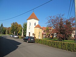
Kozlany is a village and municipality (obec) in Vyškov District in the South Moravian Region of the Czech Republic.
The municipality covers an area of 7.58 square kilometres (2.93 sq mi), and has a population of 319 (as at 3 July 2006).
Kozlany lies approximately 8 kilometres (5 mi) south-east of Vyškov, 31 km (19 mi) east of Brno, and 213 km (132 mi) south-east of Prague.
References[]
| Wikimedia Commons has media related to Kozlany (Vyškov District). |
| Authority control: National libraries |
|---|
This South Moravian Region location article is a stub. You can help Wikipedia by . |
Categories:
- Villages in Vyškov District
- South Moravian Region geography stubs