Zelená Hora (Vyškov District)
Zelená Hora | |
|---|---|
Municipality | |
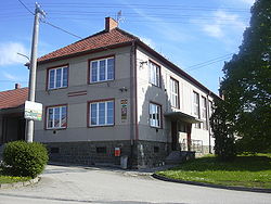 Municipal office | |
 Flag 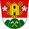 Coat of arms | |
 Zelená Hora | |
| Coordinates: 49°19′59″N 17°1′16″E / 49.33306°N 17.02111°ECoordinates: 49°19′59″N 17°1′16″E / 49.33306°N 17.02111°E | |
| Country | |
| Region | South Moravian |
| District | Vyškov |
| Area | |
| • Total | 2.95 km2 (1.14 sq mi) |
| Elevation | 368 m (1,207 ft) |
| Population (2006) | |
| • Total | 230 |
| • Density | 78/km2 (200/sq mi) |
| Postal code | 683 21 |
| Website | http://www.zelenahora.eu |

Zelená Hora is a village and municipality (obec) in Vyškov District in the South Moravian Region of the Czech Republic.
The municipality covers an area of 2.95 square kilometres (1.14 sq mi), and has a population of 230 (as of 3 July 2006).
Zelená Hora lies approximately 8 kilometres (5 mi) north of Vyškov, 33 km (21 mi) north-east of Brno, and 206 km (128 mi) south-east of Prague.
References[]
| Authority control: National libraries |
|---|
This South Moravian Region location article is a stub. You can help Wikipedia by . |
Categories:
- Villages in Vyškov District
- South Moravian Region geography stubs