Kračúnovce
Kračúnovce | |
|---|---|
Municipality | |
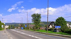 | |
 Kračúnovce Location of Kračúnovce in the Prešov Region | |
| Coordinates: 49°06′N 21°30′E / 49.100°N 21.500°ECoordinates: 49°06′N 21°30′E / 49.100°N 21.500°E | |
| Country | |
| Region | Prešov |
| District | Svidník |
| First mentioned | 1347 |
| Area | |
| • Total | 8.259 km2 (3.189 sq mi) |
| Elevation | 198 m (650 ft) |
| Population | |
| • Total | 1,179 |
| • Density | 140/km2 (370/sq mi) |
| Time zone | UTC+1 (CET) |
| • Summer (DST) | UTC+2 (CEST) |
| Postal code | 087 01 (pošta Giraltovce) |
| Area code(s) | +421-54 |
| Car plate | SK |
| Website | kracunovce |


Kračúnovce (Hungarian: Karácsonmező) is a village and municipality in Svidník District in the Prešov Region of north-eastern Slovakia.
History[]
In historical records the village was first mentioned in 1347.
Geography[]
The municipality lies at an altitude of 198 metres and covers an area of 8.259 km2. It has a population of about 1179 people.[1]
See also[]
References[]
- ^ "Statisticky urad Slovenskej republiky" (PDF). 2009 Villages Demography. Statistical Office of the Slovak Republic. Retrieved 2010-07-27.
Genealogical resources[]
The records for genealogical research are available at the state archive "Statny Archiv in Presov, Slovakia"
- Roman Catholic church records (births/marriages/deaths): 1776-1897 (parish A)
- Greek Catholic church records (births/marriages/deaths): 1862-1933 (parish B)
- Lutheran church records (births/marriages/deaths): 1742-1897 (parish B)
External links[]
 Media related to Kračúnovce at Wikimedia Commons
- Official website

- https://web.archive.org/web/20100202015957/http://www.statistics.sk/mosmis/eng/run.html
- Surnames of living people in Kracunovce
This Prešov Region geography article is a stub. You can help Wikipedia by . |
Categories:
- Villages and municipalities in Svidník District
- Šariš
- Prešov Region geography stubs