L'Aiguillon-sur-Vie
L'Aiguillon-sur-Vie | |
|---|---|
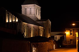 The 12th century church in L'Aiguillon-sur-Vie | |
show Location of L'Aiguillon-sur-Vie | |
 L'Aiguillon-sur-Vie | |
| Coordinates: 46°40′16″N 1°49′40″W / 46.6711°N 1.8278°WCoordinates: 46°40′16″N 1°49′40″W / 46.6711°N 1.8278°W | |
| Country | France |
| Region | Pays de la Loire |
| Department | Vendée |
| Arrondissement | Les Sables-d'Olonne |
| Canton | Saint-Hilaire-de-Riez |
| Intercommunality | |
| Government | |
| • Mayor (2020–2026) | André Coquelin |
| Area 1 | 23.22 km2 (8.97 sq mi) |
| Population (Jan. 2018)[1] | 1,987 |
| • Density | 86/km2 (220/sq mi) |
| Time zone | UTC+01:00 (CET) |
| • Summer (DST) | UTC+02:00 (CEST) |
| INSEE/Postal code | 85002 /85220 |
| Elevation | 2–49 m (6.6–160.8 ft) (avg. 20 m or 66 ft) |
| 1 French Land Register data, which excludes lakes, ponds, glaciers > 1 km2 (0.386 sq mi or 247 acres) and river estuaries. | |


L'Aiguillon-sur-Vie (French pronunciation: [lɛɡɥijɔ̃ syʁ vi], literally L'Aiguillon on Vie) is a commune in the Vendée department in the Pays de la Loire region in western France.
Population[]
| Year | Pop. | ±% |
|---|---|---|
| 2006 | 1,521 | — |
| 2007 | 1,580 | +3.9% |
| 2008 | 1,595 | +0.9% |
| 2009 | 1,631 | +2.3% |
| 2010 | 1,693 | +3.8% |
| 2011 | 1,757 | +3.8% |
| 2012 | 1,821 | +3.6% |
| 2013 | 1,853 | +1.8% |
| 2014 | 1,894 | +2.2% |
| 2015 | 1,918 | +1.3% |
| 2016 | 1,941 | +1.2% |
See also[]
References[]
- ^ "Populations légales 2018". INSEE. 28 December 2020.
| Wikimedia Commons has media related to L'Aiguillon-sur-Vie. |
| show Authority control |
|---|
This Vendée geographical article is a stub. You can help Wikipedia by . |
Categories:
- Communes of Vendée
- Vendée geography stubs