La Plata, Missouri
La Plata, Missouri | |
|---|---|
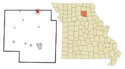 Location within Macon County and Missouri | |
| Coordinates: 40°1′26″N 92°29′32″W / 40.02389°N 92.49222°WCoordinates: 40°1′26″N 92°29′32″W / 40.02389°N 92.49222°W | |
| Country | United States |
| State | Missouri |
| County | Macon |
| Area | |
| • Total | 1.59 sq mi (4.13 km2) |
| • Land | 1.59 sq mi (4.11 km2) |
| • Water | 0.01 sq mi (0.02 km2) |
| Elevation | 935 ft (285 m) |
| Population | |
| • Total | 1,366 |
| • Estimate (2019)[5] | 1,308 |
| • Density | 823.68/sq mi (317.92/km2) |
| Time zone | UTC-6 (Central (CST)) |
| • Summer (DST) | UTC-5 (CDT) |
| ZIP code | 63549 |
| Area code | 660 |
| FIPS code | 29-40682 [3] |
| GNIS feature ID | 0739998 [4] |
| Website | cityoflaplata.net |

La Plata is a city in Macon County, Missouri, United States. The population was 1,366 at the 2010 census. La Plata is located next to the Adair County line.
History[]
The beginnings of La Plata can be traced back to March 17, 1827 when Drury Davis established a trading post near the town's current location.[6] The ensuing few years saw Davis joined by family and friends to create a small village that included a blacksmith shop, an inn, and stagecoach station.[6]
La Plata was platted in 1855. It was named after the city of La Plata, in Argentina.[7] The name is of Spanish origin meaning "silver".[8] Two men, Louis Gex and Thomas Saunders, were the primary force behind the town's platting, and drew straws to choose the community's name.[9] Saunders wanted to name the town Charlottesville to honor a favorite sister, while Gex pushed for the name La Plata. Gex won out and the town is believed to have been first incorporated on September 29, 1856.[9] Another of the early settlers who helped in creating the town was Dr. W. W. Moore, who erected La Plata's first hotel.[10] The North Missouri (later known as the Wabash Railroad) came to town in 1867, and the Santa Fe Railroad twenty years later, passing through La Plata on its route from Chicago to Kansas City.[6] The combination of the two railroads made La Plata an ideal shipping point for timber, livestock, grains, and other goods for northern Macon County and southern portions of neighboring Adair County as well.[11] As part of this growth, the town was incorporated as a fourth-class city on April 4, 1881 with Jacob Gilstrap serving as first mayor.[10] La Plata's first major industry, a creamery, was established in 1883. The facility had the capacity to produce up to 1.25 tons of butter per day.[6] However, fire destroyed the creamery and it was never rebuilt. Other light agriculture-related industry has existed in the town over the years, including a large chicken hatchery and turkey hatchery. Two major oil pipelines pass through La Plata as well, the Prairie Pipeline being the first in 1912.[6] A "tank farm" of large storage tanks was located for many years on the city's northern edge. The Wabash railroad through La Plata was abandoned after it was merged in 1991 with the Norfolk and Western Railway, but the Amtrak station is still in operation on the Burlington Northern Santa Fe rail system, and the town is served by the Southwest Chief. A small but active business community still exists in the town.
The first school, named Long Branch for a nearby creek, was established in 1868. It was replaced, in 1872, by a five-room brick schoolhouse.[6] Today, children of La Plata and the surrounding rural area are educated by the La Plata R-2 school district.
The Lester and Norma Dent House, John T. and Mary M. Doneghy House, Gilbreath-McLorn House, and La Plata Square Historic District are listed on the National Register of Historic Places.[12]
Geography[]
La Plata is located at 40°1′26″N 92°29′32″W / 40.02389°N 92.49222°W (40.024013, -92.492279).[13] According to the United States Census Bureau, the city has a total area of 1.60 square miles (4.14 km2), of which 1.59 square miles (4.12 km2) is land and 0.01 square miles (0.03 km2) is water.[14]
Demographics[]
| Historical population | |||
|---|---|---|---|
| Census | Pop. | %± | |
| 1870 | 546 | — | |
| 1880 | 529 | −3.1% | |
| 1890 | 1,169 | 121.0% | |
| 1900 | 1,345 | 15.1% | |
| 1910 | 1,605 | 19.3% | |
| 1920 | 1,463 | −8.8% | |
| 1930 | 1,406 | −3.9% | |
| 1940 | 1,421 | 1.1% | |
| 1950 | 1,331 | −6.3% | |
| 1960 | 1,365 | 2.6% | |
| 1970 | 1,377 | 0.9% | |
| 1980 | 1,423 | 3.3% | |
| 1990 | 1,401 | −1.5% | |
| 2000 | 1,486 | 6.1% | |
| 2010 | 1,366 | −8.1% | |
| 2019 (est.) | 1,308 | [5] | −4.2% |
| U.S. Decennial Census[15] | |||
2010 census[]
As of the census[2] of 2010, there were 1,366 people, 584 households, and 364 families residing in the city. The population density was 859.1 inhabitants per square mile (331.7/km2). There were 683 housing units at an average density of 429.6 per square mile (165.9/km2). The racial makeup of the city was 96.5% White, 0.2% African American, 0.1% Asian, 0.5% Pacific Islander, 1.0% from other races, and 1.7% from two or more races. Hispanic or Latino of any race were 1.3% of the population.
There were 584 households, of which 28.8% had children under the age of 18 living with them, 45.2% were married couples living together, 12.5% had a female householder with no husband present, 4.6% had a male householder with no wife present, and 37.7% were non-families. 33.4% of all households were made up of individuals, and 18.5% had someone living alone who was 65 years of age or older. The average household size was 2.26 and the average family size was 2.83.
The median age in the city was 42.1 years. 23.4% of residents were under the age of 18; 8.3% were between the ages of 18 and 24; 21.9% were from 25 to 44; 24.2% were from 45 to 64; and 22.4% were 65 years of age or older. The gender makeup of the city was 47.1% male and 52.9% female. La Plata has a growing settlement of Amish, most of whom are engaged in farming.[16]
2000 census[]
As of the census[3] of 2000, there were 1,486 people, 630 households, and 388 families residing in the city. The population density was 1,219.0 people per square mile (470.3/km2). There were 702 housing units at an average density of 575.9/sq mi (222.2/km2). The racial makeup of the city was 98.65% White, 0.13% African American, 0.07% Native American, 0.13% Asian, 0.27% from other races, and 0.74% from two or more races. Hispanic or Latino of any race were 1.68% of the population.
There were 630 households, out of which 28.6% had children under the age of 18 living with them, 48.6% were married couples living together, 10.3% had a female householder with no husband present, and 38.3% were non-families. 35.4% of all households were made up of individuals, and 24.0% had someone living alone who was 65 years of age or older. The average household size was 2.28 and the average family size was 2.96.
In the city the population was spread out, with 25.2% under the age of 18, 7.3% from 18 to 24, 23.8% from 25 to 44, 17.8% from 45 to 64, and 26.0% who were 65 years of age or older. The median age was 40 years. For every 100 females there were 79.7 males. For every 100 females age 18 and over, there were 74.4 males.
The median income for a household in the city was $29,583, and the median income for a family was $36,071. Males had a median income of $26,438 versus $17,880 for females. The per capita income for the city was $19,675. About 9.0% of families and 14.1% of the population were below the poverty line, including 21.8% of those under age 18 and 9.7% of those age 65 or over.
Education[]
Public education in La Plata is administered by La Plata R-II School District, which operates one elementary school and .[17]
La Plata has a lending library, the La Plata Public Library.[18]
Transportation[]
- La Plata (Amtrak station) provides passenger train service east to Chicago, Illinois and west to Los Angeles, California on Amtrak's Southwest Chief. The distance to Truman State University in Kirksville is approximately 12.5 miles (20.1 km).
- Kirksville Regional Airport, six miles north of La Plata, provides commuter airline connector flights.
- U.S. Highway 63 has been expanded to four lanes.
Notable people[]
- Lester Dent, author, Doc Savage books.
- Thomas Rubey, Missouri's 25th Lieutenant Governor and former U.S. Congressman.
References[]
- ^ "2019 U.S. Gazetteer Files". United States Census Bureau. Retrieved July 26, 2020.
- ^ Jump up to: a b "U.S. Census website". United States Census Bureau. Retrieved 2012-07-08.
- ^ Jump up to: a b "U.S. Census website". United States Census Bureau. Retrieved 2008-01-31.
- ^ "US Board on Geographic Names". United States Geological Survey. 2007-10-25. Retrieved 2008-01-31.
- ^ Jump up to: a b "Population and Housing Unit Estimates". United States Census Bureau. May 24, 2020. Retrieved May 27, 2020.
- ^ Jump up to: a b c d e f "History of La Plata". City of La Plata official website. 2014. Retrieved 13 April 2014.
- ^ Ramsay, Robert L. (1952). Our Storehouse of Missouri Place Names. University of Missouri Press. p. 28. ISBN 9780826205865.
- ^ Eaton, David Wolfe (1916). How Missouri Counties, Towns and Streams Were Named. The State Historical Society of Missouri. p. 192.
- ^ Jump up to: a b "Macon County place names" (PDF). Macon County Historical Society. 2014. Retrieved 13 April 2014.
- ^ Jump up to: a b "A Directory of Towns, Villages and Hamlets of Macon County Missouri". Macon County Historical Society. 2014. Retrieved 13 April 2014.
- ^ "Macon County History". Genealogy Trails via Macon County Historical Society. 2014. Retrieved 13 April 2014.
- ^ "National Register Information System". National Register of Historic Places. National Park Service. July 9, 2010.
- ^ "US Gazetteer files: 2010, 2000, and 1990". United States Census Bureau. 2011-02-12. Retrieved 2011-04-23.
- ^ "US Gazetteer files 2010". United States Census Bureau. Archived from the original on 2012-01-25. Retrieved 2012-07-08.
- ^ "Census of Population and Housing". Census.gov. Retrieved June 4, 2015.
- ^ Winnerman, Jim (August 12, 2012). "Amish migrate to new home in Missouri". St. Louis Post-Dispatch. Retrieved May 25, 2020.
- ^ "La Plata R-Ii School District". Great Schools. Retrieved 2 June 2019.
- ^ "Missouri Public Libraries". PublicLibraries.com. Archived from the original on 10 June 2017. Retrieved 2 June 2019.
External links[]
- City of La Plata website
- Historic maps of La Plata in the Sanborn Maps of Missouri Collection at the University of Missouri Digital Library
| show Municipalities and communities of Macon County, Missouri, United States |
|---|

| show Authority control |
|---|
- Cities in Macon County, Missouri
- 1855 establishments in Missouri
- Cities in Missouri