Lamut, Ifugao
Lamut | |
|---|---|
| Municipality of Lamut | |
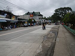 Downtown area | |
 Flag  Seal | |
 Map of Ifugao with Lamut highlighted | |
OpenStreetMap  | |
 Lamut Location within the Philippines | |
| Coordinates: 16°39′00″N 121°13′30″E / 16.65°N 121.225°ECoordinates: 16°39′00″N 121°13′30″E / 16.65°N 121.225°E | |
| Country | Philippines |
| Region | Cordillera Administrative Region |
| Province | Ifugao |
| District | Lone district |
| Founded | 1959 |
| Barangays | 18 (see Barangays) |
| Government | |
| • Type | Sangguniang Bayan |
| • Mayor | Mariano B. Buyagawan Jr. |
| • Vice Mayor | Victomar H. Bunnol |
| • Representative | Solomon R. Chungalao |
| • Electorate | 16,892 voters (2019) |
| Area | |
| • Total | 159.65 km2 (61.64 sq mi) |
| Elevation | 246 m (807 ft) |
| Highest elevation | 415 m (1,362 ft) |
| Lowest elevation | 203 m (666 ft) |
| Population (2020 census) [3] | |
| • Total | 26,235 |
| • Density | 160/km2 (430/sq mi) |
| • Households | 5,593 |
| Economy | |
| • Income class | 4th municipal income class |
| • Poverty incidence | 21.17% (2015)[4] |
| • Revenue | ₱139,144,270.97 (2020) |
| • Assets | ₱358,194,652.84 (2020) |
| • Expenditure | ₱112,083,278.06 (2020) |
| • Liabilities | ₱48,247,475.77 (2020) |
| Service provider | |
| • Electricity | Ifugao Electric Cooperative (IFELCO) |
| Time zone | UTC+8 (PST) |
| ZIP code | 3605 |
| PSGC | |
| IDD : area code | +63 (0)74 |
| Native languages | Ifugao Tuwali Ilocano Tagalog |
| Website | lamut |

Lamut, officially the Municipality of Lamut is a 4th class municipality in the province of Ifugao, Philippines. According to the 2020 census, it has a population of 26,235 people. [3]
Lamut has the following schools: Lamut Central School, San Francisco High School, and Ifugao State University (formerly Ifugao State College of Agriculture and Forestry or ISCAF).
Barangays[]
Lamut is politically subdivided into 18 barangays. [5]
- Ambasa
- Bimpal
- Hapid
- Holowon
- Lawig
- Lucban
- Mabatobato
- Magulon
- Nayon
- Panopdopan
- Payawan
- Pieza
- Poblacion East (Lamut)
- Poblacion West (Lamut)
- Pugol (Ifugao Reservation)
- Salamague
- Sanafe
- Umilag
Climate[]
| Climate data for Lamut, Ifugao | |||||||||||||
|---|---|---|---|---|---|---|---|---|---|---|---|---|---|
| Month | Jan | Feb | Mar | Apr | May | Jun | Jul | Aug | Sep | Oct | Nov | Dec | Year |
| Average high °C (°F) | 24 (75) |
26 (79) |
28 (82) |
31 (88) |
31 (88) |
31 (88) |
30 (86) |
30 (86) |
29 (84) |
28 (82) |
27 (81) |
24 (75) |
28 (83) |
| Average low °C (°F) | 19 (66) |
19 (66) |
20 (68) |
22 (72) |
23 (73) |
24 (75) |
23 (73) |
23 (73) |
23 (73) |
22 (72) |
21 (70) |
20 (68) |
22 (71) |
| Average precipitation mm (inches) | 119 (4.7) |
83 (3.3) |
54 (2.1) |
37 (1.5) |
133 (5.2) |
132 (5.2) |
161 (6.3) |
163 (6.4) |
153 (6.0) |
142 (5.6) |
160 (6.3) |
224 (8.8) |
1,561 (61.4) |
| Average rainy days | 18.4 | 13.6 | 11.6 | 9.4 | 19.3 | 21.9 | 23.9 | 23.4 | 21.1 | 16.3 | 18.1 | 21.4 | 218.4 |
| Source: Meteoblue [6] | |||||||||||||
History[]
In 1959, the barrios of Lamut, Mabatobato, Lawig, Panopdopan, Magulon, Peiza, Payawan, Nayon, Halog, Pulaan, Dilan, Pangka, Hapid, Bulao, Allupapan, Pugol and Salamagui of the municipal district of Kiangan were separated from the said municipal district and constituted into the municipal district of Lamut.[7] It was then composed of 4 barangays, namely: Mabatobato, Payawan, Nayon and Panopdopan.
The first appointed municipal mayor was Guinid Tuguinay who was later replaced by Alberto Puguon through a formal election held in November 1967, to December 1963. From January 1964 to December 1967, the municipal mayor was Alberto Bunoan, Sr. He was succeeded by Angelito Guinid from January 1968 to November 24, 1976, who was in turn succeeded by Gregorio Kitong who was appointed as municipal mayor. Kitong served until January 1986. When Corazon C. Aquino became the president, she appointed lady lawyer Lynda Bongyo-Chaguile as the O.I.C. mayor of Lamut and continued to serve until 1998. Lynda Chaguile was the first woman to serve and be elected as mayor in the municipality of Lamut and in the province.
Demographics[]
| Year | Pop. | ±% p.a. |
|---|---|---|
| 1960 | 5,554 | — |
| 1970 | 8,068 | +3.80% |
| 1975 | 9,416 | +3.15% |
| 1980 | 11,017 | +3.19% |
| 1990 | 14,101 | +2.50% |
| 1995 | 17,081 | +3.66% |
| 2000 | 18,731 | +2.00% |
| 2007 | 22,109 | +2.31% |
| 2010 | 23,088 | +1.59% |
| 2015 | 25,279 | +1.74% |
| 2020 | 26,235 | +0.73% |
| Source: Philippine Statistics Authority [8] [9] [10][11] | ||
In the 2020 census, the population of Lamut, Ifugao, was 26,235 people, [3] with a density of 160 inhabitants per square kilometre or 410 inhabitants per square mile.
Economy[]
| Poverty Incidence of Lamut | |
| Source: Philippine Statistics Authority[12][13][14][15][16][17][18] | |
References[]
- ^ Municipality of Lamut | (DILG)
- ^ "2015 Census of Population, Report No. 3 – Population, Land Area, and Population Density" (PDF). Philippine Statistics Authority. Quezon City, Philippines. August 2016. ISSN 0117-1453. Archived (PDF) from the original on May 25, 2021. Retrieved July 16, 2021.
- ^ a b c Census of Population (2020). "Cordillera Administrative Region (CAR)". Total Population by Province, City, Municipality and Barangay. PSA. Retrieved 8 July 2021.
- ^ https://psa.gov.ph/sites/default/files/City%20and%20Municipal-level%20Small%20Area%20Poverty%20Estimates_%202009%2C%202012%20and%202015_0.xlsx; publication date: 10 July 2019; publisher: Philippine Statistics Authority.
- ^ "Province: Ifugao". PSGC Interactive. Quezon City, Philippines: Philippine Statistics Authority. Retrieved 12 November 2016.
- ^ "Lamut: Average Temperatures and Rainfall". Meteoblue. Retrieved 8 March 2020.
- ^ "R.A. No. 2111, An Act Creating the Municipal District of Lamut in the Mountain Province". LawPH.com. Retrieved 2011-04-13.
- ^ Census of Population (2015). "Cordillera Administrative Region (CAR)". Total Population by Province, City, Municipality and Barangay. PSA. Retrieved 20 June 2016.
- ^ Census of Population and Housing (2010). "Cordillera Administrative Region (CAR)". Total Population by Province, City, Municipality and Barangay. NSO. Retrieved 29 June 2016.
- ^
Censuses of Population (1903–2007). "Cordillera Administrative Region (CAR)". Table 1. Population Enumerated in Various Censuses by Province/Highly Urbanized City: 1903 to 2007. NSO.
{{cite encyclopedia}}: CS1 maint: url-status (link) - ^ "Province of Ifugao". Municipality Population Data. Local Water Utilities Administration Research Division. Retrieved 17 December 2016.
- ^ "Poverty incidence (PI):". Philippine Statistics Authority. Retrieved 28 December 2020.
- ^ https://psa.gov.ph/sites/default/files/NSCB_LocalPovertyPhilippines_0.pdf; publication date: 29 November 2005; publisher: Philippine Statistics Authority.
- ^ https://psa.gov.ph/sites/default/files/2003%20SAE%20of%20poverty%20%28Full%20Report%29_1.pdf; publication date: 23 March 2009; publisher: Philippine Statistics Authority.
- ^ https://psa.gov.ph/sites/default/files/2006%20and%202009%20City%20and%20Municipal%20Level%20Poverty%20Estimates_0_1.pdf; publication date: 3 August 2012; publisher: Philippine Statistics Authority.
- ^ https://psa.gov.ph/sites/default/files/2012%20Municipal%20and%20City%20Level%20Poverty%20Estima7tes%20Publication%20%281%29.pdf; publication date: 31 May 2016; publisher: Philippine Statistics Authority.
- ^ https://psa.gov.ph/sites/default/files/City%20and%20Municipal-level%20Small%20Area%20Poverty%20Estimates_%202009%2C%202012%20and%202015_0.xlsx; publication date: 10 July 2019; publisher: Philippine Statistics Authority.
- ^ "PSA Releases the 2018 Municipal and City Level Poverty Estimates". Philippine Statistics Authority. 15 December 2021. Retrieved 22 January 2022.
External links[]
| Wikimedia Commons has media related to Lamut, Ifugao. |
- lamut.gov.ph
- Lamut Profile at PhilAtlas.com
- Philippine Standard Geographic Code
- Philippine Census Information
- Local Governance Performance Management System
Places adjacent to Lamut, Ifugao | ||||||||||||||||
|---|---|---|---|---|---|---|---|---|---|---|---|---|---|---|---|---|
| ||||||||||||||||
- Municipalities of Ifugao