Landingville, Pennsylvania
Landingville, Pennsylvania | |
|---|---|
Borough | |
 Landingville. Faith United Church of Christ. | |
 Location of Landingville in Schuylkill County, Pennsylvania. | |
 Landingville Location in Pennsylvania | |
| Coordinates: 40°37′35″N 76°07′24″W / 40.62639°N 76.12333°WCoordinates: 40°37′35″N 76°07′24″W / 40.62639°N 76.12333°W | |
| Country | United States |
| State | Pennsylvania |
| County | Schuylkill |
| Incorporated | 1887 |
| Government | |
| • Type | Borough Council |
| Area | |
| • Total | 0.86 sq mi (2.22 km2) |
| • Land | 0.86 sq mi (2.22 km2) |
| • Water | 0.00 sq mi (0.00 km2) |
| Population (2010) | |
| • Total | 159 |
| • Estimate (2019)[2] | 150 |
| • Density | 174.83/sq mi (67.49/km2) |
| Time zone | UTC-5 (Eastern (EST)) |
| • Summer (DST) | UTC-4 (EDT) |
| ZIP code | 17942 |
| Area code(s) | 570 Exchange: 366 |
| FIPS code | 42-41264 |


Landingville is a borough in Schuylkill County, Pennsylvania, United States. The population was 175 at the 2000 census.
Geography[]
Landingville is located at 40°37′35″N 76°7′24″W / 40.62639°N 76.12333°W (40.626509, -76.123342).[3]
According to the United States Census Bureau, the borough has a total area of 0.8 square miles (2.1 km2), all of it land.
Demographics[]
| Historical population | |||
|---|---|---|---|
| Census | Pop. | %± | |
| 1880 | 712 | — | |
| 1890 | 316 | −55.6% | |
| 1900 | 244 | −22.8% | |
| 1910 | 268 | 9.8% | |
| 1920 | 245 | −8.6% | |
| 1930 | 273 | 11.4% | |
| 1940 | 255 | −6.6% | |
| 1950 | 230 | −9.8% | |
| 1960 | 224 | −2.6% | |
| 1970 | 175 | −21.9% | |
| 1980 | 170 | −2.9% | |
| 1990 | 192 | 12.9% | |
| 2000 | 175 | −8.9% | |
| 2010 | 159 | −9.1% | |
| 2019 (est.) | 150 | [2] | −5.7% |
| Sources:[4][5][6] | |||
As of the census[5] of 2000, there were 175 people, 68 households, and 45 families residing in the borough. The population density was 207.6 people per square mile (80.4/km2). There were 74 housing units at an average density of 87.8 per square mile (34.0/km2). The racial makeup of the borough was 99.43% White, and 0.57% from two or more races.
There were 68 households, out of which 35.3% had children under the age of 18 living with them, 54.4% were married couples living together, 11.8% had a female householder with no husband present, and 32.4% were non-families. 25.0% of all households were made up of individuals, and 13.2% had someone living alone who was 65 years of age or older. The average household size was 2.57 and the average family size was 3.04.
In the borough the population was spread out, with 25.7% under the age of 18, 8.6% from 18 to 24, 28.6% from 25 to 44, 25.7% from 45 to 64, and 11.4% who were 65 years of age or older. The median age was 37 years. For every 100 females, there were 88.2 males. For every 100 females age 18 and over, there were 78.1 males.
The median income for a household in the borough was $40,417, and the median income for a family was $41,667. Males had a median income of $33,571 versus $18,750 for females. The per capita income for the borough was $16,965. About 4.2% of families and 9.5% of the population were below the poverty line, including 12.8% of those under the age of eighteen and 21.4% of those 65 or over.
Gallery[]

Community Fire Co.
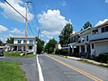
Main St.
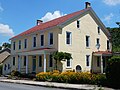
Residence on Main St.

Welcome United Methodist Church.

Schuylkill River in Landingville.


References[]
- ^ "2019 U.S. Gazetteer Files". United States Census Bureau. Retrieved July 28, 2020.
- ^ Jump up to: a b "Population and Housing Unit Estimates". United States Census Bureau. May 24, 2020. Retrieved May 27, 2020.
- ^ "US Gazetteer files: 2010, 2000, and 1990". United States Census Bureau. 2011-02-12. Retrieved 2011-04-23.
- ^ "Census of Population and Housing". U.S. Census Bureau. Retrieved 11 December 2013.
- ^ Jump up to: a b "U.S. Census website". United States Census Bureau. Retrieved 2008-01-31.
- ^ "Incorporated Places and Minor Civil Divisions Datasets: Subcounty Resident Population Estimates: April 1, 2010 to July 1, 2012". Population Estimates. U.S. Census Bureau. Archived from the original on 11 June 2013. Retrieved 11 December 2013.
| Wikimedia Commons has media related to Landingville, Pennsylvania. |
| show Municipalities and communities of Schuylkill County, Pennsylvania, United States |
|---|

| show Authority control |
|---|
- Populated places established in 1887
- Boroughs in Schuylkill County, Pennsylvania
- Populated places on the Schuylkill River
- 1887 establishments in Pennsylvania