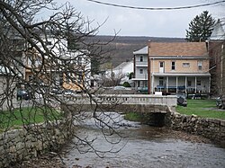
Tremont, Pennsylvania
Tremont, Pennsylvania | |
|---|---|
Borough | |
 Tremont | |
 Location of Tremont in Schuylkill County, Pennsylvania. | |
 Tremont Location in Pennsylvania | |
| Coordinates: 40°37′48″N 76°23′23″W / 40.63000°N 76.38972°WCoordinates: 40°37′48″N 76°23′23″W / 40.63000°N 76.38972°W | |
| Country | United States |
| State | Pennsylvania |
| County | Schuylkill |
| Settled | 1844 |
| Incorporated | 1866 |
| Government | |
| • Type | Borough Council |
| • Mayor | Ricky A. Nye, Jr. |
| Area | |
| • Total | 0.73 sq mi (1.88 km2) |
| • Land | 0.73 sq mi (1.88 km2) |
| • Water | 0.00 sq mi (0.00 km2) |
| Population (2010) | |
| • Total | 1,752 |
| • Estimate (2019)[2] | 1,666 |
| • Density | 2,294.77/sq mi (886.40/km2) |
| Time zone | UTC-5 (Eastern (EST)) |
| • Summer (DST) | UTC-4 (EDT) |
| ZIP code | 17981 |
| Area code(s) | 717 Exchange: 647 |
| FIPS code | 42-77392 |


Tremont is a borough in Schuylkill County, Pennsylvania, United States. The population was 1,752 at the 2010 census.
Geography[]
Tremont is located at 40°37′48″N 76°23′23″W / 40.63000°N 76.38972°W (40.630052, -76.389677).[3]
According to the United States Census Bureau, the borough has a total area of 0.8 square miles (2.1 km2), all of it land.
Demographics[]
| Historical population | |||
|---|---|---|---|
| Census | Pop. | %± | |
| 1870 | 1,709 | — | |
| 1880 | 1,785 | 4.4% | |
| 1890 | 2,064 | 15.6% | |
| 1900 | 1,947 | −5.7% | |
| 1910 | 2,067 | 6.2% | |
| 1920 | 2,015 | −2.5% | |
| 1930 | 2,304 | 14.3% | |
| 1940 | 2,314 | 0.4% | |
| 1950 | 2,102 | −9.2% | |
| 1960 | 1,893 | −9.9% | |
| 1970 | 1,833 | −3.2% | |
| 1980 | 1,796 | −2.0% | |
| 1990 | 1,814 | 1.0% | |
| 2000 | 1,784 | −1.7% | |
| 2010 | 1,752 | −1.8% | |
| 2019 (est.) | 1,666 | [2] | −4.9% |
| Sources:[4][5][6] | |||
At the 2000 census there were 1,784 people, 695 households, and 442 families living in the borough. The population density was 2,305.5 people per square mile (894.6/km²). There were 749 housing units at an average density of 968.0 per square mile (375.6/km²). The racial makeup of the borough was 98.99% White, 0.39% African American, 0.06% Native American, 0.06% Asian, 0.06% Pacific Islander, and 0.45% from two or more races. Hispanic or Latino of any race were 0.06%.[5]
Of the 695 households 26.8% had children under the age of 18 living with them, 49.2% were married couples living together, 10.1% had a female householder with no husband present, and 36.4% were non-families. 30.5% of households were one person and 17.6% were one person aged 65 or older. The average household size was 2.36 and the average family size was 2.95.
The age distribution was 20.5% under the age of 18, 7.6% from 18 to 24, 24.4% from 25 to 44, 23.3% from 45 to 64, and 24.3% 65 or older. The median age was 43 years. For every 100 females there were 86.0 males. For every 100 females age 18 and over, there were 82.2 males.
The median household income was $30,167 and the median family income was $35,326. Males had a median income of $31,542 versus $20,395 for females. The per capita income for the borough was $14,698. About 9.5% of families and 13.1% of the population were below the poverty line, including 28.2% of those under age 18 and 5.5% of those age 65 or over.
References[]
- ^ "2019 U.S. Gazetteer Files". United States Census Bureau. Retrieved July 28, 2020.
- ^ a b "Population and Housing Unit Estimates". United States Census Bureau. May 24, 2020. Retrieved May 27, 2020.
- ^ "US Gazetteer files: 2010, 2000, and 1990". United States Census Bureau. 2011-02-12. Retrieved 2011-04-23.
- ^ "Census of Population and Housing". U.S. Census Bureau. Retrieved 11 December 2013.
- ^ a b "U.S. Census website". United States Census Bureau. Retrieved 2008-01-31.
- ^ "Incorporated Places and Minor Civil Divisions Datasets: Subcounty Resident Population Estimates: April 1, 2010 to July 1, 2012". Population Estimates. U.S. Census Bureau. Archived from the original on 11 June 2013. Retrieved 11 December 2013.
| Wikimedia Commons has media related to Tremont, Pennsylvania. |

Authority control | |
|---|---|
| General | |
| National libraries | |
- Populated places established in 1844
- Boroughs in Schuylkill County, Pennsylvania
- 1866 establishments in Pennsylvania