Laurel, Florida
Laurel, Florida | |
|---|---|
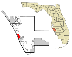 Location in Sarasota County and the state of Florida | |
| Coordinates: 27°8′29″N 82°27′44″W / 27.14139°N 82.46222°WCoordinates: 27°8′29″N 82°27′44″W / 27.14139°N 82.46222°W[1] | |
| Country | |
| State | |
| County | Sarasota |
| Area | |
| • Total | 6.1 sq mi (15.8 km2) |
| • Land | 5.1 sq mi (13.2 km2) |
| • Water | 1.0 sq mi (2.5 km2) |
| Elevation | 10 ft (3 m) |
| Population (2010) | |
| • Total | 8,171 |
| • Density | 1,600/sq mi (617.9/km2) |
| Time zone | UTC-5 (Eastern (EST)) |
| • Summer (DST) | UTC-4 (EDT) |
| ZIP code | 34272 |
| Area code(s) | 941 |
| FIPS code | 12-39600[2] |
| GNIS feature ID | 0285395[3] |

Laurel is a census-designated place (CDP) in Sarasota County, Florida, United States. The population was 8,171 at the 2010 census.[4] People who live in the CDP have a Nokomis mailing address and signs along U.S. 41 refer to the entire extent between (at the southern extent of the Nokomis CDP) and (at the northern extent of the Laurel CDP) as "Nokomis."[5]
Laurel is part of the Bradenton–Sarasota–Venice Metropolitan Statistical Area.
Geography[]
According to the United States Census Bureau, the CDP has a total area of 6.1 square miles (15.8 km2), of which 5.1 square miles (13.2 km2) is land and 0.97 square miles (2.5 km2), or 16.13%, is water.[4]
Demographics[]

As of the 2000 US Census, there were 8,393 people, 4,179 households, and 2,670 families residing in the CDP.[2] The population density was 1,609.5 people per square mile (622.0/km2). There were 5,047 housing units at an average density of 967.9/sq mi (374.0/km2). The racial makeup of the CDP was 95.73% White, 1.97% African American, 0.30% Native American, 0.76% Asian, 0.01% Pacific Islander, 0.30% from other races, and 0.93% from two or more races. Hispanic or Latino of any race were 1.29% of the population.
There were 4,179 households, out of which 13.2% had children under the age of 18 living with them, 55.5% were married couples living together, 5.9% had a female householder with no husband present, and 36.1% were non-families. 30.4% of all households were made up of individuals, and 19.0% had someone living alone who was 65 years of age or older. The average household size was 2.01 and the average family size was 2.44.
In the CDP, the population was spread out, with 12.4% under the age of 18, 3.1% from 18 to 24, 16.5% from 25 to 44, 28.8% from 45 to 64, and 39.3% who were 65 years of age or older. The median age was 58 years. For every 100 females, there were 90.8 males. For every 100 females age 18 and over, there were 88.2 males.
The median income for a household in the CDP was $42,186, and the median income for a family was $51,153. Males had a median income of $32,425 versus $27,905 for females. The per capita income for the CDP was $30,485. About 5.2% of families and 8.4% of the population were below the poverty line, including 14.6% of those under age 18 and 6.3% of those age 65 or over.
Notable people[]
- Vivian E. Browne, visual artist
References[]
- ^ "US Gazetteer files: 2010, 2000, and 1990". United States Census Bureau. February 12, 2011. Retrieved April 23, 2011.
- ^ Jump up to: a b "U.S. Census website". United States Census Bureau. Retrieved January 31, 2008.
- ^ "US Board on Geographic Names". United States Geological Survey. October 25, 2007. Retrieved January 31, 2008.
- ^ Jump up to: a b "Geographic Identifiers: 2010 Demographic Profile Data (G001): Laurel CDP, Florida". U.S. Census Bureau, American Factfinder. Archived from the original on February 12, 2020. Retrieved April 12, 2013.
- ^ Google Street View link
| show Municipalities and communities of Sarasota County, Florida, United States |
|---|

| show Authority control |
|---|
- Census-designated places in Sarasota County, Florida
- Sarasota metropolitan area
- Census-designated places in Florida
- Populated places on the Intracoastal Waterway in Florida