Leeuwarderadeel
Leeuwarderadeel
Ljouwerteradiel | |
|---|---|
Municipality | |
 Wind mill in Leeuwarderadeel | |
 Flag  Coat of arms | |
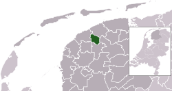 Location in Friesland | |
| Coordinates: 53°16′N 5°46′E / 53.267°N 5.767°ECoordinates: 53°16′N 5°46′E / 53.267°N 5.767°E | |
| Country | Netherlands |
| Province | Friesland |
| Merged | 2018 |
| Area | |
| • Total | 41.46 km2 (16.01 sq mi) |
| • Land | 40.91 km2 (15.80 sq mi) |
| • Water | 0.55 km2 (0.21 sq mi) |
| Elevation | 1 m (3 ft) |
| Highest elevation | 1.7 m (5.6 ft) |
| Lowest elevation | 0.6 m (2.0 ft) |
| Time zone | UTC+1 (CET) |
| • Summer (DST) | UTC+2 (CEST) |
| Postcode | 9050–9057 9071–9072 |
| Area code | 0518, 058 |
| Website | www |

Leeuwarderadeel (Dutch: [leːˈʋɑrdəraːˌdeːl] (![]() listen); West Frisian: Ljouwerteradiel) is a former municipality in the northern Netherlands. Its capital was Stiens.
listen); West Frisian: Ljouwerteradiel) is a former municipality in the northern Netherlands. Its capital was Stiens.
History[]
On 1 January 2018 it merged with the municipality of Leeuwarden.
Population centres[]
- Bartlehiem
- Britsum
- Cornjum
- Finkum
- Hijum
- Jelsum
- Oude Leije
- Stiens
Topography[]

Dutch Topographic map of the municipality of Leeuwarderadeel, June 2015.
Bartlehiem[]
The hamlet of Bartlehiem is partially in Leeuwarderadeel partially in Ferwerderadiel and partially in Tytsjerksteradiel.
References[]
- ^ "Kerncijfers wijken en buurten 2020" [Key figures for neighbourhoods 2020]. StatLine (in Dutch). CBS. 24 July 2020. Retrieved 19 September 2020.
- ^ "Postcodetool for 9051AR". Actueel Hoogtebestand Nederland (in Dutch). Het Waterschapshuis. Retrieved 19 September 2013.
- ^ "Bevolkingsontwikkeling; regio per maand" [Population growth; regions per month]. CBS Statline (in Dutch). CBS. 1 January 2019. Retrieved 1 January 2019.
External links[]
 Media related to Leeuwarderadeel at Wikimedia Commons
- Official website
| show Places adjacent to Leeuwarderadeel |
|---|
| show Authority control |
|---|
This Friesland location article is a stub. You can help Wikipedia by . |
Categories:
- Leeuwarden
- Former municipalities of Friesland
- Friesland geography stubs