Lemieux, Quebec
Lemieux | |
|---|---|
Municipality | |
 | |
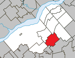 Location within Bécancour RCM | |
 Lemieux Location in southern Quebec | |
| Coordinates: 46°18′N 72°07′W / 46.3°N 72.12°WCoordinates: 46°18′N 72°07′W / 46.3°N 72.12°W[1] | |
| Country | |
| Province | |
| Region | Centre-du-Québec |
| RCM | Bécancour |
| Constituted | August 14, 1922 |
| Government | |
| • Mayor | Jean-Louis Belisle |
| • Federal riding | Bas-Richelieu— Nicolet—Bécancour |
| • Prov. riding | Nicolet-Bécancour |
| Area | |
| • Total | 74.20 km2 (28.65 sq mi) |
| • Land | 74.80 km2 (28.88 sq mi) |
| There is an apparent contradiction between two authoritative sources | |
| Population | |
| • Total | 304 |
| • Density | 4.1/km2 (11/sq mi) |
| • Pop 2006-2011 | |
| • Dwellings | 132 |
| Time zone | UTC−5 (EST) |
| • Summer (DST) | UTC−4 (EDT) |
| Postal code(s) | G0X 1S0 |
| Area code(s) | 819 |
| Highways | |

Lemieux is a municipality in the Centre-du-Québec region of the province of Quebec in Canada.
See also[]
References[]
- ^ Reference number 35388 of the Commission de toponymie du Québec (in French)
- ^ Jump up to: a b Geographic code 38020 in the official Répertoire des municipalités (in French)
- ^ Jump up to: a b "(Code 2438020) Census Profile". 2011 census. Statistics Canada. 2012.
External links[]
 Media related to Lemieux, Quebec at Wikimedia Commons
| show Adjacent Municipal Subdivisions |
|---|
| hide | |
|---|---|
| Cities | |
| Municipalities | |
| Parishes | |
| |
| show Authority control |
|---|
This Quebec location article is a stub. You can help Wikipedia by . |
Categories:
- Municipalities in Quebec
- Incorporated places in Centre-du-Québec
- Quebec geography stubs