Leudelange
Leudelange
Leideleng | |
|---|---|
Commune | |
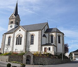 The church of Leudelange | |
 Coat of arms | |
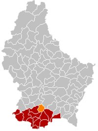 Map of Luxembourg with Leudelange highlighted in orange, and the canton in dark red | |
| Coordinates: 49°34′00″N 6°04′00″E / 49.5667°N 6.0667°ECoordinates: 49°34′00″N 6°04′00″E / 49.5667°N 6.0667°E | |
| Country | |
| Canton | Esch-sur-Alzette |
| Area | |
| • Total | 13.57 km2 (5.24 sq mi) |
| Area rank | 84th of 102 |
| Highest elevation | 359 m (1,178 ft) |
| • Rank | 77th of 102 |
| Lowest elevation | 276 m (906 ft) |
| • Rank | 77th of 102 |
| Population (2018) | |
| • Total | 2,579 |
| • Rank | 58th of 102 |
| • Density | 190/km2 (490/sq mi) |
| • Density rank | 40th of 102 |
| Time zone | UTC+1 (CET) |
| • Summer (DST) | UTC+2 (CEST) |
| LU0000207 | |
| Website | leudelange.lu |

Leudelange (Luxembourgish: Leideleng, German: Leudelingen) is a commune and town in south-western Luxembourg. It is situated in the canton of Esch-sur-Alzette.
As of 2007, the town of Leudelange, which lies in the centre of the commune, had a population of 2,100.
Leudelange was formed on 1 July 1856, when it was detached from the commune of Reckange-sur-Mess. The law forming Leudelange was passed on the 3 March 1856.[1]
Notable residents[]
Gilles Müller, professional tennis player
References[]
- ^ (in French and German) "Mémorial A, 1856, No. 7" (PDF). Service central de législation. Retrieved 2006-08-15.[permanent dead link]
External links[]
- Eco Habitat Lux: Solar pannel installation, Leudelange
 Media related to Leudelange at Wikimedia Commons
| show Places adjacent to Leudelange |
|---|

| Authority control |
|---|
This article related to the geography of Esch-sur-Alzette canton is a stub. You can help Wikipedia by . |
Categories:
- Leudelange
- Communes in Esch-sur-Alzette (canton)
- Towns in Luxembourg
- Luxembourg geography stubs