Roeser
This article needs additional citations for verification. (June 2020) |
Roeser
Réiser | |
|---|---|
Commune | |
 Town hall | |
 Coat of arms | |
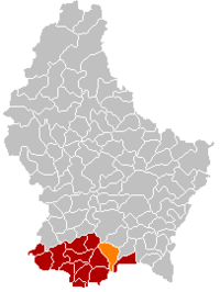 Map of Luxembourg with Roeser highlighted in orange, and the canton in dark red | |
| Coordinates: 49°32′10″N 6°08′45″E / 49.5361°N 6.1458°ECoordinates: 49°32′10″N 6°08′45″E / 49.5361°N 6.1458°E | |
| Country | |
| Canton | Esch-sur-Alzette |
| Area | |
| • Total | 23.8 km2 (9.2 sq mi) |
| Area rank | 38th of 102 |
| Highest elevation | 311 m (1,020 ft) |
| • Rank | 97th of 102 |
| Lowest elevation | 256 m (840 ft) |
| • Rank | 60th of 102 |
| Population (2018) | |
| • Total | 6,278 |
| • Rank | 22nd of 102 |
| • Density | 260/km2 (680/sq mi) |
| • Density rank | 10th of 102 |
| Time zone | UTC+1 (CET) |
| • Summer (DST) | UTC+2 (CEST) |
| LU0000211 | |
| Website | roeser.lu |

Roeser (Luxembourgish: Réiser [ˈʀəɪzɐ]) is a commune and small town in southern Luxembourg. It is part of the canton of Esch-sur-Alzette. As of the February 1, 2011 census, the commune had a population of 5,302.
As of 2005, the town of Roeser, which lies in the north of the commune, has a population of 682. Other towns within the commune include Berchem, Bivange, Crauthem, Kockelscheuer, Livange, and Peppange.
Twin towns — sister cities[]
Roeser is twinned with:[1]
References[]
- ^ "Alliances". roeser.lu (in French). Roeser. Retrieved 2019-09-08.
External links[]
 Media related to Roeser at Wikimedia Commons
| show Places adjacent to Roeser |
|---|

| show Authority control |
|---|
This article related to the geography of Esch-sur-Alzette canton is a stub. You can help Wikipedia by . |
Categories:
- Roeser
- Communes in Esch-sur-Alzette (canton)
- Towns in Luxembourg
- Luxembourg geography stubs