Weiler-la-Tour
This article needs additional citations for verification. (March 2019) |
Weiler-la-Tour
Weiler zum Tuer (Luxembourgish) | |
|---|---|
Commune | |
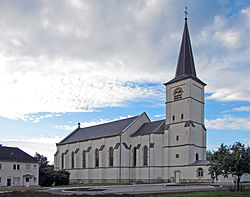 Weiler-la-Tour church | |
 Coat of arms | |
 Map of Luxembourg with Weiler-la-Tour highlighted in orange, and the canton in dark red | |
| Coordinates: 49°32′35″N 6°12′00″E / 49.5431°N 6.2°ECoordinates: 49°32′35″N 6°12′00″E / 49.5431°N 6.2°E | |
| Country | |
| Canton | Luxembourg |
| Government | |
| • Mayor | Vincent Reding (CSV) |
| Area | |
| • Total | 17.07 km2 (6.59 sq mi) |
| Area rank | 69th of 102 |
| Highest elevation | 329 m (1,079 ft) |
| • Rank | 92nd of 102 |
| Lowest elevation | 243 m (797 ft) |
| • Rank | 53rd of 102 |
| Population (2018) | |
| • Total | 2,389 |
| • Rank | 62nd of 102 |
| • Density | 140/km2 (360/sq mi) |
| • Density rank | 51st of 102 |
| Time zone | UTC+1 (CET) |
| • Summer (DST) | UTC+2 (CEST) |
| LU0000311 | |
| Website | weiler-la-tour.lu |

Weiler-la-Tour (Luxembourgish: Weiler zum Tuer, German: Weiler zum Turm) is a commune and small town in southern Luxembourg. It is located south-east of Luxembourg City. The commune's administrative centre is Hassel.
As of 2005, the town of Weiler-la-Tour, which lies in the south of the commune, has a population of 477. Other towns within the commune include Hassel and Syren.
References[]
- ^ "WEILER-LA-TOUR - Syvicol". www.syvicol.lu. Retrieved 3 April 2019.
External links[]
 Media related to Weiler-la-Tour at Wikimedia Commons
| show Places adjacent to Weiler-la-Tour |
|---|

| Authority control |
|
|---|
This article related to the geography of Luxembourg canton is a stub. You can help Wikipedia by . |
Categories:
- Communes in Luxembourg (canton)
- Towns in Luxembourg
- Luxembourg canton geography stubs