Liberty Township, White County, Indiana
Liberty Township | |
|---|---|
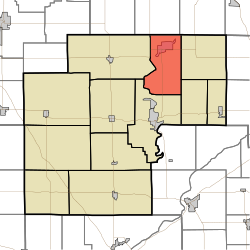 Location in White County | |
| Coordinates: 40°51′02″N 86°44′27″W / 40.85056°N 86.74083°WCoordinates: 40°51′02″N 86°44′27″W / 40.85056°N 86.74083°W | |
| Country | United States |
| State | Indiana |
| County | White |
| Government | |
| • Type | Indiana township |
| Area | |
| • Total | 33.99 sq mi (88.0 km2) |
| • Land | 33.22 sq mi (86.0 km2) |
| • Water | 0.77 sq mi (2.0 km2) 2.27% |
| Elevation | 676 ft (206 m) |
| Population (2010) | |
| • Total | 2,223 |
| • Density | 66.9/sq mi (25.8/km2) |
| ZIP codes | 47925, 47960 |
| GNIS feature ID | 453567 |

Liberty Township is one of twelve townships in White County, Indiana, United States. As of the 2010 census, its population was 2,223 and it contained 2,082 housing units.[1]
Liberty Township was established in 1838.[2]
Geography[]
According to the 2010 census, the township has a total area of 33.99 square miles (88.0 km2), of which 33.22 square miles (86.0 km2) (or 97.73%) is land and 0.77 square miles (2.0 km2) (or 2.27%) is water.[1]
Cities, towns, villages[]
Unincorporated towns[]
(This list is based on USGS data and may include former settlements.)
Adjacent townships[]
- Beaver Township, Pulaski County (north)
- Indian Creek Township, Pulaski County (northeast)
- Cass Township (east)
- Lincoln Township (southeast)
- Union Township (south)
- Monon Township (west)
Cemeteries[]
The township contains these three cemeteries: Clark, Hughes and Warden.
Landmarks[]
- Cp Buffalo
School districts[]
- North White School Corporation
- Twin Lakes School Corporation
Political districts[]
- Indiana's 2nd congressional district
- State House District 15
- State House District 16
- State Senate District 07
References[]
- United States Census Bureau 2007 TIGER/Line Shapefiles
- United States Board on Geographic Names (GNIS)
- IndianaMap
- ^ Jump up to: a b "Population, Housing Units, Area, and Density: 2010 - County -- County Subdivision and Place -- 2010 Census Summary File 1". United States Census. Archived from the original on 2020-02-12. Retrieved 2013-05-10.
- ^ Hamelle, W. H. (1915). A Standard History of White County, Indiana: An Authentic Narrative of the Past, with an Extended Survey of Modern Developments in the Progress of Town and Country. Unigraphic. p. 265.
External links[]
| show Municipalities and communities of White County, Indiana, United States |
|---|
| show Authority control |
|---|
Categories:
- Townships in White County, Indiana
- Townships in Indiana
- 1838 establishments in Indiana
- Populated places established in 1838