Princeton Township, White County, Indiana
Princeton Township | |
|---|---|
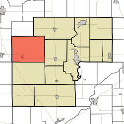 Location in White County | |
| Coordinates: 40°47′13″N 87°00′54″W / 40.78694°N 87.01500°WCoordinates: 40°47′13″N 87°00′54″W / 40.78694°N 87.01500°W | |
| Country | United States |
| State | Indiana |
| County | White |
| Government | |
| • Type | Indiana township |
| Area | |
| • Total | 62.53 sq mi (162.0 km2) |
| • Land | 62.53 sq mi (162.0 km2) |
| • Water | 0 sq mi (0 km2) 0% |
| Elevation | 692 ft (211 m) |
| Population (2010) | |
| • Total | 1,553 |
| • Density | 24.8/sq mi (9.6/km2) |
| ZIP codes | 47959, 47980, 47995 |
| GNIS feature ID | 453777 |

Princeton Township is one of twelve townships in White County, Indiana, United States. As of the 2010 census, its population was 1,553 and it contained 644 housing units.[1]
Princeton Township was organized in 1844, and named after the ship on which an early settler had immigrated to America.[2]
Geography[]
According to the 2010 census, the township has a total area of 62.53 square miles (162.0 km2), all land.[1]
Cities, towns, villages[]
Unincorporated towns[]
(This list is based on USGS data and may include former settlements.)
Adjacent townships[]
- Milroy Township, Jasper County (north)
- Monon Township (northeast)
- Honey Creek Township (east)
- West Point Township (south)
- Gilboa Township, Benton County (southwest)
- Carpenter Township, Jasper County (west)
- Jordan Township, Jasper County (west)
Cemeteries[]
The township contains these five cemeteries: Apostolic, Dobbins, Palestine, Palestine and Wolcott.
School districts[]
- Tri-County School Corporation
Political districts[]
- Indiana's 4th congressional district
- State House District 16
- State Senate District 07
References[]
- United States Census Bureau 2007 TIGER/Line Shapefiles
- United States Board on Geographic Names (GNIS)
- IndianaMap
- ^ a b "Population, Housing Units, Area, and Density: 2010 - County -- County Subdivision and Place -- 2010 Census Summary File 1". United States Census. Archived from the original on 2020-02-12. Retrieved 2013-05-10.
- ^ Hamelle, W. H. (1915). A Standard History of White County, Indiana: An Authentic Narrative of the Past, with an Extended Survey of Modern Developments in the Progress of Town and Country. Unigraphic. p. 254.
External links[]
Municipalities and communities of White County, Indiana, United States | ||
|---|---|---|
| City | ||
| Towns | ||
| Townships | ||
| CDPs | ||
| Other unincorporated communities | ||
| ||
Categories:
- Townships in White County, Indiana
- Townships in Indiana