White County, Indiana
White County | |
|---|---|
U.S. county | |
 White County Courthouse in Monticello | |
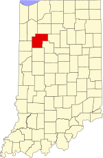 Location within the U.S. state of Indiana | |
 Indiana's location within the U.S. | |
| Coordinates: 40°45′N 86°52′W / 40.75°N 86.86°W | |
| Country | |
| State | |
| Founded | 1 February 1834 (authorized) |
| Named for | Isaac White |
| Seat | Monticello |
| Largest city | Monticello |
| Area | |
| • Total | 508.68 sq mi (1,317.5 km2) |
| • Land | 505.12 sq mi (1,308.3 km2) |
| • Water | 3.56 sq mi (9.2 km2) 0.70%% |
| Population | |
| • Estimate (2018) | 24,133 |
| • Density | 47.8/sq mi (18.5/km2) |
| Time zone | UTC−5 (Eastern) |
| • Summer (DST) | UTC−4 (EDT) |
| Congressional district | 4th |
| Website | www |
| Indiana county number 91 | |

White County is a county in the U.S. state of Indiana. As of the 2010 United States Census, the population was 24,643.[1] The county seat (and only incorporated city) is Monticello.[2]
History[]
The first white settlers[3] in the future White County arrived in the land west of Tippecanoe River in 1829, and in other parts of the county in 1831. This area was part of Carroll County during that period.
By 1833, so many settlers had entered the area that the state legislature were pressured to have a separate county created. On 1 February 1834 the state approved the creation of this county, directing that it be named for Isaac White. Interim commissioners were named and directed to organize the county during the summer of 1834, and to choose a county seat in September. They did so on 5 September 1834, naming Monticello as the future seat, due to its central location. While the county was being organized, it was attached to Carroll County for administrative and judicial purposes.
The county name honored Isaac White of Equality, Illinois who was killed at the Battle of Tippecanoe in 1811. White was a Colonel in the Illinois militia, who volunteered to serve as a Private in the Indiana militia in the march against Prophetstown. He was placed under the command of Kentucky Maj. Joseph Hamilton Daveiss. The two exchanged swords in a demonstration of mutual respect at Fort Vincennes. In the Battle of Tippecanoe they died together and were buried in a common grave at Battle Ground.
Alterations were made to the county's boundaries on 24 December 1834, on 4 February 1837, and on 14 February 1839. In addition, the counties of Jasper (1837), Pulaski (1839), Newton (1839), and Benton (1840) removed significant portions of the county's territory. The borders have remained unchanged since 1840.[4]
Geography[]
The low, rolling hills of White County are entirely devoted to agriculture or to urban development.[5] The Tippecanoe River flows southward through the central part of the county. The highest point on the terrain (770 feet/235 meters ASL) is a gentle rise about 2.8 miles (4.5 km) SSE from Wolcott.[6]
According to the 2010 United States Census, the county has a total area of 508.68 square miles (1,317.5 km2), of which 505.12 square miles (1,308.3 km2) (or 99.30%) is land and 3.56 square miles (9.2 km2) (or 0.70%) is water.[7]
Adjacent counties[]
- Pulaski County - north
- Cass County - east
- Carroll County - southeast
- Tippecanoe County - south
- Benton County - west
- Jasper County - northwest/CST Border
City and towns[]
- Brookston (town)
- Burnettsville (town)
- Chalmers (town)
- Monon (town)
- Monticello (city/county seat)
- Reynolds (town)
- Wolcott (town)
Census-designated places[]
Unincorporated places[]
Townships[]
Major highways[]
Railroads[]
- CSX Transportation
- Toledo, Peoria and Western Railway
Climate and weather[]
| Monticello, Indiana | ||||||||||||||||||||||||||||||||||||||||||||||||||||||||||||
|---|---|---|---|---|---|---|---|---|---|---|---|---|---|---|---|---|---|---|---|---|---|---|---|---|---|---|---|---|---|---|---|---|---|---|---|---|---|---|---|---|---|---|---|---|---|---|---|---|---|---|---|---|---|---|---|---|---|---|---|---|
| Climate chart (explanation) | ||||||||||||||||||||||||||||||||||||||||||||||||||||||||||||
| ||||||||||||||||||||||||||||||||||||||||||||||||||||||||||||
| ||||||||||||||||||||||||||||||||||||||||||||||||||||||||||||
In recent years, average temperatures in Monticello have ranged from a low of 17 °F (−8 °C) in January to a high of 86 °F (30 °C) in July, although a record low of −25 °F (−32 °C) was recorded in January 1963 and a record high of 107 °F (42 °C) was recorded in July 1954. Average monthly precipitation ranged from 1.94 inches (49 mm) in February to 4.16 inches (106 mm) in July.[8]
Government[]
The county government is a constitutional body, and is granted specific powers by the Constitution of Indiana, and by the Indiana Code.
County Council: The legislative branch of the county government; controls spending and revenue collection in the county. Representatives are elected to four-year terms from county districts. They set salaries, the annual budget, and special spending. The council has limited authority to impose local taxes, in the form of an income and property tax that is subject to state level approval, excise taxes, and service taxes.[9][10]
Board of Commissioners: The executive body of the county; commissioners are elected county-wide, to staggered four-year terms. One commissioner serves as president. The commissioners execute acts legislated by the council, collect revenue, and manage the county government.[9][10]
Court: The county maintains a small claims court that handles civil cases. The judge on the court is elected to a term of four years and must be a member of the Indiana Bar Association. The judge is assisted by a constable who is also elected to a four-year term. In some cases, court decisions can be appealed to the state level circuit court.[10]
County Officials: The county has other elected offices, including sheriff, coroner, auditor, treasurer, recorder, surveyor, and circuit court clerk. These officers are elected to four-year terms. Members elected to county government positions are required to declare party affiliations and to be residents of the county.[10]
Demographics[]
| Historical population | |||
|---|---|---|---|
| Census | Pop. | %± | |
| 1840 | 1,832 | — | |
| 1850 | 4,761 | 159.9% | |
| 1860 | 8,258 | 73.5% | |
| 1870 | 10,554 | 27.8% | |
| 1880 | 13,795 | 30.7% | |
| 1890 | 15,671 | 13.6% | |
| 1900 | 19,138 | 22.1% | |
| 1910 | 17,602 | −8.0% | |
| 1920 | 17,351 | −1.4% | |
| 1930 | 15,831 | −8.8% | |
| 1940 | 17,037 | 7.6% | |
| 1950 | 18,042 | 5.9% | |
| 1960 | 19,709 | 9.2% | |
| 1970 | 20,995 | 6.5% | |
| 1980 | 23,867 | 13.7% | |
| 1990 | 23,265 | −2.5% | |
| 2000 | 25,267 | 8.6% | |
| 2010 | 24,643 | −2.5% | |
| 2018 (est.) | 24,133 | [12] | −2.1% |
| US Decennial Census[13] 1790-1960[14] 1900-1990[15] 1990-2000[16] 2010-2013[1] | |||
2010 Census[]
As of the 2010 United States Census, there were 24,643 people, 9,741 households, and 6,849 families in the county.[17] The population density was 48.8 inhabitants per square mile (18.8/km2). There were 12,970 housing units at an average density of 25.7 per square mile (9.9/km2).[7] The racial makeup of the county was 93.9% white, 0.4% Asian, 0.3% American Indian, 0.3% black or African American, 3.7% from other races, and 1.4% from two or more races. Those of Hispanic or Latino origin made up 7.1% of the population.[17] In terms of ancestry, 27.0% were German, 13.3% were Irish, 9.7% were English, and 8.4% were American.[18]
Of the 9,741 households, 31.3% had children under the age of 18 living with them, 56.1% were married couples living together, 9.3% had a female householder with no husband present, 29.7% were non-families, and 24.8% of all households were made up of individuals. The average household size was 2.50 and the average family size was 2.96. The median age was 41.9 years.[17]
The median income for a household in the county was $47,697 and the median income for a family was $52,626. Males had a median income of $39,715 versus $28,880 for females. The per capita income for the county was $22,323. About 7.7% of families and 9.5% of the population were below the poverty line, including 13.0% of those under age 18 and 4.5% of those age 65 or over.[19]
Education[]
Public schools in White County are administered by the , North White School Corporation, and .
High Schools and Middle Schools
- Tri-County Middle/Senior High School [1]
- Frontier Junior-Senior High School [2]
- North White High School [3]
- [4]
- [5]
- Twin Lakes High School [6]
Elementary Schools [7]
See also[]
References[]
- ^ Jump up to: a b "White County QuickFacts". US Census Bureau. Retrieved 25 September 2011.
- ^ "Find a County". National Association of Counties. Retrieved 7 June 2011.
- ^ "It is generally claimed that Joseph H. Thompson was the first white man to make settlement within the present boundaries of the county. He located in what is now Big Creek Township in the spring of 1829." (Pioneers Ante-dating County Organization, Hamelle, 1915.)
- ^ Hamelle, W.H. (ed.) (1915). A Standard History of White County Indiana: An Authentic Narrative of the Past, with an Extended Survey of Modern Developments in the Progress of Town and Country. Chicago and New York: Lewis Publishing Co. Archived from the original on 10 October 2006. Retrieved 17 August 2020.CS1 maint: extra text: authors list (link)
- ^ White County IN (Google Maps, accessed 17 August 2020)
- ^ White County High Point, Indiana (PeakBagger.com, accessed 17 August 2020)
- ^ Jump up to: a b "Population, Housing Units, Area, and Density: 2010 - County". US Census Bureau. Archived from the original on 12 February 2020. Retrieved 10 July 2015.
- ^ Jump up to: a b "Monthly Averages for Monticello IN". The Weather Channel. Retrieved 27 January 2011.
- ^ Jump up to: a b Indiana Code. "Title 36, Article 2, Section 3". IN.gov. Retrieved 16 September 2008.
- ^ Jump up to: a b c d Indiana Code. "Title 2, Article 10, Section 2" (PDF). IN.gov. Retrieved 16 September 2008.
- ^ Leip, David. "Atlas of US Presidential Elections". uselectionatlas.org. Retrieved 21 May 2018.
- ^ "Population and Housing Unit Estimates". Retrieved July 26, 2019.
- ^ "US Decennial Census". US Census Bureau. Retrieved July 10, 2014.
- ^ "Historical Census Browser". University of Virginia Library. Retrieved July 10, 2014.
- ^ "Population of Counties by Decennial Census: 1900 to 1990". US Census Bureau. Retrieved July 10, 2014.
- ^ "Census 2000 PHC-T-4. Ranking Tables for Counties: 1990 and 2000" (PDF). US Census Bureau. Retrieved July 10, 2014.
- ^ Jump up to: a b c "Profile of General Population and Housing Characteristics: 2010 Demographic Profile Data". US Census Bureau. Archived from the original on 13 February 2020. Retrieved 10 July 2015.
- ^ "Selected SocialCharacteristics in the US – 2006-2010 American Community Survey 5-Year Estimates". US Census Bureau. Archived from the original on 14 February 2020. Retrieved 10 July 2015.
- ^ "Selected Economic Characteristics – 2006-2010 American Community Survey 5-Year Estimates". US Census Bureau. Archived from the original on 14 February 2020. Retrieved 10 July 2015.
External links[]
| Wikimedia Commons has media related to White County, Indiana. |
| show Places adjacent to White County, Indiana |
|---|
| show Municipalities and communities of White County, Indiana, United States |
|---|

Coordinates: 40°45′N 86°52′W / 40.75°N 86.86°W
| show Authority control |
|---|
- Indiana counties
- White County, Indiana
- 1834 establishments in Indiana
- Populated places established in 1834
- Sundown towns in Indiana