Line 2 (São Paulo Metro)
This article may be expanded with text translated from the corresponding article in Portuguese. (September 2020) Click [show] for important translation instructions.
|
| São Paulo Metro Line 2 (Green) | |||||||||||||||||||||||||||||||||||||||||||||||||||||||||||||||||||||||||||||||||||||||||||||||||||||||||||||||||||||||||||||||||||||||||||||||||||||||||||||||||||||||||||||||||||||||||||||||||||||||||||||||||||||||||||||||||||||||||||||||||||||||||||||||||||||||||||||||||||||||||||||||||||||||||||||||||||||||||||||||||||||||||||||||||||||||||||||||||||||||||
|---|---|---|---|---|---|---|---|---|---|---|---|---|---|---|---|---|---|---|---|---|---|---|---|---|---|---|---|---|---|---|---|---|---|---|---|---|---|---|---|---|---|---|---|---|---|---|---|---|---|---|---|---|---|---|---|---|---|---|---|---|---|---|---|---|---|---|---|---|---|---|---|---|---|---|---|---|---|---|---|---|---|---|---|---|---|---|---|---|---|---|---|---|---|---|---|---|---|---|---|---|---|---|---|---|---|---|---|---|---|---|---|---|---|---|---|---|---|---|---|---|---|---|---|---|---|---|---|---|---|---|---|---|---|---|---|---|---|---|---|---|---|---|---|---|---|---|---|---|---|---|---|---|---|---|---|---|---|---|---|---|---|---|---|---|---|---|---|---|---|---|---|---|---|---|---|---|---|---|---|---|---|---|---|---|---|---|---|---|---|---|---|---|---|---|---|---|---|---|---|---|---|---|---|---|---|---|---|---|---|---|---|---|---|---|---|---|---|---|---|---|---|---|---|---|---|---|---|---|---|---|---|---|---|---|---|---|---|---|---|---|---|---|---|---|---|---|---|---|---|---|---|---|---|---|---|---|---|---|---|---|---|---|---|---|---|---|---|---|---|---|---|---|---|---|---|---|---|---|---|---|---|---|---|---|---|---|---|---|---|---|---|---|---|---|---|---|---|---|---|---|---|---|---|---|---|---|---|---|---|---|---|---|---|---|---|---|---|---|---|---|---|---|---|---|---|---|---|---|---|---|---|---|---|---|---|---|---|---|---|---|---|---|---|---|---|---|---|---|---|---|---|---|---|---|---|---|---|---|---|---|---|
| Overview | |||||||||||||||||||||||||||||||||||||||||||||||||||||||||||||||||||||||||||||||||||||||||||||||||||||||||||||||||||||||||||||||||||||||||||||||||||||||||||||||||||||||||||||||||||||||||||||||||||||||||||||||||||||||||||||||||||||||||||||||||||||||||||||||||||||||||||||||||||||||||||||||||||||||||||||||||||||||||||||||||||||||||||||||||||||||||||||||||||||||||
| Status | Operational | ||||||||||||||||||||||||||||||||||||||||||||||||||||||||||||||||||||||||||||||||||||||||||||||||||||||||||||||||||||||||||||||||||||||||||||||||||||||||||||||||||||||||||||||||||||||||||||||||||||||||||||||||||||||||||||||||||||||||||||||||||||||||||||||||||||||||||||||||||||||||||||||||||||||||||||||||||||||||||||||||||||||||||||||||||||||||||||||||||||||||
| Owner | |||||||||||||||||||||||||||||||||||||||||||||||||||||||||||||||||||||||||||||||||||||||||||||||||||||||||||||||||||||||||||||||||||||||||||||||||||||||||||||||||||||||||||||||||||||||||||||||||||||||||||||||||||||||||||||||||||||||||||||||||||||||||||||||||||||||||||||||||||||||||||||||||||||||||||||||||||||||||||||||||||||||||||||||||||||||||||||||||||||||||
| Locale | São Paulo, Brazil | ||||||||||||||||||||||||||||||||||||||||||||||||||||||||||||||||||||||||||||||||||||||||||||||||||||||||||||||||||||||||||||||||||||||||||||||||||||||||||||||||||||||||||||||||||||||||||||||||||||||||||||||||||||||||||||||||||||||||||||||||||||||||||||||||||||||||||||||||||||||||||||||||||||||||||||||||||||||||||||||||||||||||||||||||||||||||||||||||||||||||
| Termini | Vila Madalena Vila Prudente | ||||||||||||||||||||||||||||||||||||||||||||||||||||||||||||||||||||||||||||||||||||||||||||||||||||||||||||||||||||||||||||||||||||||||||||||||||||||||||||||||||||||||||||||||||||||||||||||||||||||||||||||||||||||||||||||||||||||||||||||||||||||||||||||||||||||||||||||||||||||||||||||||||||||||||||||||||||||||||||||||||||||||||||||||||||||||||||||||||||||||
| Connecting lines | |||||||||||||||||||||||||||||||||||||||||||||||||||||||||||||||||||||||||||||||||||||||||||||||||||||||||||||||||||||||||||||||||||||||||||||||||||||||||||||||||||||||||||||||||||||||||||||||||||||||||||||||||||||||||||||||||||||||||||||||||||||||||||||||||||||||||||||||||||||||||||||||||||||||||||||||||||||||||||||||||||||||||||||||||||||||||||||||||||||||||
| Stations | 14 | ||||||||||||||||||||||||||||||||||||||||||||||||||||||||||||||||||||||||||||||||||||||||||||||||||||||||||||||||||||||||||||||||||||||||||||||||||||||||||||||||||||||||||||||||||||||||||||||||||||||||||||||||||||||||||||||||||||||||||||||||||||||||||||||||||||||||||||||||||||||||||||||||||||||||||||||||||||||||||||||||||||||||||||||||||||||||||||||||||||||||
| Service | |||||||||||||||||||||||||||||||||||||||||||||||||||||||||||||||||||||||||||||||||||||||||||||||||||||||||||||||||||||||||||||||||||||||||||||||||||||||||||||||||||||||||||||||||||||||||||||||||||||||||||||||||||||||||||||||||||||||||||||||||||||||||||||||||||||||||||||||||||||||||||||||||||||||||||||||||||||||||||||||||||||||||||||||||||||||||||||||||||||||||
| Type | Rapid transit | ||||||||||||||||||||||||||||||||||||||||||||||||||||||||||||||||||||||||||||||||||||||||||||||||||||||||||||||||||||||||||||||||||||||||||||||||||||||||||||||||||||||||||||||||||||||||||||||||||||||||||||||||||||||||||||||||||||||||||||||||||||||||||||||||||||||||||||||||||||||||||||||||||||||||||||||||||||||||||||||||||||||||||||||||||||||||||||||||||||||||
| System | São Paulo Metro | ||||||||||||||||||||||||||||||||||||||||||||||||||||||||||||||||||||||||||||||||||||||||||||||||||||||||||||||||||||||||||||||||||||||||||||||||||||||||||||||||||||||||||||||||||||||||||||||||||||||||||||||||||||||||||||||||||||||||||||||||||||||||||||||||||||||||||||||||||||||||||||||||||||||||||||||||||||||||||||||||||||||||||||||||||||||||||||||||||||||||
| Operator(s) | |||||||||||||||||||||||||||||||||||||||||||||||||||||||||||||||||||||||||||||||||||||||||||||||||||||||||||||||||||||||||||||||||||||||||||||||||||||||||||||||||||||||||||||||||||||||||||||||||||||||||||||||||||||||||||||||||||||||||||||||||||||||||||||||||||||||||||||||||||||||||||||||||||||||||||||||||||||||||||||||||||||||||||||||||||||||||||||||||||||||||
| Depot(s) | Tamanduateí rail yard Paulo Freire rail yard (under construction) | ||||||||||||||||||||||||||||||||||||||||||||||||||||||||||||||||||||||||||||||||||||||||||||||||||||||||||||||||||||||||||||||||||||||||||||||||||||||||||||||||||||||||||||||||||||||||||||||||||||||||||||||||||||||||||||||||||||||||||||||||||||||||||||||||||||||||||||||||||||||||||||||||||||||||||||||||||||||||||||||||||||||||||||||||||||||||||||||||||||||||
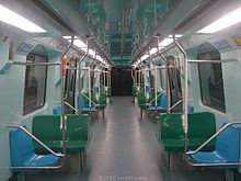
| Rolling stock |
| ||||||||||||||||||||||||||||||||||||||||||||||||||||||||||||||||||||||||||||||||||||||||||||||||||||||||||||||||||||||||||||||||||||||||||||||||||||||||||||||||||||||||||||||||||||||||||||||||||||||||||||||||||||||||||||||||||||||||||||||||||||||||||||||||||||||||||||||||||||||||||||||||||||||||||||||||||||||||||||||||||||||||||||||||||||||||||||||||||||||||
| Daily ridership | 256,000/business day[1] | ||||||||||||||||||||||||||||||||||||||||||||||||||||||||||||||||||||||||||||||||||||||||||||||||||||||||||||||||||||||||||||||||||||||||||||||||||||||||||||||||||||||||||||||||||||||||||||||||||||||||||||||||||||||||||||||||||||||||||||||||||||||||||||||||||||||||||||||||||||||||||||||||||||||||||||||||||||||||||||||||||||||||||||||||||||||||||||||||||||||||
| History | |||||||||||||||||||||||||||||||||||||||||||||||||||||||||||||||||||||||||||||||||||||||||||||||||||||||||||||||||||||||||||||||||||||||||||||||||||||||||||||||||||||||||||||||||||||||||||||||||||||||||||||||||||||||||||||||||||||||||||||||||||||||||||||||||||||||||||||||||||||||||||||||||||||||||||||||||||||||||||||||||||||||||||||||||||||||||||||||||||||||||
| Commenced | 1987 | ||||||||||||||||||||||||||||||||||||||||||||||||||||||||||||||||||||||||||||||||||||||||||||||||||||||||||||||||||||||||||||||||||||||||||||||||||||||||||||||||||||||||||||||||||||||||||||||||||||||||||||||||||||||||||||||||||||||||||||||||||||||||||||||||||||||||||||||||||||||||||||||||||||||||||||||||||||||||||||||||||||||||||||||||||||||||||||||||||||||||
| Opened | January 25, 1991 | ||||||||||||||||||||||||||||||||||||||||||||||||||||||||||||||||||||||||||||||||||||||||||||||||||||||||||||||||||||||||||||||||||||||||||||||||||||||||||||||||||||||||||||||||||||||||||||||||||||||||||||||||||||||||||||||||||||||||||||||||||||||||||||||||||||||||||||||||||||||||||||||||||||||||||||||||||||||||||||||||||||||||||||||||||||||||||||||||||||||||
| Last extension | August 21, 2010 | ||||||||||||||||||||||||||||||||||||||||||||||||||||||||||||||||||||||||||||||||||||||||||||||||||||||||||||||||||||||||||||||||||||||||||||||||||||||||||||||||||||||||||||||||||||||||||||||||||||||||||||||||||||||||||||||||||||||||||||||||||||||||||||||||||||||||||||||||||||||||||||||||||||||||||||||||||||||||||||||||||||||||||||||||||||||||||||||||||||||||
| Technical | |||||||||||||||||||||||||||||||||||||||||||||||||||||||||||||||||||||||||||||||||||||||||||||||||||||||||||||||||||||||||||||||||||||||||||||||||||||||||||||||||||||||||||||||||||||||||||||||||||||||||||||||||||||||||||||||||||||||||||||||||||||||||||||||||||||||||||||||||||||||||||||||||||||||||||||||||||||||||||||||||||||||||||||||||||||||||||||||||||||||||
| Line length | 14.7 km (9.1 mi) | ||||||||||||||||||||||||||||||||||||||||||||||||||||||||||||||||||||||||||||||||||||||||||||||||||||||||||||||||||||||||||||||||||||||||||||||||||||||||||||||||||||||||||||||||||||||||||||||||||||||||||||||||||||||||||||||||||||||||||||||||||||||||||||||||||||||||||||||||||||||||||||||||||||||||||||||||||||||||||||||||||||||||||||||||||||||||||||||||||||||||
| Track gauge | 1,600 mm (5 ft 3 in) [2] | ||||||||||||||||||||||||||||||||||||||||||||||||||||||||||||||||||||||||||||||||||||||||||||||||||||||||||||||||||||||||||||||||||||||||||||||||||||||||||||||||||||||||||||||||||||||||||||||||||||||||||||||||||||||||||||||||||||||||||||||||||||||||||||||||||||||||||||||||||||||||||||||||||||||||||||||||||||||||||||||||||||||||||||||||||||||||||||||||||||||||
| Electrification | 750 V DC third rail | ||||||||||||||||||||||||||||||||||||||||||||||||||||||||||||||||||||||||||||||||||||||||||||||||||||||||||||||||||||||||||||||||||||||||||||||||||||||||||||||||||||||||||||||||||||||||||||||||||||||||||||||||||||||||||||||||||||||||||||||||||||||||||||||||||||||||||||||||||||||||||||||||||||||||||||||||||||||||||||||||||||||||||||||||||||||||||||||||||||||||
| Operating speed | 87 km/h (54 mph) | ||||||||||||||||||||||||||||||||||||||||||||||||||||||||||||||||||||||||||||||||||||||||||||||||||||||||||||||||||||||||||||||||||||||||||||||||||||||||||||||||||||||||||||||||||||||||||||||||||||||||||||||||||||||||||||||||||||||||||||||||||||||||||||||||||||||||||||||||||||||||||||||||||||||||||||||||||||||||||||||||||||||||||||||||||||||||||||||||||||||||
| Signalling | CBTC | ||||||||||||||||||||||||||||||||||||||||||||||||||||||||||||||||||||||||||||||||||||||||||||||||||||||||||||||||||||||||||||||||||||||||||||||||||||||||||||||||||||||||||||||||||||||||||||||||||||||||||||||||||||||||||||||||||||||||||||||||||||||||||||||||||||||||||||||||||||||||||||||||||||||||||||||||||||||||||||||||||||||||||||||||||||||||||||||||||||||||
| |||||||||||||||||||||||||||||||||||||||||||||||||||||||||||||||||||||||||||||||||||||||||||||||||||||||||||||||||||||||||||||||||||||||||||||||||||||||||||||||||||||||||||||||||||||||||||||||||||||||||||||||||||||||||||||||||||||||||||||||||||||||||||||||||||||||||||||||||||||||||||||||||||||||||||||||||||||||||||||||||||||||||||||||||||||||||||||||||||||||||
Line 2 (Green) (Portuguese: Linha 2–Verde) is one of the six lines that make up the São Paulo Metro and one of the thirteen lines that make up the Metropolitan Rail Transportation Network. It currently runs between the Vila Madalena and Vila Prudente stations. The line is also called the Paulista Line, because it goes along much of the Avenida Paulista, one of the leading financial centers in São Paulo. Despite being the second line to be planned, it was the third to be built—the second line built was actually Line 3 (Red). This line connects West to South-East regions.
History[]

The first section of Line 2 (Green Line), initially called the Paulista Line, was built using the New Austrian Tunnelling Method.[3] The line opened on January 25, 1991, having at that time a length of 2.9 kilometres (1.8 mi) and four stations. With this line the metro system was extended to include a major axis of the expanded center of São Paulo, with a large concentration of financial institutions, hospitals, schools, hotels, consulates, offices of state radio and television, theaters and museums. The following year the Ana Rosa and Clínicas stations were opened, increasing the line to 4.7 kilometres (2.9 mi). In 1998 two new stations (Vila Madalena and Santuário Nossa Senhora de Fátima-Sumaré) were completed, adding a further 2.3 kilometres (1.4 mi) stretch.
On March 30, 2006 the then Governor Geraldo Alckmin on his last day in office opened the Santos-Imigrantes station. Shortly after, on May 9, 2006, the Chácara Klabin station was formally opened by former Governor Claudio Lembo, thus completing the 2.9 kilometres (1.8 mi) stretch between Ana Rosa and Santos-Imigrantes, making the line a total of 9.9 kilometres (6.2 mi) long.

On June 30, 2007 the Governor José Serra opened the Alto do Ipiranga station, located at the junction of Avenida Dr. Gentil de Moura and Rua Visconde de Piraja, bringing the metro network in São Paulo to a total length of 61 kilometres (38 mi), with a forecast of passenger demand on Line 2 of 370,000 people per day. Jose Serra published a decree and authorization to extend the line to Vila Prudente, adding the Sacomã, Tamanduateí and Vila Prudente stations.
On May 10, 2007, during the Papal visit of Benedict XVI to the city of São Paulo, Line 2 had the highest demand of its history up until then, carrying 370,226 passengers. During the weekend of May 17–18, 2008 Line 2 was temporarily shut down between the stations Clínicas and Consolação to allow the use of a tunnel boring machine just seven meters below the level of its tunnel being used for the extension project of Line 4 (Yellow). The current record of passengers carried by the line was on May 7, 2008, with 428,056 passengers.
On March 28, 2009, the first of the sixteen new trains came into operation for the inauguration of the Sacomã - Vila Prudente stretch. On January 10, 2010, Sacomã station was opened to the public, initially only in operation from 10:30 to 15:00 and then from the 22nd, from 10:00 to 16:00. Finally, on the 30th of that month, it was fully opened to the public. Although the extension project of Line 2 was the only one to receive the whole amount in 2009, the schedule was delayed—the opening of the Tamanduateí and Vila Prudente stations originally scheduled for March 2010 was postponed.[4] On August 18 it was announced that the opening of Vila Prudente station would happen just three days later. On September 21, the Tamanduateí station opened.
Stations[]

The Santos-Imigrantes station is semi-elevated with metal and concrete structures that support the roof of the station. The Santuário Nossa Senhora de Fátima-Sumaré station is elevated and situated in a valley (under the Dr. Arnold viaduct). The Tamanduateí station is elevated with concrete structures mixed with metal, supporting the arched ceiling. All other stations are underground. The Trianon-Masp, Consolação, Brigadeiro, Ana Rosa, Chácara Klabin, and Santos-Imigrantes stations are composed of core platforms. The others are just side platforms.
The line also integrates with Line 15 (Silver) and the extension of Line 5 (Lilac).
- Note: Stations in bold are under construction; stations in italic are in planning.
Expansion plans[]
Vila Prudente ↔ Cidade Tiradentes[]
In May 2009 a joint delegation of the city and the state of São Paulo visited the monorail system in Tokyo to begin planning the implementation of a monorail to extend Line 2 (Green) from Vila Prudente to Cidade Tiradentes.[5] On November 6, 2009, international bidding was opened in order to build the monorail system. On November 23, 2009, construction on the Vila Prudente-Oratório was started. The system will be 23.8 kilometres (14.8 mi) long between Vila Prudente and Cidade Tiradentes and will have 17 stations (Vila Prudente, Oratório, São Lucas, Vila Tolstoi, Vila União, Jardim Planalto, Sapopemba, Fazenda da Juta, São Mateus, Jardim Colonial, Iguatemi, Jaquiriça, Bento Guelf, Érico Semer, Márcio Beck, and Cidade Tiradentes) and 54 trains, each capable of carrying 1000 passengers. The line is projected to carry around 510,000 passengers daily.[6]
However, it was decided in September 2012, that the eastward extension monorail to Cidade Tiradentes will be named Line 15, and Line 2 will be extended northwards from Vila Prudente to Dutra. The extension will be 13.3 km (8.3 mi) long and have 13 stations. Funds were approved in mid-2012 for the first section (4.6 km or 2.9 mi), which includes the Orfanato, Santa Clara, Anália Franco and Vila Formosa stations. This section is expected to open in 2017 or 2018.[needs update]
Vila Madalena ↔ Cerro Corá[]
In addition, there are plans to expand Line 2 (Green) 2.9 kilometres (1.8 mi) from Vila Madalena station to Avenida Cerro Corá, in the neighborhood of Lapa.[7]
References[]
- ^ "Passageiros Transportados por Linha - Maio/2021" (PDF) (in Portuguese). 2021-06-18. Retrieved 2021-07-05.
- ^ Ferreira, Robert; Tharcisiu Alves. (January 2012). "São Paulo Metro". www.nycsubway.org. www.nycsubway.org. Archived from the original on 2014-02-02. Retrieved 2014-02-02.
On Lines 1, 2 and 3, the track gauge is a non standard 1600 mm, the third rail is 750 V DC and under running. For Lines 4 and 5, the track gauge is 1435 mm and they use overhead pantograph, precluding any connection to the rest of the system, plus the 4 and 5 lines can't connect because the trains on the 4 line use drive-less technology while trains on 5 line are OPTO. Lines 7, 8, 9, 10, 11 and 12 (operated by CPTM) are all 1600mm and use overhead pantograph.
- ^ Uchôa, Marco (April 7, 1992). "Túnel passará pela torre da 'Cultura'". O Estado de S. Paulo (in Portuguese). São Paulo. pp. Cidades, pg. 2.
- ^ Grandin, Felipe (2010-04-26). "Governo de SP deixou de investir R$ 1,3 bi no Metrô". Jornal da Tarde (in Portuguese). No. 14490. São Paulo. pp. 3A. ISSN 1516-294X. Archived from the original on 2011-07-06. Retrieved 2010-05-01.
- ^ Mayor of São Paulo visits monorail system in Tokyo. (in Portuguese) Archived 2012-06-30 at archive.today
- ^ Construction begins on the monorail between Vila Prudente and Cidade Tiradentes (in Portuguese)
- ^ Companhia do Metropolitano de São Paulo - METRÔ (2006). "Rede Essencial".
| Commuter rail |  | |
|---|---|---|
| Rapid transit | ||
| Bus rapid transit | ||
| Bus lines | ||
| Airports | ||
| Bus terminals |
| |
| Intermodal terminals |
| |
- São Paulo Metro
- Rapid transit lines in Brazil
- Railway lines opened in 1991