List of Indiana state historical markers in Wayne County
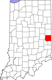
Location of Wayne County in Indiana
This is a list of the Indiana state historical markers in Wayne County.
This is intended to be a complete list of the official state historical markers placed in Wayne County, Indiana, United States by the Indiana Historical Bureau. The locations of the historical markers and their latitude and longitude coordinates are included below when available, along with their names, years of placement, and topics as recorded by the Historical Bureau. There are 7 historical markers located in Wayne County.[1]
Historical markers[]
| Marker title | Image | Year placed | Location | Topics |
|---|---|---|---|---|
| Oliver P. Morton Home[2] | 
|
1962 | Junction of W. Main Street (U.S. Route 40) and Willow Grove Road in Centerville 39°49′2″N 85°0′2.7″W / 39.81722°N 85.000750°W |
Military, Politics |
| Iron Brigade Commander[3] | 
|
1963 | Junction of W. Main Street (U.S. Route 40) and S. Gay Street in Cambridge City 39°48′46″N 85°9′46.2″W / 39.81278°N 85.162833°W |
Military |
| East Germantown Civil War Band[4] | 1978 | Junction of Old National Road (U.S. Route 40) and Milton Street 39°48′47.4″N 85°8′11″W / 39.813167°N 85.13639°W |
[None] | |
| Overbeck House and Studio[5] | 
|
1992 | Junction of E. Main Street (U.S. Route 40) and S. Pearl Street in Cambridge City 39°48′42.6″N 85°9′42.6″W / 39.811833°N 85.161833°W |
Arts and Culture, Women |
| Cambridge City[6] | 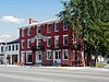
|
1992 | Junction of E. Main Street (U.S. Route 40) and Foote Street in Cambridge City 39°48′44.6″N 85°10′17.4″W / 39.812389°N 85.171500°W |
Historic District, Neighborhoods, and Towns, Transportation |
| Levi Coffin[7] | 
|
2002 | 113 N. U.S. Route 27 in Fountain City 39°57′22″N 84°55′3″W / 39.95611°N 84.91750°W |
Underground Railroad, African American |
| [8] | 2003 | 2224 Cumberland Road (U.S. Route 40) in Dublin 39°48′43.4″N 85°12′28″W / 39.812056°N 85.20778°W |
Women, Politics |
See also[]
- List of Indiana state historical markers
- National Register of Historic Places listings in Wayne County, Indiana
References[]
- ^ "Indiana Historical Markers by County". State of Indiana. Retrieved 2012-03-15.
- ^ Oliver P. Morton Home, Indiana Historical Bureau, n.d. Accessed 2012-03-14.
- ^ Iron Brigade Commander, Indiana Historical Bureau, n.d. Accessed 2012-03-14.
- ^ East Germantown Civil War Band, Indiana Historical Bureau, n.d. Accessed 2012-03-14.
- ^ Overbeck House and Studio, Indiana Historical Bureau, n.d. Accessed 2012-03-14.
- ^ Cambridge City, Indiana Historical Bureau, n.d. Accessed 2012-03-14.
- ^ Levi Coffin, Indiana Historical Bureau, n.d. Accessed 2012-03-14.
- ^ Indiana's First Woman's Rights Convention, Indiana Historical Bureau, n.d. Accessed 2012-03-14.
External links[]
Municipalities and communities of Wayne County, Indiana, United States | ||
|---|---|---|
| City | ||
| Towns | ||
| Townships | ||
| Unincorporated communities | ||
| ||
Categories:
- Indiana state historical markers
- Tourist attractions in Wayne County, Indiana