List of National Monuments in County Wexford

From Wikipedia, the free encyclopedia
Map all coordinates using: OpenStreetMap 
Download coordinates as: KML

The Irish state has officially approved the following List of National Monuments in County Wexford. In the Republic of Ireland, a structure or site may be deemed to be a "National Monument", and therefore worthy of state protection, if it is of national importance. If the land adjoining the monument is essential to protect it, this land may also be protected.

National Monuments[]

NM# Monument name Description Image Townland Location
516 Ballyhack CastleCastleBallyhack Castle.jpgBallyhack 52°14′46″N 6°58′03″W / 52.246065°N 6.967478°W / 52.246065; -6.967478
375 Ballymoty MotteMotte 52°30′20″N 6°27′41″W / 52.505617°N 6.461506°W / 52.505617; -6.461506
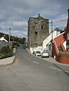
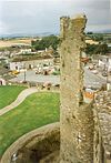
521 Ferns CastleCastleTower of Ferns Castle.jpgFerns 52°35′27″N 6°29′58″W / 52.590721°N 6.499309°W / 52.590721; -6.499309
665 Clone ChurchChurchClone Church - County Wexford, Ireland.jpg 52°34′06″N 6°30′18″W / 52.568347°N 6.504963°W / 52.568347; -6.504963
644 Coolhull CastleFortified HouseCoolhull Castle - geograph.org.uk - 14545.jpgCoolhull 52°14′03″N 6°42′18″W / 52.234239°N 6.705093°W / 52.234239; -6.705093
192 Dunbrody AbbeyAbbey (Cistercian)Dunbrody Abbey SE and Young Bulls 1997 08 27.jpg 52°17′01″N 6°57′33″W / 52.283518°N 6.959281°W / 52.283518; -6.959281
668 Duncannon Artillery FortArtillery fortDuncannon Fort, Co. Wexford - geograph.org.uk - 830116.jpgDuncannon 52°13′15″N 6°56′12″W / 52.220754°N 6.936643°W / 52.220754; -6.936643
457 Tacumshane WindmillWindmillWindmill in Tacumshane.jpgTacumshane 52°12′32″N 6°25′26″W / 52.208751°N 6.423955°W / 52.208751; -6.423955
133 Ferns ChurchChurchFerns 52°35′31″N 6°29′26″W / 52.591919°N 6.490515°W / 52.591919; -6.490515
133 Ferns Cathedral & CrossesChurchFerns Cathedral Chancel 2009 09 28.jpgFerns 52°35′24″N 6°29′31″W / 52.590016°N 6.492041°W / 52.590016; -6.492041
133 Ferns AbbeyPriory (Augustinian)Ferns Abbey South Range 2009 09 28.jpgFerns 52°35′22″N 6°29′30″W / 52.589577°N 6.491654°W / 52.589577; -6.491654
443 St. Mary's ChurchChurchRuins of St Marys Church, New Ross.jpgNew Ross 52°23′47″N 6°56′27″W / 52.396252°N 6.94072°W / 52.396252; -6.94072
434 Rathmacknee CastleCastleWalshestown Castle Geograph-3036259-by-Mike-Searle.jpg 52°16′09″N 6°29′26″W / 52.269301°N 6.490495°W / 52.269301; -6.490495
229 Rathumney CastleCastleRathumney Castle.jpg 52°17′43″N 6°52′28″W / 52.295312°N 6.874471°W / 52.295312; -6.874471
429 Slade CastleCastleSlade castle - geograph.org.uk - 206105.jpg 52°08′02″N 6°54′38″W / 52.133842°N 6.910632°W / 52.133842; -6.910632
392 Vinegar Hill WindmillWindmillVinegar Hill Windmill 2.jpg 52°30′06″N 6°33′13″W / 52.501632°N 6.553488°W / 52.501632; -6.553488
506, 614 Tintern AbbeyAbbey (Cistercian), Church & bridgeTintern Abbey (Co. Wexford).jpg 52°14′13″N 6°50′18″W / 52.236867°N 6.838217°W / 52.236867; -6.838217
445 St. Selskar's PrioryChurch (Augustinian)Selskar Abbey, Wexford, Ireland.jpgWexford 52°20′29″N 6°27′57″W / 52.341375°N 6.465887°W / 52.341375; -6.465887

Sources[]

Retrieved from ""