List of Pennsylvania state historical markers in Cumberland County
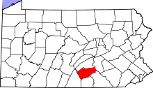
Location of Cumberland County in Pennsylvania
This is a list of the Pennsylvania state historical markers in Cumberland County.
This is intended to be a complete list of the official state historical markers placed in Cumberland County, Pennsylvania by the Pennsylvania Historical and Museum Commission (PHMC). The locations of the historical markers, as well as the latitude and longitude coordinates as provided by the PHMC's database, are included below when available. There are 71 historical markers located in Cumberland County.[1]
Historical markers[]
| Marker title | Image | Date dedicated | Location | Marker type | Topics |
|---|---|---|---|---|---|

|
May 9, 2009 | 131 E Pomfret St., Carlisle |
City | African American, Religion, Underground Railroad | |

|
August 18, 1985 | S. Corporation St. at church, Newville 40°10′22″N 77°23′50″W / 40.17272°N 77.39736°W |
Roadside | Religion | |
|
|
December 6, 1949 | S. Hanover St. between Pomfret & High Sts., Carlisle 40°12′03″N 77°11′21″W / 40.20075°N 77.18907°W |
City | American Revolution, George Washington, Military, Whiskey Rebellion | |
| Braddock Expedition |
|
November 3, 1961 | US 11 (W. King St.), Shippensburg 40°02′53″N 77°31′36″W / 40.04797°N 77.52655°W |
Roadside | French & Indian War, Military |
| Carlisle |
|
July 30, 1947 | Near Walnut Bottom Rd. & Washington St. intersection, at Thornwall Park entrance, Carlisle 40°11′37″N 77°11′53″W / 40.19357°N 77.19817°W |
Roadside | Cities & Towns, Early Settlement, Military, Whiskey Rebellion |
| Carlisle |
|
July 30, 1947 | US 11N, east of Carlisle 40°12′41″N 77°10′51″W / 40.21144°N 77.18074°W |
Roadside | American Revolution, Cities & Towns, Early Settlement, Government & Politics, Whiskey Rebellion |
| Carlisle |
|
July 30, 1947 | U.S. 11 W of Carlisle 40°12′06″N 77°12′42″W / 40.20167°N 77.21158°W |
Roadside | American Revolution, Cities & Towns, Government & Politics, Whiskey Rebellion |
| Carlisle |
|
July 30, 1947 | PA 34 S of Carlisle, between Noble Blvd. & W Ridge St. 40°11′32″N 77°11′25″W / 40.19227°N 77.19037°W |
Roadside | American Revolution, Cities & Towns, Government & Politics, Whiskey Rebellion |
| Carlisle |
|
July 30, 1947 | PA 34 N of Carlisle, at PA Turnpike overpass 40°13′13″N 77°11′12″W / 40.22017°N 77.18666°W |
Roadside | Cities & Towns |
| Carlisle Barracks | 
|
n/a | U.S. 11 opposite War College, NE end Carlisle 40°12′45″N 77°10′43″W / 40.21258°N 77.17875°W |
Roadside | American Revolution, Military, Native American |
|
|
November 3, 1961 | W. High St. between Pitt & Hanover Sts., Carlisle 40°12′06″N 77°11′27″W / 40.20156°N 77.19075°W |
City | American Revolution, Military | |
| Carlisle Indian Industrial School | 
|
August 31, 2003 | North side of Claremont Road, 50 feet East of the Carlisle Barracks entrance 40°12′27″N 77°10′15″W / 40.20754°N 77.17075°W |
Roadside | Education, Native American |
|
|
August 4, 1947 | PA 174 just E of Boiling Springs 40°09′02″N 77°07′28″W / 40.15061°N 77.12449°W |
Roadside | Business & Industry, Coal, Furnaces, Iron | |
| Charles Albert "Chief" Bender | 
|
October 17, 2003 | Indian Field, Carlisle Barracks, off U.S. 11, Carlisle 40°12′33″N 77°10′31″W / 40.20907°N 77.17532°W |
Roadside | Baseball, Education, Native American, Sports |
| Cumberland County |
|
May 17, 1982 | Old Courthouse, High & Hanover Sts., Carlisle 40°12′05″N 77°11′22″W / 40.20129°N 77.1894°W |
City | Government & Politics, Government & Politics 18th Century, Roads, Transportation |
|
|
May 25, 1948 | At park, Market St. between 24th & 25th Sts., Camp Hill 40°14′28″N 76°55′31″W / 40.24099°N 76.9254°W |
Roadside | American Revolution, Military | |
| Cumberland Valley Railroad | 
|
May 1, 1992 | 4 Strawberry Alley, Mechanicsburg 40°12′50″N 77°00′31″W / 40.21377°N 77.00872°W |
Roadside | Railroads, Transportation |
| Daniel Drawbaugh |
|
May 1, 1965 | 155 Lake Rd. (SR 2033) at Eberly's Mill, 1 mile W of New Cumberland 40°13′27″N 76°54′25″W / 40.22423°N 76.90683°W |
Roadside | Business & Industry, Invention, Professions & Vocations |
|
|
May 25, 2002 | 301 Front Street, Boiling Springs 40°08′18″N 77°07′38″W / 40.1384°N 77.12717°W |
Roadside | African American, Early Settlement, Underground Railroad | |
| Dickinson College | 
|
July 1, 1947 | W High St., near 74N intersection at campus, Carlisle 40°12′08″N 77°11′44″W / 40.20223°N 77.19549°W |
Roadside | Education |
| Dickinson School of Law |
|
October 20, 1949 | S. College St. near South St. at Law School, Carlisle 40°11′58″N 77°11′49″W / 40.19933°N 77.19696°W |
City | Education |
|
|
October 20, 1949 | NE corner, High & Hanover Sts., Carlisle 40°12′06″N 77°11′20″W / 40.20161°N 77.18888°W |
City | Government & Politics 18th Century, Religion | |
|
|
October 1929 | PA 34 (E side), .7 mile N of Carlisle Springs |
Plaque | Civil War, Military | |

|
October 21, 1949 | NW corner, High & Hanover Sts., Carlisle 40°12′06″N 77°11′21″W / 40.20172°N 77.18926°W |
City | Buildings, George Washington, Religion | |
|
|
January 7, 1952 | US 11 just W of Carlisle 40°12′05″N 77°12′44″W / 40.20144°N 77.21228°W |
Roadside | French & Indian War, Military, Roads, Transportation | |
|
|
January 7, 1952 | US 11, 1 mile NE of Shippensburg 40°04′16″N 77°29′24″W / 40.07105°N 77.49013°W |
Roadside | French & Indian War, Military, Roads, Transportation | |
|
|
August 10, 1947 | 8th & Ohio Sts., Lemoyne 40°14′46″N 76°54′15″W / 40.24607°N 76.90425°W |
Roadside | Civil War, Forts, Military | |
|
|
October 13, 1953 | Indiana Ave., betw. 8th St. & West Park, Lemoyne 40°14′48″N 76°54′17″W / 40.24669°N 76.90478°W |
City | Civil War, Forts, Military | |
|
|
n/a | U.S. 11 in Shippensburg (MISSING) |
Roadside | Early Settlement, Forts, French & Indian War, Military, Native American | |
| Fort Morris |
|
November 3, 1961 | King (US 11) & Queen Sts., Shippensburg 40°03′16″N 77°30′54″W / 40.0545°N 77.51511°W |
Roadside | Forts, French & Indian War, Military |
|
|
October 1, 1921 | N side of W King St. (US 11), betw. Spring & Morris, Shippensburg 40°03′16″N 77°30′54″W / 40.0545°N 77.51511°W |
Plaque | Forts, French & Indian War, Military, Native American | |
| Frederick Watts |
|
June 11, 1994 | Ritner Hwy. (US 11) & Shearer Dr. at entrance to Watts Bus. Park, W of Carlisle 40°11′34″N 77°14′11″W / 40.19287°N 77.23634°W |
Roadside | Agriculture, Education, Environment, Government & Politics, Professions & Vocations |
|
|
November 30, 1949 | NE corner, High & Bedford Sts., Carlisle 40°12′04″N 77°11′11″W / 40.20111°N 77.18647°W |
City | American Revolution, Government & Politics, Military | |
|
|
November 30, 1949 | SE corner, High & Bedford Sts., Carlisle 40°12′04″N 77°11′12″W / 40.201123°N 77.18657°W |
City | American Revolution, Government & Politics 18th Century, Medicine & Science, Military, Professions & Vocations | |
| George Washington | 
|
October 20, 1949 | W High & West Sts., Carlisle 40°12′07″N 77°11′36″W / 40.20186°N 77.19345°W |
City | American Revolution, George Washington, Military, Whiskey Rebellion |
| Gettysburg Campaign |
|
April 25, 2001 | 5115 East Trindle Road, Mechanicsburg 40°13′26″N 76°58′32″W / 40.22389°N 76.97544°W |
Roadside | Civil War, Military |
| Gettysburg Campaign |
|
June 21, 1997 | 5002 Carlisle Pike, Hampden Township(@ Ye Olde Ale House) 40°14′24″N 76°55′57″W / 40.23997°N 76.93239°W |
Roadside | Civil War, Military |
| Gettysburg Campaign |
|
July 29, 1947 | PA 74 just E of Carlisle near I-81 40°11′43″N 77°10′04″W / 40.19517°N 77.1679°W |
Roadside | Civil War, Military |
| Gettysburg Campaign |
|
July 29, 1949 | PA 34, .3 mile S of Carlisle near I-81 40°10′43″N 77°11′25″W / 40.17874°N 77.19034°W |
Roadside | Civil War, Military |
| Gettysburg Campaign |
|
July 29, 1947 | Walnut Bottom Rd. (SR 3023), .5 mile SW of Carlisle near I-81 40°11′18″N 77°12′18″W / 40.18822°N 77.20499°W |
Roadside | Civil War, Military |
| Gettysburg Campaign |
|
June 28, 1963 | 3025 Market St., Camp Hill 40°14′24″N 76°55′57″W / 40.23997°N 76.93239°W |
Roadside | Civil War, Military |
| Green Tree Inn |
|
November 30, 1949 | S. Hanover St. between Pomfret & High Sts., Carlisle 40°12′03″N 77°11′22″W / 40.20086°N 77.18943°W |
City | Business & Industry, George Washington, Native American, Inns & Taverns |
| Harrisburg |
|
August 1, 1947 | Front St., at Market St., Wormleysburg 40°15′11″N 76°53′45″W / 40.253067°N 76.89576°W |
Roadside | Cities & Towns, Early Settlement, Government & Politics |
|
|
November 22, 2004 | Valley Road on edge of campus of Central Pennsylvania College, Enola 40°18′20″N 76°56′00″W / 40.30543°N 76.9334°W |
Roadside | Bridges, Business & Industry, Iron, Transportation | |
| Irving Female College | 
|
September 29, 1954 | E. Main St. (Pa. 641) near Filbert St., Mechanicsburg 40°12′56″N 76°59′59″W / 40.21547°N 76.99963°W |
City | Education, Women |
| James Wilson | 
|
October 20, 1949 | SW corner, High & Pitt Sts., Carlisle 40°12′05″N 77°11′31″W / 40.20141°N 77.19194°W |
City | Government & Politics, Government & Politics 18th Century, Professions & Vocations |
| John Bannister Gibson | 
|
November 30, 1949 | E. High St. between Hanover & Bedford Sts., Carlisle 40°12′05″N 77°11′17″W / 40.20141°N 77.18794°W |
City | Government & Politics, Government & Politics 19th Century, Professions & Vocations, Writers |
| John W. Geary (1819-1873) | 
|
June 10, 1995 | 3rd & Bridge Sts., New Cumberland 40°13′32″N 76°51′50″W / 40.22568°N 76.86383°W |
City | Civil War, Government & Politics, Government & Politics 19th Century, Governors, Military |
| Joseph Ritner | 
|
October 11, 1951 | US 11, 6 miles SW of Carlisle 40°09′36″N 77°19′11″W / 40.16003°N 77.31985°W |
Roadside | Education, Government & Politics, Government & Politics 19th Century, Governors |
|
|
July 29, 1947 | PA 641 at E end of Newville 40°10′29″N 77°23′30″W / 40.17476°N 77.39155°W |
Roadside | Buildings, Business & Industry, Mills | |
|
|
May 28, 2007 | 100 block of N Queen St., Shippensburg |
Roadside | African American, Civil War, Military | |
| Major Andre | 
|
December 6, 1949 | S. Hanover St. between South & Pomfret Sts., Carlisle 40°11′57″N 77°11′22″W / 40.19918°N 77.1894°W |
City | American Revolution, Military |
| Marcus A. Reno | 
|
September 9, 2001 | 3rd & Reno Sts., New Cumberland 40°13′31″N 76°51′55″W / 40.22526°N 76.86534°W |
City | Civil War, Military |
|
|
April 25, 2002 | 343 N Hanover Street, Carlisle 40°12′22″N 77°11′15″W / 40.20614°N 77.18754°W |
City | Education, Women, Writers | |
| Middle Spring Church | 
|
November 6, 1950 | SR 4001 (old PA 696), 2.6 miles N of Shippensburg 40°04′54″N 77°32′28″W / 40.08162°N 77.54112°W |
Roadside | Buildings, Ethnic & Immigration, Religion |
| Molly Pitcher | 
|
November 30, 1949 | S. Hanover St. between Walnut & South Sts., Carlisle 40°11′51″N 77°11′22″W / 40.19762°N 77.18935°W |
City | American Revolution, Military, Women |
|
|
November 18, 1947 | E King St. (US 11) & Queen St., Shippensburg 40°05′04″N 77°30′47″W / 40.08456°N 77.51296°W |
Roadside | Buildings, Government & Politics, Government & Politics 18th Century, Inns & Taverns | |
|
|
May 29, 1970 | N Earl St./Newburg Rd. (PA 696) at the University, Shippensburg 40°03′21″N 77°31′27″W / 40.05594°N 77.52427°W |
Roadside | Buildings, Education | |
| Peace Church | 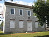
|
Pa. 641 (Trindle Rd.) at St. John's Rd. W of Camp Hill 40°13′54″N 76°57′18″W / 40.23169°N 76.95499°W |
Roadside | Buildings, Religion | |
| Peace Church |
|
May 25, 1948 | Carlisle Pike (SR 1010) at St. John's Rd., 1.2 miles W. of Camp Hill 40°14′15″N 76°57′42″W / 40.23757°N 76.96156°W |
Roadside | Buildings, Religion |
| Robert Whitehill (1735-1813) |
|
December 15, 1991 | 1903 Market St., Camp Hill 40°14′24″N 76°54′59″W / 40.23988°N 76.9163°W |
Roadside | Government & Politics, Government & Politics 18th Century, Mansions & Manors, William Penn |
| Shippensburg |
|
June 1, 1948 | E King St. (US 11) near Walnut Bottom Rd. (Rt. 174), E end of Shippensburg 40°03′34″N 77°30′25″W / 40.05935°N 77.50686°W |
Roadside | Cities & Towns |
|
|
June 1, 1925 | King St. (US 11) & Prince St., on Vigilant Hose Co. #1 bldg., Shippensburg 40°03′34″N 77°30′25″W / 40.05935°N 77.50686°W |
Plaque | Cities & Towns, Early Settlement | |

|
n/a | 444 Silver Spring Rd., at church, S of Carlisle Pk. (US 11), Mechanicsburg 40°14′20″N 77°00′28″W / 40.23893°N 77.00765°W |
Roadside | Early Settlement, Ethnic & Immigration, Religion | |
|
|
September 29, 1954 | Simpson St. near Walnut St., Mechanicsburg 40°12′47″N 77°00′04″W / 40.21296°N 77.00122°W |
City | Early Settlement, Roads, Transportation | |
|
|
October 19, 1986 | 140 E. Pomfret St. at church, Carlisle 40°11′58″N 77°11′09″W / 40.19952°N 77.18578°W |
City | Buildings, Native American, Religion | |
|
|
July 29, 1970 | Walnut St. near Big Spring Ave., Newville 40°10′12″N 77°24′05″W / 40.16993°N 77.40149°W |
Roadside | Education, Police and Safety | |
| Thomas Butler |
|
October 21, 1949 | W. High St. between Pitt & West Sts., Carlisle 40°12′09″N 77°11′33″W / 40.20253°N 77.19253°W |
City | American Revolution, Military, Professions & Vocations |
| Thompson's Rifle Battalion |
|
November 11, 1986 | E. South St. at Old Graveyard, Carlisle (MISSING) |
City | American Revolution, Military |
|
|
September 29, 1954 | 39 E. Main St. (Pa. 641) at church, Mechanicsburg 40°12′49″N 77°00′25″W / 40.21372°N 77.00688°W |
City | Buildings, Religion | |
|
|
October 19, 1980 | Williams Grove Rd. (SR 2011), .5 mile S of Wms. Grove Park |
Roadside | Agriculture, Railroads, Transportation |

See also[]
- List of Pennsylvania state historical markers
- National Register of Historic Places listings in Cumberland County, Pennsylvania
References[]
- ^ "PHMC Historical Markers Search" (Searchable database). Pennsylvania Historical and Museum Commission. Commonwealth of Pennsylvania. Retrieved 2010-07-19.
External links[]
Municipalities and communities of Cumberland County, Pennsylvania, United States | ||
|---|---|---|
| Boroughs |  | |
| Townships | ||
| CDPs | ||
| Other communities | ||
| Footnotes | ‡This populated place also has portions in an adjacent county or counties | |
| ||
| Topics |
|
|---|---|
| City Government | |
| |

Categories:
- History of Cumberland County, Pennsylvania
- History of Harrisburg, Pennsylvania
- Pennsylvania state historical markers
- Harrisburg–Carlisle metropolitan statistical area
- Landmarks in Harrisburg, Pennsylvania
- Susquehanna Valley
- Tourist attractions in Cumberland County, Pennsylvania