List of Pennsylvania state historical markers in Mifflin County
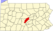
Location of Mifflin County in Pennsylvania
This is a list of the Pennsylvania state historical markers in Mifflin County.
This is intended to be a complete list of the official state historical markers placed in Mifflin County, Pennsylvania by the Pennsylvania Historical and Museum Commission (PHMC). The locations of the historical markers, as well as the latitude and longitude coordinates as provided by the PHMC's database, are included below when available. There are 12 historical markers located in Mifflin County.[1]
Historical markers[]
| Marker title | Image | Date dedicated | Location | Marker type | Topics |
|---|---|---|---|---|---|
| Chief Logan | 
|
March 31, 1947 | SR 1005 (old U.S. 322), .5 mile N of Reedsville 40°40′32″N 77°36′00″W / 40.67548°N 77.60004°W |
Roadside | Native American |
| Fort Granville | 
|
March 27, 1947 | 1200 W. 4th St. (U.S. 22 & 522), Lewistown 40°35′18″N 77°36′06″W / 40.58839°N 77.6016°W |
Roadside | Forts, French & Indian War, Military |
| Fort Granville - PLAQUE |
|
May 1, 1916 | 1200 W. 4th St. (US 22 & 522), Lewistown 40°35′18″N 77°36′06″W / 40.58837°N 77.60164°W |
Plaque | Forts, French & Indian War, Military, Native American |
|
|
March 31, 1947 | SR 1005 (old U.S. 322) at Burnham 40°37′45″N 77°34′02″W / 40.62918°N 77.56736°W |
Roadside | Business & Industry, Iron, Steel | |
| Joseph T. Rothrock | 
|
April 1, 1947 | U.S. 22 & 522 at McVeytown 40°29′58″N 77°44′26″W / 40.49956°N 77.74042°W |
Roadside | Environment, Professions & Vocations |
|
|
August 21, 1947 | U.S. 22 & 522 at Strodes Mills, 4.9 miles SW of Lewistown 40°32′54″N 77°40′38″W / 40.5482°N 77.67725°W |
Roadside | Business & Industry, Coal, Iron | |
|
|
October 19, 1996 | Jct. Pa. 103 & Helen St., S end of Lewistown |
Roadside | Business & Industry, Railroads, Transportation | |

|
March 27, 1967 | 17 N. Main St., Lewistown 40°35′53″N 77°34′30″W / 40.59805°N 77.57505°W |
City | Military, Military Post-Civil War | |
| Mifflin County | 
|
September 19, 1981 | Old Courthouse, Monument Square, Market & Main Sts., Lewistown 40°35′51″N 77°34′30″W / 40.59761°N 77.57488°W |
City | Canals, Government & Politics, Government & Politics 18th Century, Governors, Iron |
|
|
March 28, 1947 | Bus. 22, just E of Lewistown 40°35′05″N 77°33′27″W / 40.58467°N 77.55741°W |
Roadside | Bridges, Transportation | |
| Three Locks |
|
April 1, 1947 | US 22/522 near Strodes Run Rd./Middle Rd., at Strodes Mills, 4.6 miles SW of Lewistown 40°33′05″N 77°40′22″W / 40.55132°N 77.67265°W |
Roadside | Canals, Navigation, Transportation |
|
|
March 28, 1947 | US 22/322 westbound at Bus. 22 exit, near Lewistown |
Roadside | Bridges, Canals, Navigation, Roads, Transportation |

See also[]
- List of Pennsylvania state historical markers
- National Register of Historic Places listings in Mifflin County, Pennsylvania
References[]
- ^ "PHMC Historical Markers Search" (Searchable database). Pennsylvania Historical and Museum Commission. Commonwealth of Pennsylvania. Retrieved 2010-07-19.
External links[]
Municipalities and communities of Mifflin County, Pennsylvania, United States | ||
|---|---|---|
| Boroughs |  | |
| Townships | ||
| CDPs | ||
| Unincorporated communities | ||
| ||

Pennsylvania Historical and Museum Commission | ||
|---|---|---|
| Museums and Archives |
|  |
Categories:
- Mifflin County, Pennsylvania
- Pennsylvania state historical markers
- Tourist attractions in Mifflin County, Pennsylvania