List of streets in Bayswater, Western Australia

From Wikipedia, the free encyclopedia

Bayswater is a suburb of Perth, Western Australia which was established in the 1880s. This article is a list of streets in Bayswater, along with the origin of their names. Some common street name origins in Bayswater are places in the United Kingdom, particularly England, early residents of Bayswater, soldiers in World War I, and former councillors.

City of Bayswater street name signs in Bayswater

List of streets in Bayswater[]

Streets starting with A or B[]

Name Date built Name origin Notes Image
Adelia Street Adelia Fleming, landowner. The family sold the land under the condition that a street be named after her.[1]
Adelphi Street c. 1912 Adelphi, London.
Alderhurst Crescent c. 1970
Aldwych Street Aldwych, a street in London.
Almondbury Street Almondbury, England.
Anzac Street 1900s Australian and New Zealand Army Corps (ANZAC).[2] Formerly known as Bauer Street.
Anzac Terrace 1960s Australian and New Zealand Army Corps (ANZAC).[2] Formerly known as Railway Terrace[3] and Gilbert Road.
Armada Street 1950s Armada Street Bayswater.jpg
Arundel Street c. 1912 Arundel, England.
Ashfield Parade c. 1913[4] Ashfield District, Nottinghamshire, England.[3] The suburb of Ashfield, Western Australia was later named after Ashfield Parade.[4]
Aughton Street 1900s Probably one of the places named Aughton in England.
Avenell Road 1900s
Babington Crescent c. 1970 Possibly someone named Babington or a place in England.
Bassendean Road 1900s Perth suburb of Bassendean.
Batey Lane c. 2006 James Earl Batey, councillor on the Bayswater Roads Board in the 1930s.[1] Formerly part of Thomas Street.
Bay View Street Bay View Street, Bayswater outside Hillcrest Primary School 1.jpg
Beard Elbow 2004 Robert H. Beard, chairman of the Bayswater Road Board in the 1900s.[5]
Bedford Street c. 1970
Beechboro Road North c. 1910 Perth suburb of Beechboro, which Beechboro Road leads to. 
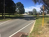
In 1984, Beechboro Road was split in two by the construction of Tonkin Highway. Beechboro Road South is a local distributor in parts, with a speed limit of 60 kilometres per hour (37 mph).
Beechboro Road South
Belham Street c. 1970
Bellevue Street Late–1990s Street name has existed since before 1952, but the street was not constructed until the late–1990s.
Bowden Street 1880s–1890s Possibly someone named Bowden or a place in England.
Broadway 1900s Named due to the road's large width. It was built that way so that carriages could turn without being unhitched.[3]
Brooks Drive 1990 Harry and James Brooks, early residents of Bayswater. Alfred William Brooks, soldier at Gallipoli and the Middle East.[2]
Burnside Street 1880s–1890s Robert Burnside, early resident of Bayswater.[1][6] Formerly known as Swan Street west of Coode Street.[6]

Streets starting with C or D[]

Name Date built Name origin Notes Image
Cabramatta Street Possibly Cabramatta, New South Wales.
Cannon Street c. 1970
Cantlebury Road 1900s
Catt Court Early–1990s Alfred Clifford Catt, early resident of Bayswater. Formerly part of Burnside Street, split off in the early–1990s.
Cedar Street c. 1970
Chalkley Place Mid–1970s Probably someone named Chalkley.
Christian Court
Clavering Road 1900s Clavering, Essex, a village in England.
Clune Street Matthew Daniel Clune, who leased an estate in Bassendean.[3]
Cobden Street 1900s
Collier Link 2017 Constructed in 2017 as a realignment of Collier Road near Tonkin Highway. The road has a single point urban interchange with Tonkin Highway. It is a local distributor road with a speed limit of 60 kilometres per hour (37 mph).
Collier Road 1900s–1910s Philip Collier, Premier of Western Australia from 1924 to 1930.[1][3] Local distributor with a speed limit of 60 kilometres per hour (37 mph). Part bypassed by Collier Link is a local road with a speed limit of 50 kilometres per hour (31 mph).
Colwyn Road c. 1920
Coode Street 1880s John Coode, who wrote two reports on the proposed construction of Fremantle Harbour.[1][7] Local distributor with a speed limit of 60 kilometres per hour (37 mph). Coode Street Bayswater facing north-west near Hester Street.jpg
Coombe Street Probably somewhere in England named Coombe.
Constance Street
Copley Street Benjamin Copley, resident of Bayswater in the 1890s, owner of a slaughterhouse, member of the Bayswater Roads Board, and chairman in 1901. His former house is located on the corner of Copley and Coode Streets.[1][6]
Cosentino Place
Cossom Place W. Cossom, soldier killed in World War I. Named in 1968.[2] Formerly part of River Road.[2]
Cox Street
Crowther Street 1900s Frederick Powell Crowther, a director of Gold Estates of Australia Pty Ltd, a company that bought and subdivided land in Bayswater and across Perth.[8]
Cullen Street
Dandy Place Early 1990s
Darby Street S. T. Darby.
Digwood Close
Donald Square c. 1966 Donald Traylen, relative of William Traylen, landowner in the 1890s who subdivided his land, naming various roads after family members.[9]
Donald Way c. 1966 Donald Traylen, relative of William Traylen, landowner in the 1890s who subdivided his land, naming various roads after family members.[9]
Drake Street 1880s–1890s William Henry Drake, early landowner in Bayswater and treasurer of Western Australia from 1838 to 1848. Drake Street, Bayswater outside Hillcrest Primary School 1.jpg
Drynan Street 1900s
Duchess Court Late–1990s
Duffy Street Jarlath Stephen Duffy[3]
Dunkley Place Formerly known as Fashoda Street.
Dunstone Road 1988
Durham Road 1900s Durham, England, a town in England.

Streets starting with E, F or G[]

Name Date built Name origin Notes Image
Elizabeth Street c. 1912
Embleton Avenue Perth suburb of Embleton, which was named after George Embleton, an early resident of Bayswater. Embleton Avenue is a local distributor with a speed limit of 60 kilometres per hour (37 mph).
Essex Street 1880s–1890s Essex, a county in England. Formerly known as Newtown Street west of Batey Lane.
Evans Place Early–1960s
Farley Way c. 1970 Possibly a place named Farley in England.
Foyle Road 1900s
Flinders Street
Flora Avenue c. 1965
Focal Way 2018 Part of the theme of "Centrality".[10] The Tonkin Highway Industrial Estate has a theme of "Centrality" due to its good location near Perth and next to Tonkin Highway.[10]
Francis Street
Frew Court Early–1990s
Frinton Street Frinton-on-Sea, a town in England.
Garratt Road 1890s Mary Anne Garratt, wife of William Traylen, landowner in the 1890s who subdivided his land, naming various roads after family members.[9]
Alternatively, W. J. Garratt, who was a resident of the area from 1899 to 1934.[1]
Garratt Road is a main road which forms part of State Route 55, and has a speed limit of 60 kilometres per hour (37 mph). It crosses the Swan River at the Garratt Road Bridge. Bayswater welcome - Bayswater Garratt 1.jpg
Georgina Street
Gilbert Street c. 1912
Gilders Place
Gobba Court Mid–1970s Gobba Lake, which is in turn named after Gino Gobba, owner of a dairy in the 1930s.
Goldmead Street
Goongarrie Street Possibly named after Goongarrie, Western Australia, an abandoned town north of Kalgoorlie, which is an aboriginal word of unknown origin.
Gordon Street
Grafton Street 1880s–1890s Grafton Estate, an early land sale in the area.[1] Formerly named Crofton Street.
Grand Promenade 1880s–1890s Grand Promenade is a main road which forms part of State Route 55. It has a speed limit of 60 kilometres per hour (37 mph). Grand Promenade, Bayswater, facing north 2.jpg
Grey Street 1900s George Grey, who explored the north west coast of Western Australia.[3] Formerly known as Walker Road, which was named after Thomas Walker, who was a politician, and Speaker of the Western Australian Legislative Assembly from 1924 to 1930.[1]
Grosvenor Road Possibly a place named Grosvenor in England.
Guildford Road 1830s Perth suburb of Guildford, which the road leads to. Guildford Road is a main road which forms part of State Route 51. It has a speed limit of 60 kilometres per hour (37 mph).

Streets starting with H, I or J[]

Name Date built Name origin Notes Image
Hackbridge Way c. 1970 Hackbridge, a suburb of London.
Haddrill Street
Halliday Street Henry Thomas Halliday and his family, residents of Bayswater from the 1880s onwards. Their house, Halliday House is located nearby at 114 King William Street.[6]
Hamilton Street 1890s John Hamilton, early landowner in Bayswater.[1][6]
Hardy Road c. 1920 Hardey Family.
Hayward Street
Henrietta Street 1900s
Hester Street Hester Street Bayswater facing west near Coode Street.jpg
Higgins Way Late–1980s
Hill Street 1890s Street is located on a hill. Could also be possibly named after R.V. Hill, chairman of the Bayswater Road Board in the 1940s. Formerly known as Kennedy Street.[6]
Hobart Street 1880s–1890s
Horley Street c. 1970 Horley, a town in England.
Hotham Street 1880s–1890s
Headley Place c. 1970 Possibly a place named Headley in England.
Hudson Street 1900s T.A. Hudson, councillor on the Bayswater Road Board in the 1930s. Formerly known as Main Road.
Ingles Place 2010
Inner Court 2018
Irvine Street
Jackson Street , first Chairman of the West Guildford Roads Board (predecessor to the Town of Bassendean), and prominent educationalist in Western Australia.[3]
Jacqueline Street
James Street
John Street

Streets starting with K, L or M[]

Name Date built Name origin Notes Image
Katanning Street c. 1920 Town of Katanning, Western Australia.
Kenilworth Street Kenilworth, a town in England.
Kenmure Avenue
Kitchener Avenue 1890s
King Street
King William Street 1880s King William IV of the United Kingdom.[1] Local distributor with a speed limit of 60 kilometres per hour (37 mph) in parts. In 2018, the speed limit was lowered to 40 kilometres per hour (25 mph) in the Bayswater town centre.[11] King William Street from Bayswater Bridge 1.jpg
Langley Road 1900s
Lawrence Street 1880s–1890s Stephen Lawrence, arrived in Bayswater in 1902. His three sons served in World War I.[2] Lawrence Street Bayswater facing north-west 1.jpg
Leake Street 1880s–1890s Leake Street was converted to a "bike boulevard" in 2017, with a speed limit of 30 kilometres per hour (19 mph).[12] Leake Street Bayswater Bike Boulevard 1.jpg
Letizia Lane 2006
Little Street
Lovell Way c. 1970
Mahdi Street
Maurice Street 1900s
May Street c. 1912 Formerly known as Queen Street. May Street was converted to a "bike boulevard" in 2017, with a speed limit of 30 kilometres per hour (19 mph).[12] May Street Bayswater Bike Boulevard 4.jpg
McGann Street
McWhae Gardens Late–1990s Douglas McWhae, medical officer.
Meakins Court Robert James Meakins, owner of a dairy on Coode Street.[6]
Memorial Drive 1997 Memorial to residents from the Bayswater area who served in World War I, World War II, Korea, Malaya, Bornea or Vietnam.[13] Speed limit is 40 kilometres per hour (25 mph).
Menmuir Place Mid–1990s Edward Menmuir, chairman of the Bayswater Road Board in the 1940s and 1950s.
Mills Avenue James Mills, resident of Bayswater in the 1880s and owner of a nursery.[1][6]
Milne Street 1900s Charles Williamson Milne, a director of Gold Estates of Australia Pty Ltd, a company that bought and subdivided land in Bayswater and across Perth.[1][8]
Moojebing Street c. 1920 Moojebing, Western Australia, a locality near Katanning. Wesley Maley, who subdivided land in Bassendean, owned land at Moojebing.[3]
Mooney Street P.J. Mooney, Bayswater Road Board councillor in the 1910s.
Moore Street Samuel Moore, builder and resident of Bayswater around the 1920s.
Morey Crescent Late 1990s.
Munt Street C. A. Munt, civil servant.[1]
Muriel Street
Murray Street 1890s. David Murray, resident of Bayswater in the 1880s and owner of Murray's Dairy. His house still stands at 7 Murray Street.[1][6]

Streets starting with N, O or P[]

Name Date built Name origin Notes Image
Nanhob Street
Neville Street R Nevill Roberts, a director of Gold Estates of Australia Pty Ltd, a company that bought and subdivided land in Bayswater and across Perth.[8]
Newton Street 1962 F. R. Newton. Arrived in Bayswater in 1888. Killed in World War I.[1][2]
Nexus Way 2018 Part of the theme of "Centrality".[10] The Tonkin Highway Industrial Estate has a theme of "Centrality" due to its good location near Perth and next to Tonkin Highway.[10]
Nolan Place Early–1990s
Norco Way
Nutfield Street c. 1970
Olfe Street
Paddington Street Paddington, a district of London.
Paterson Street 1880s–1890s Paterson Street Bayswater facing south.jpg
Pearson Street c. 1920 John Pearson Learmonth, who owned land in the area.[3]
Percy Road 1890s Percy Traylen, relative of William Traylen, landowner in the 1890s who subdivided his land, naming various roads after family members.[9]
Piaggio Court 1900s–1910s
Pickett Street George Squire Birkley Pickett, who was the second chairman of the Bayswater Roads Board.[14]
Purley Street c. 1970 Purley, London, a district of London.

Streets starting with Q or R[]

Name Date built Name origin Notes Image
Queen Street 1890s
Radius Loop 2018 Part of the theme of "Centrality".[10] The Tonkin Highway Industrial Estate has a theme of "Centrality" due to its good location near Perth and next to Tonkin Highway.[10]
Railway Parade 1880s–1890s Midland railway line, which Railway Parade runs alongside.[3] Formerly known as Railway Crescent,[15] but was renamed in 1946.[7] Railway Parade near Mills Avenue, Bayswater.jpg
Rain Place Early–1990s
Raleigh Road 1900s Formerly known as Raleigh Street.
Raymond Avenue
Redlands Street c. 1970
Reman Road 1900s Formerly known as Reman Street.
Rio Street
River Road c. 1920
Roberts Street 1900s
Rose Avenue 1880s Rose Smeed, wife of William Leonard Smeed, owner of a nursery in Bayswater during the 1880s and 1890s.[1][6]
Rosebury Street Lord Rosebery, Prime Minister of the United Kingdom from 1894 to 1895.[1]
Rosher Place
Rotary Place 2004
Rugby Street 1900s Rugby School, a school in England that prospector Harry Anstey attended.[3] Formerly known as Johnson Road.
Rundal Street c. 1970

Streets starting with S, T, U or V[]

Name Date built Name origin Notes Image
Salisbury Street 1900s Lord Salisbury, Prime Minister of the United Kingdom several times in the late 19th century and early 20th century.[1]
Sang Place Early–1990s
Shaftesbury Avenue c. 1912 Seventh Earl of Shaftesbury
Shalford Street c. 1970 Probably one of the places named Shalford in England.
Short Street
Skew Road 1900s
Skippers Row 2019 Road name has existed since before 1952, but the street was not constructed until 2019.
Slade Street 1880s–1890s A family that settled in Guildford in the 1840s.[1]
Spencer Street
Station Street A Latitude Station was located on the street, at what is now Hamilton Reserve.[1]
Stone Street 1880s Frederick Stone, resident of Bayswater in the 1880s and owner of a nursery. He was a member of the Bayswater Roads Board, and Secretary of the board from 1898 to 1904. He played a prominent role in lobbying the Board of Education for a primary school to be built in Bayswater. His house still stands at 78 Stone Street.[1][16] Formerly known as Mary Street, named after Mary Traylen, who was a relative of William Traylen. He was a landowner in the 1890s who subdivided his land, naming streets after family members.[6][9]
Sutherland Street Sutherland, place in Scotland.
The Strand c. 1912 Strand (also known as the Strand), a street in London.[7]
Thomas Street c. 2007 Thomas Street was originally the name of Birkett Street, a street in Bedford just north of Thomas Street. The current Thomas Street was an unpaved laneway up until c. 2007, when it was sealed and turned into a road.
Toms Court Early–1990s Merv Toms, councillor on the Bayswater Road Board from 1944 to 1971, member of parliament for Maylands, Bayswater and Ascot between 1956 and 1971.[17]
Tonkin Highway 1984 John Tonkin, former Premier of Western Australia. Tonkin Highway was opened north of Railway Parade on 11 July 1984, and south of Railway Parade on 16 April 1988.
Toowong Street 1880s–1890s Formerly known as Kooroong Street.
Traylen Road William Traylen, landowner in the 1890s who subdivided his land, naming streets after family members.[9]
Union Street
Veitch Street

Streets starting with W, X or Y[]

Name Date built Name origin Notes Image
Vincent Street 2018 George Vincent, Chief Draughtsman in the Lands Department c. 1876.[3] Road has been named since before 1916, but was not constructed until 2018.
Walter Road East 1880s There are conflicting reports as to the origin of the name. One option is Walter Browne, who was born in Bayswater in 1903 and lived there for some time.[18]: 204 [19] Another possibility is , who worked for Gold Estates, a property development company, and was Chairman of the Perth Road Board (precursor to the City of Stirling).[7] Another possibility is Walter Padbury, who was a pioneer and politician.[3] Formerly known as Government Road.
Walton Street Possibly a place named Walton in England.
Warren Avenue
Whatley Crescent John and Anne Whatley, residents of what would become Bayswater briefly in 1830.[1][6] Known as South Crescent until c. 1946,[14] as the road was shaped like a crescent.[1] E37 Bayswater Station (October 2020) 14.jpg
White Street
Whittaker Street c. 1912 John Whittaker, Bayswater Road Board councillor in the 1910s. Formerly known as Little Street.
Wholley Street 1900s
Wicks Street 2018 Charles R. Wicks, who was a foundational member of the West Guildford Roads Board.[3]
Williamson Street R.A. Williamson, 1960s business owner in Bayswater.
Wills Street c. 1912 Formerly known as Bourke Street.
Wisbech Street 1890s Wisbech, town in England.
Witley Street c. 1970 Witley, village in England.
Winifred Road 1900s
Wotton Street Formerly part of Broadway.
Wotzko Court 2000 Christian John Wotzko, councillor on the Bayswater Roads Board in the 1950s.
Wright Crescent Bert Wright, Shire of Bayswater councillor and local business owner. Bert Wright Park is also named after him.
Wright Street
Wyatt Road
Young Street I. J. Young and A. Young. Killed in World War I.[2]

See also[]

References[]

  1. ^ a b c d e f g h i j k l m n o p q r s t u v w x Sewell, Margaret (1972). Bayswater ... and 75 years. Shire of Bayswater. pp. 35, 42–43.
  2. ^ a b c d e f g h "Local street and roads named in honour of war veterans" (PDF). John Forrest Secondary College. Archived (PDF) from the original on 15 November 2021. Retrieved 14 November 2021.
  3. ^ a b c d e f g h i j k l m n o "Street Name Origins in the Town of Bassendean" (PDF). Town of Bassendean. 3 June 2020. p. 22. Archived (PDF) from the original on 5 March 2021. Retrieved 25 November 2021.
  4. ^ a b "Perth and surrounds suburb names". Landgate. Archived from the original on 30 June 2017. Retrieved 4 September 2020.
  5. ^ White, Simon. "The best, worst (and even worse) of Perth street names". The Sydney Morning Herald. Archived from the original on 8 November 2020. Retrieved 3 September 2020.
  6. ^ a b c d e f g h i j k l "Bayswater Thematic Framework April 2020". City of Bayswater. Archived from the original on 8 April 2021. Retrieved 3 September 2020.
  7. ^ a b c d "Origin of street names within the City of Stirling" (PDF). City of Stirling. February 2008. p. 55. Archived from the original (PDF) on 2 April 2015.
  8. ^ a b c "The Real Gold" (PDF). Gold Estates Holdings. p. 156. Archived (PDF) from the original on 4 March 2021. Retrieved 30 April 2021.
  9. ^ a b c d e f Heritage Council of Western Australia (March 2010). "Register of Heritage Places – Assessment Documentation: Garratt Road Bridge". Government of Western Australia. Archived from the original (PDF) on 26 December 2014. Retrieved 26 December 2014.
  10. ^ a b c d e f "Proposed New Road Names - Subdivision of former CSBP site". Engage Bayswater. Archived from the original on 17 March 2020. Retrieved 3 September 2020.
  11. ^ Lim, Kristie. "Bayswater Council slows down speed limit to 40km/h in town centre". Perth Now. Archived from the original on 25 November 2021. Retrieved 5 September 2020.
  12. ^ a b "Bayswater to Morley Bike Boulevard". Engage Bayswater. Archived from the original on 25 January 2021. Retrieved 9 October 2020.
  13. ^ "Centennial Memorial Drive". Monument Australia. Archived from the original on 25 November 2021. Retrieved 3 September 2020.
  14. ^ a b "Bayswater Heritage Survey March 2020". City of Bayswater. Archived from the original on 8 April 2021. Retrieved 27 September 2020.
  15. ^ "Western Australia Post Office Directory Map of Perth & Fremantle and their suburbs". State Library of Western Australia. Archived from the original on 30 April 2021. Retrieved 3 September 2020.
  16. ^ "78 Stone St Bayswater". Heritage Council of WA. Retrieved 3 September 2020.
  17. ^ "John Mervin Toms". Parliament of Western Australia. Archived from the original on 12 August 2020. Retrieved 27 September 2020.
  18. ^ May, Catherine (2013). Changes they've seen : the city and people of Bayswater 1827-2013. Morley, W.A.: City of Bayswater. ISBN 9780646596082.
  19. ^ "Heritage Assessment" (PDF). City of Vincent. Archived (PDF) from the original on 5 June 2021. Retrieved 5 June 2021.
Retrieved from ""