List of waterfalls of Australia
This article needs additional citations for verification. (July 2008) |

This is a list of waterfalls in Australia.
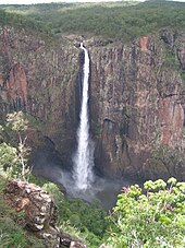
Wallaman Falls in Queensland are Australia's tallest permanent waterfall with a plunge of nearly 300 metres (980 ft). Wollomombi Falls in New South Wales are second with a 220-metre (720 ft) combined drop and Ellenborough Falls, also in New South Wales, is third plunging 160 metres (520 ft) as a single drop.[1]
Australian Capital Territory[]
The following waterfalls are located in the Australian Capital Territory:
This list is incomplete; you can help by . (August 2008) |
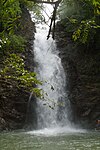
| Image | Waterfall | Location | Drop | Type | Coordinates | Notes | |
|---|---|---|---|---|---|---|---|
| m | ft | ||||||
 |
Gibraltar Falls | Namadgi National Park | 67–120 | 220–394 | Cascade | 35°29′12″S 148°56′06″E / 35.48667°S 148.93500°E | [2] |
| Ginini Falls | 190–220 | 623–722 | 35°29′43″S 148°48′16″E / 35.49528°S 148.80444°E | [3] | |||

New South Wales[]
The following waterfalls are located in New South Wales:
This list is incomplete; you can help by . (August 2008) |


Northern Territory[]
The following waterfalls are location in the Northern Territory:
This list is incomplete; you can help by . (August 2008) |


Queensland[]
The following waterfalls are located in Queensland:
This list is incomplete; you can help by . (August 2008) |


South Australia[]
The following waterfalls are located in South Australia:
This list is incomplete; you can help by . (August 2008) |

Tasmania[]
The following waterfalls are located in Tasmania:
This list is incomplete; you can help by . (August 2008) |
| Image | Waterfall | Location | Drop | Type | Coordinates | Notes | |
|---|---|---|---|---|---|---|---|
| m | ft | ||||||
 |
Delaneys Falls | North West Tasmania | 25 | 82 | Plunge | 41°16′48″S 146°03′36″E / 41.28000°S 146.06000°E | [204] |
 |
Dip Falls | Dip Range Regional Reserve, North West Tasmania |
22–34 | 72–112 | Cascade | 41°01′48″S 145°22′12″E / 41.03000°S 145.37000°E | [205] |
 |
Guide Falls | North West Tasmania | 22–38 | 72–125 | Tiered–cascade | 41°09′00″S 145°48′00″E / 41.15000°S 145.80000°E | [206] |
 |
Horseshoe Falls | Mount Field National Park | Tiered–cascade | 42°40′12″S 146°42′36″E / 42.67000°S 146.71000°E | |||
 |
Lady Barron Falls | Mount Field National Park | Tiered–cascade | 42°41′24″S 146°41′24″E / 42.69000°S 146.69000°E | |||
 |
Liffey Falls | Meander Valley, Midlands | 120–160 | 394–525 | Tiered–cascade | 41°41′24″S 146°45′36″E / 41.69000°S 146.76000°E | [207] |
 |
Montezuma Falls | West Coast Range | 103–110 | 338–361 | Horsetail | 41°49′48″S 145°28′12″E / 41.83000°S 145.47000°E | [208][209] |
 |
Nelson Falls | Franklin-Gordon Wild Rivers National Park | 30 | 98 | Cascade | 42°05′24″S 145°43′48″E / 42.09000°S 145.73000°E | [210] |
 |
Russell Falls | Mount Field National Park | 34–58 | 112–190 | Tiered–cascade | 42°40′12″S 146°42′36″E / 42.67000°S 146.71000°E | [211] |

|
Adamsons Falls | Southwest National Park | 50 | 164 | Cascade | ||
| Meander Conservation Area | Cascade | ||||||

|
Reynolds Falls Nature Recreation Area,
North West Tasmania |
Plunge | |||||
| Horsetail Falls | Queenstown, Western Tasmania | 50 | 164 | Cascade | |||
| Adams Falls | Clear Hill Regional Reserve | 40–50 | 131–164 | Cascade | [212] | ||
| Mount Roland Regional Reserve | 160–200 | 525–656 | Tiered-cascade | ||||
| Winterbrook Falls Regional Reserve,
North West Tasmania |
160 | 525 | Tiered-cascade | ||||
| Waratah, North West Tasmania | Tiered-cascade | 41°46′55″S 145°46′39″E / 41.78194°S 145.77750°E | |||||
Victoria[]
The following waterfalls are located in Victoria:
This list is incomplete; you can help by . (August 2008) |
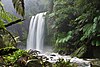
| Image | Waterfall | Location | Drop | Type | Coordinates | Notes | |
|---|---|---|---|---|---|---|---|
| m | ft | ||||||
| Toora | 59 | 194 | [213][214] | ||||
| , near Beech Forest | 16–26 | 52–85 | 38°39′03″S 143°36′27″E / 38.650897°S 143.607488°E | [215] | |||
| Great Otway National Park, near Wongarra | 64–120 | 210–394 | 38°41′32″S 143°48′33″E / 38.69226°S 143.809286°E | [216] | |||
| Carmichael Falls | Alpine National Park, Alpine Shire | 25 | 82 | 37°01′40″S 147°14′22″E / 37.027652°S 147.239324°E | [217] | ||
| Great Otway National Park, Angahook section | 89–140 | 292–459 | 38°30′30″S 143°55′37″E / 38.508415°S 143.927078°E | [218][219] | |||
| 85–110 | 279–361 | 38°33′56″S 143°55′41″E / 38.5656470°S 143.9281193°E | [220] | ||||
| Alpine National Park, western section | 255 | 837 | Plunge | [221][222] | |||
| Great Otway National Park, Angahook section | 49–57 | 161–187 | 38°29′36″S 143°54′06″E / 38.493369°S 143.901672°E | [223][224] | |||
| Great Otway National Park, Angahook section | 8 | 26 | 38°32′17″S 143°57′39″E / 38.537961°S 143.960724°E | ||||
 |
north of Allansford, near Warrnambool | 11–13 | 36–43 | 38°20′01″S 143°37′08″E / 38.3337°S 143.6189°E | [225] | ||
 |
Hopetoun Falls | Great Otway National Park, near Beech Forest | 46–49 | 151–161 | 38°39′26″S 143°34′47″E / 38.657097°S 143.579636°E | [226] | |
| Great Otway National Park, Angahook section | [227] | ||||||
| Mt Buffalo | |||||||
| near Ballarat | 130–190 | 427–623 | [228] | ||||
| Great Otway National Park | |||||||
| Snowy River National Park | [213] | ||||||
| near Daylesford | 20–28 | 66–92 | [229] | ||||
| Kinglake National Park (Sugarloaf Block), near Kinglake | 45 | 148 | [230] | ||||
| Great Otway National Park | 10 | 33 | 38°42′21″S 143°38′27″E / 38.705874°S 143.640747°E | ||||
 |
Nigretta Falls | near Coleraine | 15–16 | 49–52 | 37°39′22″S 141°55′28″E / 37.656016°S 141.924477°E | [231] | |
| Falls Rd Olinda – Dandenong Ranges | |||||||
| Great Otway National Park, Angahook section | 15 | 49 | 38°32′59″S 143°57′35″E / 38.549827°S 143.959801°E | ||||
| Alpine National Park, western section | 234 | 768} | [232] | ||||
| Great Otway National Park, near Wongarra | 130 | 427 | 38°39′45″S 143°45′12″E / 38.662459°S 143.753357°E | [233] | |||
| Great Otway National Park, Angahook section | |||||||
 |
Silverband Falls | Grampians National Park | 37°9′10″S 142°31′40″E / 37.15278°S 142.52778°E | ||||
 |
Steavenson Falls | near Marysville | 55–110 | 180–361 | 37°31′58″S 145°46′25″E / 37.5327°S 145.7737°E | [234] | |
| Stevenson Falls | , near Barramunga | 38°33′09″S 143°39′26″E / 38.552461°S 143.657227°E | |||||
| Great Otway National Park, Angahook section | 28–53 | 92–174 | [235][236] | ||||
| Toorongo Falls | Noojee | 37°50′57″S 146°2′46″E / 37.84917°S 146.04611°E | [213] | ||||
 |
Trentham | 44–48 | 144–157 | 37°22′12″S 144°19′26″E / 37.370°S 144.324°E | [237] | ||
 |
Triplet Falls | Great Otway National Park, Marreeyn section | 38°39′33″S 143°29′38″E / 38.659242°S 143.493805°E | ||||
 |
Wannon Falls | near Coleraine | 18–22 | 59–72 | 37°40′35″S 141°50′27″E / 37.676263°S 141.840835°E | [238] | |
| , Murrindindi Shire | 92–170 | 302–558 | [239] | ||||
| Great Otway National Park, Angahook section | |||||||
Western Australia[]
The following waterfalls are located in Western Australia:
| Image | Waterfall | Location | Drop | Type | Coordinates | Notes | |
|---|---|---|---|---|---|---|---|
| m | ft | ||||||
| Murray River near Dwellingup | |||||||
| in the Kimberley | |||||||
| near Pemberton | |||||||
| near Kununurra | |||||||
| Gloucester National Park | Cascade | ||||||
| near Newman | |||||||
 |
|||||||
| Karijini National Park | |||||||
| John Forrest National Park | |||||||
| Karijini National Park | |||||||
| Karijini National Park | |||||||
 |
King George Falls | King George River | |||||
| Prince Regent River near Wyndham | |||||||
| Northcliffe | 34°41′47″S 116°15′01″E / 34.696391°S 116.250286°E | ||||||
 |
Lesmurdie Falls | Mundy Regional Park | 31°59′39″S 116°02′03″E / 31.994246°S 116.03425°E | ||||
| near Marrinup | |||||||
| Mitchell Falls | The Kimberley | 14°49′00″S 125°41′00″E / 14.81667°S 125.68330°E | |||||
| John Forrest National Park | |||||||
 |
near Gidgegannup | ||||||
| Quinninup Falls | near Wilyabrup | ||||||
 |
Serpentine Falls | Serpentine National Park | |||||
| Ellis Brook Valley, Martin | |||||||
| Karijini National Park | |||||||
See also[]
References[]
- ^ "Tallest Waterfalls". Australian Government. Archived from the original on 25 May 2010. Retrieved 11 August 2009.
- ^ "Map of Gibraltar Falls, ACT". Bonzle Digital Atlas of Australia. Retrieved 17 May 2014.
- ^ "Map of Ginni Falls, ACT". Bonzle Digital Atlas of Australia. Retrieved 17 May 2014.
- ^ "Map of Abbots Falls, NSW". Bonzle Digital Atlas of Australia. Retrieved 31 January 2019.
- ^ "Adelina Falls". Geographical Names Register (GNR) of NSW. Geographical Names Board of New South Wales. Retrieved 2 February 2019.

- ^ Jump up to: a b c d e "Name search". Geographical Names Board. New South Wales Government. Retrieved 2008-08-19.
- ^ "Arethusa Falls". Geographical Names Register (GNR) of NSW. Geographical Names Board of New South Wales. Retrieved 2 February 2019.
- ^ "Bakers Creek Falls". Geographical Names Register (GNR) of NSW. Geographical Names Board of New South Wales. Retrieved 4 February 2019.
- ^ Discover North Rocks And Carlingford by Carla Grossetti. Retrieved 23 March 2020
- ^ "Barrallliers Falls". Geographical Names Register (GNR) of NSW. Geographical Names Board of New South Wales. Retrieved 2 February 2019.
- ^ "Map of Barrallliers Falls, NSW". Bonzle Digital Atlas of Australia. Retrieved 30 January 2019.
- ^ "Map of Barrier Falls, NSW". Bonzle Digital Atlas of Australia. Retrieved 31 January 2019.
- ^ "Beauchamp Falls". Geographical Names Register (GNR) of NSW. Geographical Names Board of New South Wales. Retrieved 2 February 2019.
- ^ "Beauchamp Falls" (PDF). Wild Walks. 22 November 2013. Retrieved 2 February 2019.
- ^ "Map of Belgrave Falls, NSW". Bonzle Digital Atlas of Australia. Retrieved 31 January 2019.
- ^ "Belmore Falls – Robertson". Visit NSW. Retrieved 11 February 2014.
- ^ "Map of Bernard Grotto Falls, NSW". Bonzle Digital Atlas of Australia. Retrieved 31 January 2019.
- ^ "Black Banksia Falls". Geographical Names Register (GNR) of NSW. Geographical Names Board of New South Wales. Retrieved 31 January 2019.
- ^ "Bona Vista Falls". Geographical Names Register (GNR) of NSW. Geographical Names Board of New South Wales. Retrieved 2 February 2019.
- ^ "Map of Bona Vista Falls, NSW". Bonzle Digital Atlas of Australia. Retrieved 31 January 2019.
- ^ "Bong Bong Waterfall". Geographical Names Register (GNR) of NSW. Geographical Names Board of New South Wales. Retrieved 2 February 2019.
- ^ "Map of Bong Bong Falls, NSW". Bonzle Digital Atlas of Australia. Retrieved 31 January 2019.
- ^ "Bonnie Doon Falls". Geographical Names Register (GNR) of NSW. Geographical Names Board of New South Wales. Retrieved 2 February 2019.
- ^ "Map of Boonoo Boonoo Falls, NSW". Bonzle Digital Atlas of Australia. Retrieved 31 January 2019.
- ^ "Gibraltar Range National Park". Department of Environment and Climate Change. Retrieved 2008-08-19.
- ^ "Breretons Falls". Geographical Names Register (GNR) of NSW. Geographical Names Board of New South Wales. Retrieved 4 February 2019.
- ^ "Map of Bridal Veil Falls, NSW". Bonzle Digital Atlas of Australia. Retrieved 31 January 2019.
- ^ "Bridal Veil Falls". Geographical Names Register (GNR) of NSW. Geographical Names Board of New South Wales. Retrieved 2 February 2019.
- ^ "Map of Bundundah Falls, NSW". Bonzle Digital Atlas of Australia. Retrieved 30 January 2019.
- ^ "Burgess Falls". Geographical Names Register (GNR) of NSW. Geographical Names Board of New South Wales. Retrieved 2 February 2019.
- ^ "Calcutta Falls". Geographical Names Register (GNR) of NSW. Geographical Names Board of New South Wales. Retrieved 2 February 2019.
- ^ "Map of Carrington Falls, NSW". Bonzle Digital Atlas of Australia. Retrieved 31 January 2019.
- ^ "Cataract Falls". Geographical Names Register (GNR) of NSW. Geographical Names Board of New South Wales. Retrieved 2 February 2019.
- ^ "Chandler Falls". Geographical Names Register (GNR) of NSW. Geographical Names Board of New South Wales. Retrieved 4 February 2019.
- ^ "Clarinda Falls". Geographical Names Register (GNR) of NSW. Geographical Names Board of New South Wales. Retrieved 2 February 2019.
- ^ "Clouds Creek Falls". Geographical Names Register (GNR) of NSW. Geographical Names Board of New South Wales. Retrieved 31 January 2019.
- ^ "Map of Coal Mine Falls, NSW". Bonzle Digital Atlas of Australia. Retrieved 31 January 2019.
- ^ "Map of Corrowong Falls, NSW". Bonzle Digital Atlas of Australia. Retrieved 31 January 2019.
- ^ "Map of Crooked Falls, NSW". Bonzle Digital Atlas of Australia. Retrieved 31 January 2019.
- ^ "Dangar Falls". Geographical Names Register (GNR) of NSW. Geographical Names Board of New South Wales. Retrieved 31 January 2019.
- ^ "Dangars Falls". Geographical Names Register (GNR) of NSW. Geographical Names Board of New South Wales. Retrieved 31 January 2019.
- ^ "Map of Dangars Falls, NSW". Bonzle Digital Atlas of Australia. Retrieved 30 January 2019.
- ^ "Map of Deep Gorge Falls, NSW". Bonzle Digital Atlas of Australia. Retrieved 31 January 2019.
- ^ "Diamond Falls". Geographical Names Register (GNR) of NSW. Geographical Names Board of New South Wales. Retrieved 2 February 2019.
- ^ "Map of Diamond Falls, NSW". Bonzle Digital Atlas of Australia. Retrieved 31 January 2019.
- ^ "Map of Dilgry Falls, NSW". Bonzle Digital Atlas of Australia. Retrieved 31 January 2019.
- ^ "Map of Dubbo Falls, NSW". Bonzle Digital Atlas of Australia. Retrieved 30 January 2019.
- ^ "Map of Dungeon Falls, NSW". Bonzle Digital Atlas of Australia. Retrieved 30 January 2019.
- ^ "Map of Ebor Falls, NSW". Bonzle Digital Atlas of Australia. Retrieved 30 January 2019.
- ^ "Edenderry Falls". Geographical Names Register (GNR) of NSW. Geographical Names Board of New South Wales. Retrieved 2 February 2019.
- ^ "Edith Falls". Geographical Names Register (GNR) of NSW. Geographical Names Board of New South Wales. Retrieved 2 February 2019.
- ^ "Map of Ellenborough Falls, NSW". Bonzle Digital Atlas of Australia. Retrieved 31 January 2019.
- ^ "Fairy Falls". Geographical Names Register (GNR) of NSW. Geographical Names Board of New South Wales. Retrieved 2 February 2019.
- ^ "Federal Falls". Geographical Names Register (GNR) of NSW. Geographical Names Board of New South Wales. Retrieved 2 February 2019.
- ^ "Morton National Park – Fitzroy Falls". Department of Environment and Climate Change. Retrieved 2009-06-02.
- ^ "Map of Fitzroy Falls, NSW". Bonzle Digital Atlas of Australia. Retrieved 31 January 2019.
- ^ "Frederica Falls". Geographical Names Register (GNR) of NSW. Geographical Names Board of New South Wales. Retrieved 2 February 2019.
- ^ "Fredroy Falls". Geographical Names Register (GNR) of NSW. Geographical Names Board of New South Wales. Retrieved 31 January 2019.
- ^ "Map of Gerringong Falls, NSW". Bonzle Digital Atlas of Australia. Retrieved 31 January 2019.
- ^ "Map of Ginninderra Falls, NSW". Bonzle Digital Atlas of Australia. Retrieved 31 January 2019.
- ^ "Map of Ginninderra Falls, NSW". Bonzle Digital Atlas of Australia. Retrieved 31 January 2019.
- ^ "Glenraphael Falls". Geographical Names Register (GNR) of NSW. Geographical Names Board of New South Wales. Retrieved 2 February 2019.
- ^ "Gloucester Falls". Geographical Names Register (GNR) of NSW. Geographical Names Board of New South Wales. Retrieved 31 January 2019.
- ^ "Gordon Falls". Geographical Names Register (GNR) of NSW. Geographical Names Board of New South Wales. Retrieved 2 February 2019.
- ^ "Govetts Leap". Geographical Names Register (GNR) of NSW. Geographical Names Board of New South Wales. Retrieved 1 February 2019.
- ^ "Map of Granite Falls, NSW". Bonzle Digital Atlas of Australia. Retrieved 30 January 2019.
- ^ "Hazel Falls". Geographical Names Register (GNR) of NSW. Geographical Names Board of New South Wales. Retrieved 2 February 2019.
- ^ "Map of Higgin Falls, NSW". Bonzle Digital Atlas of Australia. Retrieved 30 January 2019.
- ^ "Hilary Falls". Geographical Names Register (GNR) of NSW. Geographical Names Board of New South Wales. Retrieved 2 February 2019.
- ^ "Horseshoe Falls". Geographical Names Register (GNR) of NSW. Geographical Names Board of New South Wales. Retrieved 2 February 2019.
- ^ "Isobel Falls". Geographical Names Register (GNR) of NSW. Geographical Names Board of New South Wales. Retrieved 2 February 2019.
- ^ "Jerusalem Creek Falls". Geographical Names Register (GNR) of NSW. Geographical Names Board of New South Wales. Retrieved 31 January 2019.
- ^ "Junction Falls". Geographical Names Register (GNR) of NSW. Geographical Names Board of New South Wales. Retrieved 2 February 2019.
- ^ "Kanangra Falls". Geographical Names Register (GNR) of NSW. Geographical Names Board of New South Wales. Retrieved 31 January 2019.
- ^ "Katoomba Falls". Geographical Names Register (GNR) of NSW. Geographical Names Board of New South Wales. Retrieved 2 February 2019.
- ^ "Wild Walks". Retrieved 2009-08-31.
- ^ "Kellin Falls". Geographical Names Register (GNR) of NSW. Geographical Names Board of New South Wales. Retrieved 4 February 2019.
- ^ "Leslie Falls". Geographical Names Register (GNR) of NSW. Geographical Names Board of New South Wales. Retrieved 2 February 2019.
- ^ "Leura Falls". Geographical Names Register (GNR) of NSW. Geographical Names Board of New South Wales. Retrieved 2 February 2019.
- ^ "Lila Falls". Geographical Names Register (GNR) of NSW. Geographical Names Board of New South Wales. Retrieved 2 February 2019.
- ^ "Linda Falls". Geographical Names Register (GNR) of NSW. Geographical Names Board of New South Wales. Retrieved 2 February 2019.
- ^ "Lodore Falls". Geographical Names Register (GNR) of NSW. Geographical Names Board of New South Wales. Retrieved 2 February 2019.
- ^ "Lyrebird Falls". Geographical Names Register (GNR) of NSW. Geographical Names Board of New South Wales. Retrieved 2 February 2019.
- ^ "Mabel Falls". Geographical Names Register (GNR) of NSW. Geographical Names Board of New South Wales. Retrieved 2 February 2019.
- ^ "Magdala Falls". Geographical Names Register (GNR) of NSW. Geographical Names Board of New South Wales. Retrieved 2 February 2019.
- ^ "Margaret Falls". Geographical Names Register (GNR) of NSW. Geographical Names Board of New South Wales. Retrieved 31 January 2019.
- ^ "Map of Margaret Falls, NSW". Bonzle Digital Atlas of Australia. Retrieved 31 January 2019.
- ^ "Marshalls Falls". Geographical Names Register (GNR) of NSW. Geographical Names Board of New South Wales. Retrieved 4 February 2019.
- ^ "Martins Falls". Geographical Names Register (GNR) of NSW. Geographical Names Board of New South Wales. Retrieved 2 February 2019.
- ^ "Mihi Falls". Geographical Names Register (GNR) of NSW. Geographical Names Board of New South Wales. Retrieved 4 February 2019.
- ^ "Map of Mihi Falls, NSW". Bonzle Digital Atlas of Australia. Retrieved 30 January 2019.
- ^ "Map of Millnigang Falls, NSW". Bonzle Digital Atlas of Australia. Retrieved 30 January 2019.
- ^ "Map of Minamurra Falls, NSW". Bonzle Digital Atlas of Australia. Retrieved 30 January 2019.
- ^ "Map of Minamurra Falls, NSW". Bonzle Digital Atlas of Australia. Retrieved 30 January 2019.
- ^ "Minnatonka Falls". Geographical Names Register (GNR) of NSW. Geographical Names Board of New South Wales. Retrieved 2 February 2019.
- ^ "Minnehaha Falls". Geographical Names Register (GNR) of NSW. Geographical Names Board of New South Wales. Retrieved 2 February 2019.
- ^ "Minyon Falls". Geographical Names Register (GNR) of NSW. Geographical Names Board of New South Wales. Retrieved 31 January 2019.
- ^ "Minyon Falls". New South Wales Government. Retrieved 2009-11-18.
- ^ "Moffatt Falls". Geographical Names Register (GNR) of NSW. Geographical Names Board of New South Wales. Retrieved 4 February 2019.
- ^ "Moorakoo Falls". Geographical Names Register (GNR) of NSW. Geographical Names Board of New South Wales. Retrieved 2 February 2019.
- ^ "Map of Munnuldi Falls, NSW". Bonzle Digital Atlas of Australia. Retrieved 31 January 2019.
- ^ "Map of North Overshot, NSW". Bonzle Digital Atlas of Australia. Retrieved 31 January 2019.
- ^ "Numantia Falls". Geographical Names Register (GNR) of NSW. Geographical Names Board of New South Wales. Retrieved 2 February 2019.
- ^ "Oaky Falls". Geographical Names Register (GNR) of NSW. Geographical Names Board of New South Wales. Retrieved 4 February 2019.
- ^ "Paddys River Falls". World of Waterfalls. 10 November 2006. Retrieved 29 January 2019.
- ^ "Map of Perryman Falls, NSW". Bonzle Digital Atlas of Australia. Retrieved 31 January 2019.
- ^ "Petroi Falls". Geographical Names Register (GNR) of NSW. Geographical Names Board of New South Wales. Retrieved 4 February 2019.
- ^ "Protestors Falls". New South Wales Government. Retrieved 2009-11-18.
- ^ "Map of Rawson Falls, NSW". Bonzle Digital Atlas of Australia. Retrieved 31 January 2019.
- ^ "Second Falls". Geographical Names Register (GNR) of NSW. Geographical Names Board of New South Wales. Retrieved 2 February 2019.
- ^ "Map of Sluice Box Falls, NSW". Bonzle Digital Atlas of Australia. Retrieved 31 January 2019.
- ^ "Map of Sparkles Falls, NSW". Bonzle Digital Atlas of Australia. Retrieved 31 January 2019.
- ^ "St Michaels Falls". Geographical Names Register (GNR) of NSW. Geographical Names Board of New South Wales. Retrieved 2 February 2019.
- ^ "Terrace Falls". Geographical Names Register (GNR) of NSW. Geographical Names Board of New South Wales. Retrieved 2 February 2019.
- ^ "Trinity Falls". Geographical Names Register (GNR) of NSW. Geographical Names Board of New South Wales. Retrieved 2 February 2019.
- ^ "Map of The Upper Falls, NSW". Bonzle Digital Atlas of Australia. Retrieved 31 January 2019.
- ^ "Map of The Lower Falls, NSW". Bonzle Digital Atlas of Australia. Retrieved 31 January 2019.
- ^ "Map of Tia Falls, NSW". Bonzle Digital Atlas of Australia. Retrieved 31 January 2019.
- ^ "Map of Tia Falls, NSW". Bonzle Digital Atlas of Australia. Retrieved 31 January 2019.
- ^ "Tin Mine Falls". Geographical Names Register (GNR) of NSW. Geographical Names Board of New South Wales. Retrieved 31 January 2019.
- ^ "Map of Tianjara Falls, NSW". Bonzle Digital Atlas of Australia. Retrieved 31 January 2019.
- ^ "Map of Tuross Falls, NSW". Bonzle Digital Atlas of Australia. Retrieved 31 January 2019.
- ^ "Map of Undercliffe Falls, NSW". Bonzle Digital Atlas of Australia. Retrieved 31 January 2019.
- ^ "Valentine Falls". Geographical Names Register (GNR) of NSW. Geographical Names Board of New South Wales. Retrieved 31 January 2019.
- ^ "Vera Falls". Geographical Names Register (GNR) of NSW. Geographical Names Board of New South Wales. Retrieved 2 February 2019.
- ^ "Victor Falls". Geographical Names Register (GNR) of NSW. Geographical Names Board of New South Wales. Retrieved 2 February 2019.
- ^ "Victoria Falls". Geographical Names Register (GNR) of NSW. Geographical Names Board of New South Wales. Retrieved 2 February 2019.
- ^ "Map of Victoria Falls, NSW". Bonzle Digital Atlas of Australia. Retrieved 31 January 2019.
- ^ "Wentworth Falls". Geographical Names Register (GNR) of NSW. Geographical Names Board of New South Wales. Retrieved 2 February 2019.
- ^ "Westerway Falls". Geographical Names Register (GNR) of NSW. Geographical Names Board of New South Wales. Retrieved 2 February 2019.
- ^ "Wheengee Whungee Falls". Geographical Names Register (GNR) of NSW. Geographical Names Board of New South Wales. Retrieved 4 February 2019.
- ^ "Map of Wheengee Whungee Falls, NSW". Bonzle Digital Atlas of Australia. Retrieved 31 January 2019.
- ^ "William Falls". Geographical Names Register (GNR) of NSW. Geographical Names Board of New South Wales. Retrieved 4 February 2019.
- ^ "Map of William Falls, NSW". Bonzle Digital Atlas of Australia. Retrieved 31 January 2019.
- ^ "Wollomombi Falls". Geographical Names Register (GNR) of NSW. Geographical Names Board of New South Wales. Retrieved 31 January 2019.
- ^ "Map of Wollomombi Falls, NSW". Bonzle Digital Atlas of Australia. Retrieved 31 January 2019.
- ^ "Map of 17 Mile Falls, NT". Bonzle Digital Atlas of Australia. Retrieved 17 May 2014.
- ^ "Map of Bine – Jeruk Falls, NT". Bonzle Digital Atlas of Australia. Retrieved 17 May 2014.
- ^ "Map of Crystal Falls, NT". Bonzle Digital Atlas of Australia. Retrieved 17 May 2014.
- ^ "Map of Cuthbertson Falls, NT". Bonzle Digital Atlas of Australia. Retrieved 17 May 2014.
- ^ "Map of Edith Falls, NT". Bonzle Digital Atlas of Australia. Retrieved 17 May 2014.
- ^ "Map of Florence Falls, NT". Bonzle Digital Atlas of Australia. Retrieved 17 May 2014.
- ^ "Map of Wangi Falls, NT". Bonzle Digital Atlas of Australia. Retrieved 17 May 2014.
- ^ "Map of Havelock Falls, NT". Bonzle Digital Atlas of Australia. Retrieved 17 May 2014.
- ^ "Map of Henscke Falls, NT". Bonzle Digital Atlas of Australia. Retrieved 17 May 2014.
- ^ "Map of Inukalen Cataract, NT". Bonzle Digital Atlas of Australia. Retrieved 17 May 2014.
- ^ "Map of Jim Jim Falls (Barrkmalam), NT". Bonzle Digital Atlas of Australia. Retrieved 17 May 2014.
- ^ "Map of Kathleen Falls, NT". Bonzle Digital Atlas of Australia. Retrieved 17 May 2014.
- ^ "Map of Lily Ponds Falls, NT". Bonzle Digital Atlas of Australia. Retrieved 17 May 2014.
- ^ "Map of Mandjawuril, NT". Bonzle Digital Atlas of Australia. Retrieved 17 May 2014.
- ^ "Map of Myra Falls, NT". Bonzle Digital Atlas of Australia. Retrieved 17 May 2014.
- ^ "Map of Robin Falls, NT". Bonzle Digital Atlas of Australia. Retrieved 17 May 2014.
- ^ "Map of Rosies Falls, NT". Bonzle Digital Atlas of Australia. Retrieved 17 May 2014.
- ^ "Litchfield National Park – Surprise Creek Falls". Litchfield National Park. Retrieved 9 August 2009.
- ^ "Map of Tjaetaba Falls, NT". Bonzle Digital Atlas of Australia. Retrieved 17 May 2014.
- ^ "Map of Tjaynera Falls, NT". Bonzle Digital Atlas of Australia. Retrieved 17 May 2014.
- ^ "Map of Tjaynera (Sandy Creek) Falls, NT". Bonzle Digital Atlas of Australia. Retrieved 17 May 2014.
- ^ "Map of Tolmer Falls, NT". Bonzle Digital Atlas of Australia. Retrieved 17 May 2014.
- ^ "Map of Trudies Falls, NT". Bonzle Digital Atlas of Australia. Retrieved 17 May 2014.
- ^ "Map of Gungkurdul (Twin Falls), NT". Bonzle Digital Atlas of Australia. Retrieved 17 May 2014.
- ^ "Map of Walwalgiyn Falls, NT". Bonzle Digital Atlas of Australia. Retrieved 17 May 2014.
- ^ "Map of Wangi Falls, NT". Bonzle Digital Atlas of Australia. Retrieved 17 May 2014.
- ^ "Map of Yawuriyarra Falls, NT". Bonzle Digital Atlas of Australia. Retrieved 17 May 2014.
- ^ "Barron Falls". World Waterfall Database. 2014. Retrieved 18 May 2014.
- ^ "Map of Binda Falls, QLD". Bonzle Digital Atlas of Australia. Retrieved 2009-08-14.
- ^ "Blencoe Falls". World of Waterfalls. Johnny T. Cheng. 19 May 2008. Retrieved 18 May 2014.
- ^ "Tour the Bloomfield Falls with an expert". 150 Must dos in Queensland. RACQ. Retrieved 18 May 2014.
- ^ "Browns Falls". World of Waterfalls. Johnny T. Cheng. 9 May 2008. Retrieved 18 May 2014.
- ^ "Map of Buderim Falls, QLD". Bonzle Digital Atlas of Australia. Retrieved 2009-08-30.
- ^ Lackner, Thomas (1989). Discovering Binna Burra on Foot. Envirobook. p. 37. ISBN 0-85881-088-3.
- ^ "Davies Creek Falls". World Waterfall Database. 21 May 2011. Retrieved 20 May 2014.
- ^ "Map of Herbert River Falls, QLD". Bonzle Digital Atlas of Australia. Retrieved 23 May 2014.
- ^ "Map of Jones Falls in Queensland". Bonzle Digital Atlas of Australia. Retrieved 14 August 2009.
- ^ "Map of Josephine Falls, QLD". Bonzle Digital Atlas of Australia. Retrieved 23 May 2014.
- ^ "Map of Kondalilla Falls, QLD". Bonzle Digital Atlas of Australia. Retrieved 2009-08-14.
- ^ "Millaa Millaa Falls". World of Waterfalls. 18 May 2008. Retrieved 24 May 2014.
- ^ "Map of Milmilgee River Falls, QLD". Bonzle Digital Atlas of Australia. Retrieved 29 May 2014.
- ^ "Murray Falls". World of Waterfalls. Johnny T. Cheng. 16 May 2008.
- ^ "Purling Brook Falls". World of Waterfalls. Johnny T. Cheng. 16 May 2008. Retrieved 30 May 2014.
- ^ "Queen Mary Falls". World of Waterfalls. Johnny T. Cheng. 9 May 2008. Retrieved 18 May 2014.
- ^ "Daggs Falls". World of Waterfalls. Johnny T. Cheng. 9 May 2008. Retrieved 18 May 2014.
- ^ "Tully Falls". World Waterfall Database. 21 May 2011. Retrieved 30 May 2014.
- ^ "Education: Significant Waterfalls". Geoscience Australia. Australian Government. 23 November 2010. Retrieved 30 May 2014.
- ^ "Map of Wongalee Falls, QLD". Bonzle Digital Atlas of Australia. Retrieved 31 May 2014.
- ^ Lackner, Thomas (1989). Discovering Binna Burra on Foot. Envirobook. p. 37. ISBN 0-85881-088-3.
- ^ "Search results for "Ferntree Falls" with the following datasets selected – 'Suburbs and Localities' and 'Gazetteer'". Location SA Map Viewer. Government of South Australia. Retrieved 12 July 2019.
- ^ Jump up to: a b c d e f g h i j "PlaceNames Online, South Australian State Gazetteer". Department for Transport, Energy and Infrastructure. Archived from the original on 3 June 2011. Retrieved 30 July 2008.
- ^ "Morialta Conservation Park". South Australia Tourism. Government of South Australia. Retrieved 31 May 2014.
- ^ "Cleland Conservation Park Map" (PDF). National Parks and Wildlife South Australia. Archived from the original (PDF) on 2009-10-21. Retrieved 2009-11-24.
- ^ "Search results for "Glenora Falls" with the following datasets selected – 'Suburbs and Localities' and 'Gazetteer'". Location SA Map Viewer. Government of South Australia. Retrieved 14 July 2019.
- ^ "Search results for "Hay Flat Waterfall" with the following datasets selected – 'Suburbs and Localities' and 'Gazetteer'". Location SA Map Viewer. Government of South Australia. Retrieved 12 July 2019.
- ^ "Search results for "Hindmarsh Falls" with the following datasets selected – 'Suburbs and Localities' and 'Gazetteer'". Location SA Map Viewer. Government of South Australia. Retrieved 12 July 2019.
- ^ "Map of Ingalalla Waterfalls, SA". Bonzle Digital Atlas of Australia. Retrieved 31 May 2014.
- ^ "Search results for "Kanalla Falls" with the following datasets selected – 'Suburbs and Localities' and 'Gazetteer'". Location SA Map Viewer. Government of South Australia. Retrieved 12 July 2019.
- ^ "Map of Kanalla Falls, SA". Bonzle Digital Atlas of Australia. Retrieved 31 May 2014.
- ^ "Search results for "Ferntree Falls" with the following datasets selected – 'Suburbs and Localities' and 'Gazetteer'". Location SA Map Viewer. Government of South Australia. Retrieved 14 July 2019.
- ^ "Search results for "Malloga Falls" with the following datasets selected – 'Suburbs and Localities' and 'Gazetteer'". Location SA Map Viewer. Government of South Australia. Retrieved 12 July 2019.
- ^ "Search results for "Mannum Falls" with the following datasets selected – 'Suburbs and Localities' and 'Gazetteer'". Location SA Map Viewer. Government of South Australia. Retrieved 14 July 2019.
- ^ "Search results for "Petalinka Falls" with the following datasets selected – 'Suburbs and Localities' and 'Gazetteer'". Location SA Map Viewer. Government of South Australia. Retrieved 14 July 2019.
- ^ Jump up to: a b "National Parks and Wildlife South Australia – Morialta Conservation Park". Department for Environment and Heritage. Archived from the original on 2008-08-23. Retrieved 2008-08-14.
- ^ "Search results for "Strepara Falls" with the following datasets selected – 'Suburbs and Localities' and 'Gazetteer'". Location SA Map Viewer. Government of South Australia. Retrieved 12 July 2019.
- ^ "Search results for "Wadella Falls" with the following datasets selected – 'Suburbs and Localities' and 'Gazetteer'". Location SA Map Viewer. Government of South Australia. Retrieved 12 July 2019.
- ^ "Search results for "Waukarie Falls" with the following datasets selected – 'Suburbs and Localities' and 'Gazetteer'". Location SA Map Viewer. Government of South Australia. Retrieved 12 July 2019.
- ^ "Preston Falls (Delaney's Falls)". World of Waterfalls. Johnny T. Cheng. 27 November 2006. Retrieved 31 May 2014.
- ^ "Dip Falls". Bonzle Digital Atlas of Australia. Retrieved 31 May 2014.
- ^ "Map of Guide Falls, TAS". Bonzle Digital Atlas of Australia. Retrieved 31 May 2014.
- ^ "Map of Liffey Falls, TAS". Bonzle Digital Atlas of Australia. Retrieved 31 May 2014.
- ^ "Montezuma Falls". World Waterfall Database. 21 May 2011. Retrieved 31 May 2014.
- ^ "Montezuma Falls Area, Roseberry, TAS, Australia". Australian Heritage Database: Register of the National Estate. Retrieved 31 May 2014.
- ^ "Nelson Falls". World of Waterfalls. Johnny T. Cheng. 29 November 2006. Retrieved 31 May 2014.
- ^ "Map of Russell Falls, TAS". Bonzle Digital Atlas of Australia. Retrieved 31 May 2014.
- ^ "Discover Adams Falls in Tasmania". Waterfalls of Tasmania. Retrieved 2021-01-28.
- ^ Jump up to: a b c "Waterfalls in Gippsland". Visit Victoria. Retrieved 9 August 2009.
- ^ "Agnes Falls". Parks Victoria. Retrieved 3 June 2010.
- ^ "Map of Beauchamp Falls, VIC". Bonzle Digital Atlas of Australia. Retrieved 20 June 2014.
- ^ "Map of Carisbrook Falls, VIC". Bonzle Digital Atlas of Australia. Retrieved 20 June 2014.
- ^ "Carmichael Falls Walk" (PDF).
- ^ "Cora Lynn Cascades". Parks Victoria. Retrieved 3 June 2010.
- ^ "Map of Cora Lynn Falls, VIC". Bonzle Digital Atlas of Australia. Retrieved 20 June 2014.
- ^ "Map of Cumberland Falls, VIC". Bonzle Digital Atlas of Australia. Retrieved 20 June 2014.
- ^ "Significant Waterfalls". Geoscience Australia. Archived from the original on 25 May 2010. Retrieved 31 May 2010.
- ^ "Dandongadale Falls". World Waterfall Database. Retrieved 31 May 2010.
- ^ "Erskine Falls". Parks Victoria. Retrieved 3 June 2010.
- ^ "Map of Erskine Falls, VIC". Bonzle Digital Atlas of Australia. Retrieved 20 June 2014.
- ^ "Map of Hopkins Falls, VIC". Bonzle Digital Atlas of Australia. Retrieved 20 June 2014.
- ^ "Map of Hopetoun Falls, VIC". Bonzle Digital Atlas of Australia. Retrieved 20 June 2014.
- ^ "Kalimna Falls". Parks Victoria. Retrieved 3 June 2010.
- ^ "Map of La La Falls, VIC". Bonzle Digital Atlas of Australia. Retrieved 20 June 2014.
- ^ "Map of Loddon Falls, VIC". Bonzle Digital Atlas of Australia. Retrieved 20 June 2014.
- ^ Thomas, Tyrone T. (2000). 120 Walks in Victoria. Melbourne: Hill of Content. p. 87. ISBN 0-85572-308-4.
- ^ "Map of Nigretta Falls, VIC". Bonzle Digital Atlas of Australia. Retrieved 20 June 2014.
- ^ "Piemans Falls". World Waterfall Database. Retrieved 31 May 2010.
- ^ "Sabine Falls". World Waterfall Database. Retrieved 31 May 2010.
- ^ "Map of Steavenson Falls, VIC". Bonzle Digital Atlas of Australia. Retrieved 20 June 2014.
- ^ "Straw Falls". Parks Victoria. Retrieved 3 June 2010.
- ^ "Map of Straw Falls, VIC". Bonzle Digital Atlas of Australia. Retrieved 20 June 2014.
- ^ "Map of Trentham Falls, VIC". Bonzle Digital Atlas of Australia. Retrieved 20 June 2014.
- ^ "Map of Wannon Falls, VIC". Bonzle Digital Atlas of Australia. Retrieved 20 June 2014.
- ^ "Map of Wilhelmina Falls, VIC". Bonzle Digital Atlas of Australia. Retrieved 20 June 2014.
External links[]
| Wikimedia Commons has media related to Waterfalls in Australia. |
- Waterfalls of Australia
- Lists of landforms of Australia
- Lists of tourist attractions in Australia
- Lists of waterfalls by country