Lochbuie, Colorado
Town of Lochbuie, Colorado | |
|---|---|
Statutory Town | |
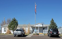 The Lochbuie Administration Building. | |
 Location of Lochbuie in Adams County and Weld County, Colorado. | |
| Coordinates: 40°0′36″N 104°42′29″W / 40.01000°N 104.70806°WCoordinates: 40°0′36″N 104°42′29″W / 40.01000°N 104.70806°W | |
| Country | |
| State | |
| Counties | Weld County[1] Adams County |
| Incorporated | May 1974[2] |
| Government | |
| • Type | Statutory Town[1] |
| Area | |
| • Total | 3.71 sq mi (9.60 km2) |
| • Land | 3.69 sq mi (9.54 km2) |
| • Water | 0.02 sq mi (0.06 km2) |
| Elevation | 5,020 ft (1,530 m) |
| Population (2010) | |
| • Total | 4,726 |
| • Estimate (2019)[5] | 7,304 |
| • Density | 1,982.09/sq mi (765.39/km2) |
| Time zone | UTC-7 (MST) |
| • Summer (DST) | UTC-6 (MDT) |
| ZIP code[6] | 80603 |
| Area code(s) | Both 303 and 720 |
| FIPS code | 08-45530 |
| GNIS feature ID | 1669461 |
| Website | Town of Lochbuie |

The Town of Lochbuie (/lɒkˈbuːi/ lok-BOO-ee)[7] is a Statutory Town located in Weld and Adams counties in the U.S. state of Colorado. The town population was 4726 at the 2010 United States Census.
Geography[]
Lochbuie is located at 40°0′36″N 104°42′29″W / 40.01000°N 104.70806°W (40.009864, -104.708080).[8]
According to the United States Census Bureau, the town has a total area of 1.4 square miles (3.5 km2), of which, 1.3 square miles (3.5 km2) of it is land and 0.04 square miles (0.1 km2) of it (1.47%) is water.
History[]
Lochbuie was developed in the 1960s as the Spacious Living Mobile Home Park, and known as Space City until it was incorporated in 1974.[9] The town was named Lochbuie after Lochbuie, Mull in Scotland.[10]
Demographics[]
| Historical population | |||
|---|---|---|---|
| Census | Pop. | %± | |
| 1980 | 895 | — | |
| 1990 | 1,168 | 30.5% | |
| 2000 | 2,049 | 75.4% | |
| 2010 | 4,726 | 130.6% | |
| 2019 (est.) | 7,304 | [5] | 54.5% |
| U.S. Decennial Census[11] | |||
As of the census[12] of 2000, there were 2,049 people, 1,643 households, and 518 families residing in the town. The population density was 1,531.6 people per square mile (590.4/km2). There were 654 housing units at an average density of 488.9 per square mile (188.4/km2). The racial makeup of the town was 73.94% White, 0.24% African American, 0.63% Native American, 0.15% Asian, 22.69% from other races, and 2.34% from two or more races. Hispanic or Latino of any race were 35.92% of the population.
There were 643 households, out of which 43.1% had children under the age of 18 living with them, 65.8% were married couples living together, 77.0% had a female householder with no husband present, and 19.4% were non-families. 15.2% of all households were made up of individuals, and 4.8% had someone living alone who was 65 years of age or older. The average household size was 3.19 and the average family size was 3.50.
In the town, the population was spread out, with 31.0% under the age of 18, 8.7% from 18 to 24, 32.9% from 25 to 44, 19.7% from 45 to 64, and 7.7% who were 65 years of age or older. The median age was 31 years. For every 100 females, there were 110.4 males. For every 100 females age 18 and over, there were 114.2 males.
The median income for a family was $40,089. Males had a median income of $30,993 versus $28,000 for females. The per capita income for the town was $14,845. About 4.3% of families and 8.5% of the population were below the poverty line, including 10.3% of those under age 18 and 8.1% of those age 65 or over.
See also[]
- Outline of Colorado
- State of Colorado
- Colorado cities and towns
- Colorado municipalities
- Colorado counties
- Colorado metropolitan areas
- Front Range Urban Corridor
- North Central Colorado Urban Area
- Denver-Aurora-Boulder, CO Combined Statistical Area
- Greeley, CO Metropolitan Statistical Area
- Colorado cities and towns
References[]
- ^ a b "Active Colorado Municipalities". State of Colorado, Department of Local Affairs. Archived from the original on 2009-12-12. Retrieved 2007-09-01.
- ^ "Colorado Municipal Incorporations". State of Colorado, Department of Personnel & Administration, Colorado State Archives. 2004-12-01. Retrieved 2007-09-02.
- ^ "2019 U.S. Gazetteer Files". United States Census Bureau. Retrieved July 1, 2020.
- ^ "US Board on Geographic Names". United States Geological Survey. 2007-10-25. Retrieved 2008-01-31.
- ^ a b "Population and Housing Unit Estimates". United States Census Bureau. May 24, 2020. Retrieved May 27, 2020.
- ^ "ZIP Code Lookup". United States Postal Service. Archived from the original (JavaScript/HTML) on January 1, 2008. Retrieved November 14, 2007.
- ^ "Colorado Day: How the bleep do you say that? A Colorado guide". TheDenverChannel.com. July 27, 2016. Retrieved October 4, 2019.
- ^ "US Gazetteer files: 2010, 2000, and 1990". United States Census Bureau. 2011-02-12. Retrieved 2011-04-23.
- ^ Dexheimer, Eric. "Turning Water into Whine", Westword, August 20, 1998, accessed 6 March 2011
- ^ Capace, Nancy The Encyclopedia of Colorado
- ^ "Census of Population and Housing". Census.gov. Retrieved June 4, 2015.
- ^ "U.S. Census website". United States Census Bureau. Retrieved 2008-01-31.
External links[]
Municipalities and communities of Adams County, Colorado, United States | ||
|---|---|---|
| Cities |  | |
| Towns | ||
| CDPs | ||
| Unincorporated communities | ||
| Footnotes | ‡This populated place also has portions in an adjacent county or counties | |
| ||
Municipalities and communities of Weld County, Colorado, United States | ||
|---|---|---|
| Cities |  | |
| Towns | ||
| CDPs | ||
| Unincorporated communities | ||
| Ghost towns | ||
| Footnotes | ‡This populated place also has portions in an adjacent county or counties | |
| ||
- ^ "Worst Places to Live in Colorado for 2021". 7 January 2020.
- Towns in Weld County, Colorado
- Towns in Adams County, Colorado
- Towns in Colorado
- Denver metropolitan area