Evans, Colorado
Evans, Colorado | |
|---|---|
Home rule municipality[1] | |
| City of Evans[1] | |
 The Evans Community Complex. | |
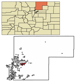 Location of the City of Evans in Weld County, Colorado. | |
 Evans Location of the City of Evans in the United States. | |
| Coordinates: 40°21′01″N 104°44′54″W / 40.350168°N 104.748388°WCoordinates: 40°21′01″N 104°44′54″W / 40.350168°N 104.748388°W[3] | |
| Country | |
| State | |
| County | Weld County[2] |
| City | Evans[1] |
| Founded | 1867 |
| Incorporated | November 15, 1885[4] |
| Government | |
| • Type | Home rule municipality[1] |
| • Mayor | Brian Rudy |
| • City Manager Jim Becklemberg | Jim Becklenberg[5] |
| Area | |
| • Total | 10.53 sq mi (27.26 km2) |
| • Land | 10.18 sq mi (26.37 km2) |
| • Water | 0.34 sq mi (0.89 km2) |
| Elevation | 4,652 ft (1,418 m) |
| Population (2010) | |
| • Total | 18,537 |
| • Estimate (2019)[8] | 21,205 |
| • Density | 2,082.60/sq mi (804.07/km2) |
| Time zone | UTC−7 (MST) |
| • Summer (DST) | UTC−6 (MDT) |
| ZIP code[9] | 80620 |
| Area code(s) | 970 |
| FIPS code | 08-25280 |
| GNIS feature ID | 0202732 |
| Highways | US 34, US 85 |
| Website | City of Evans |

The City of Evans is a home rule municipality located in Weld County, Colorado, United States. The population was 18,537 at the 2010 census, and estimated at 21,205 as of July 1, 2019, by the Census Bureau.[10]
History[]
Named for the second Territorial Governor of Colorado, John Evans,[11][12] the town was established in 1867 and was Weld County's seat of government twice before Greeley finally captured the honor. Legend in Evans is that the county records were stolen by night-riders from Greeley, who also burned the courthouse down with the county seat documents. The town was incorporated in 1885.[13]
Today, Evans, like other towns in Colorado along the South Platte River, is home to a rapidly growing Hispanic population. Evans has several primary commercial areas located along US 85 just south of its junction with US 34, as well along 23rd Avenue and on 37th Street with new commercial areas developing as the city expands to the west and south of the South Platte River.[14]
Geography[]
Evans is located at 40°22′46″N 104°42′38″W / 40.37944°N 104.71056°W (40.379310, −104.710450).[15]
According to the United States Census Bureau, the city has a total area of 10.5 square miles (27 km2), all land.
Demographics[]
| Historical population | |||
|---|---|---|---|
| Census | Pop. | %± | |
| 1870 | 189 | — | |
| 1880 | 542 | 186.8% | |
| 1890 | 306 | −43.5% | |
| 1900 | 400 | 30.7% | |
| 1910 | 600 | 50.0% | |
| 1920 | 505 | −15.8% | |
| 1930 | 540 | 6.9% | |
| 1940 | 792 | 46.7% | |
| 1950 | 862 | 8.8% | |
| 1960 | 1,453 | 68.6% | |
| 1970 | 2,570 | 76.9% | |
| 1980 | 5,063 | 97.0% | |
| 1990 | 5,877 | 16.1% | |
| 2000 | 9,514 | 61.9% | |
| 2010 | 18,537 | 94.8% | |
| 2019 (est.) | 21,205 | [8] | 14.4% |
| U.S. Decennial Census[16] | |||
As of the census[17] of 2000, there were 9,514 people, 3,277 households, and 2,359 families living in the city. The population density was 2,489.9 people per square mile (961.6/km2). There were 3,404 housing units at an average density of 890.9 per square mile (344.1/km2). The racial makeup of the city was 71.08% White, 0.79% African American, 1.28% Native American, 0.71% Asian, 0.02% Pacific Islander, 22.45% from other races, and 3.66% from two or more races. Hispanic or Latino of any race were 40.08% of the population.
There were 3,277 households, out of which 43.8% had children under the age of 18 living with them, 51.3% were married couples living together, 14.3% had a female householder with no husband present, and 28.0% were non-families. 19.3% of all households were made up of individuals, and 6.0% had someone living alone who was 65 years of age or older. The average household size was 2.90 and the average family size was 3.33.
In the city, the population was spread out, with 32.1% under the age of 18, 14.2% from 18 to 24, 32.3% from 25 to 44, 15.2% from 45 to 64, and 6.2% who were 65 years of age or older. The median age was 27 years. For every 100 females, there were 98.2 males. For every 100 females age 18 and over, there were 93.9 males.
The median income for a household in the city was $37,158, and the median income for a family was $42,983. Males had a median income of $30,938 versus $22,946 for females. The per capita income for the city was $15,329. About 9.8% of families and 14.9% of the population were below the poverty line, including 19.6% of those under age 18 and 6.4% of those age 65 or over.
Estimated population in 2015 was 20,439, making Evans one of the fastest growing cities in the state.
Education[]
Evans is within Weld County School District Six. As of 2008 zoned elementary schools serving sections of Evans include Centennial, Dos Rios, and Heiman in Evans and Bella Romero Elementary School in an unincorporated section of Weld County.[18] Middle school-aged students are zoned to Brentwood Middle School in Greeley,[19] while high school students are zoned to Greeley West High School in Greeley.[20]
See also[]
- Outline of Colorado
- State of Colorado
- Colorado cities and towns
- Colorado municipalities
- Colorado counties
- Weld County, Colorado
- Colorado metropolitan areas
- Front Range Urban Corridor
- North Central Colorado Urban Area
- Denver-Aurora-Boulder, CO Combined Statistical Area
- Greeley, CO Metropolitan Statistical Area
- Colorado cities and towns
References[]
- ^ Jump up to: a b c d "Active Colorado Municipalities". State of Colorado, Colorado Department of Local Affairs, Division of Local Government. Retrieved January 26, 2021.
- ^ "Colorado Counties". State of Colorado, Colorado Department of Local Affairs, Division of Local Government. Retrieved January 26, 2021.
- ^ "2014 U.S. Gazetteer Files: Places". United States Census Bureau. July 1, 2014. Retrieved January 6, 2015.
- ^ "Colorado Municipal Incorporations". State of Colorado, Department of Personnel & Administration, Colorado State Archives. 2004-12-01. Retrieved 2007-09-02.
- ^ "Evans City Manager". City of Evans, Colorado. Archived from the original on 2008-05-08. Retrieved 2008-06-24.
- ^ "2019 U.S. Gazetteer Files". United States Census Bureau. Retrieved July 1, 2020.
- ^ "US Board on Geographic Names". United States Geological Survey. 2007-10-25. Retrieved 2008-01-31.
- ^ Jump up to: a b "Population and Housing Unit Estimates". United States Census Bureau. May 24, 2020. Retrieved May 27, 2020.
- ^ "ZIP Code Lookup". United States Postal Service. Archived from the original (JavaScript/HTML) on November 4, 2010. Retrieved September 12, 2007.
- ^ "Population and Housing Unit Estimates". Retrieved May 21, 2020.
- ^ Gannett, Henry (1905). The Origin of Certain Place Names in the United States. Govt. Print. Off. p. 122.
- ^ Dawson, John Frank. Place names in Colorado: why 700 communities were so named, 150 of Spanish or Indian origin. Denver, CO: The J. Frank Dawson Publishing Co. p. 20.
- ^ "Evans, Colorado". City-Data.com. Retrieved 2012-10-07.
- ^ City of Evans Comprehensive Plan, http://www.cityofevans.org/department.cfm?depID=15#212 Archived 2010-02-02 at the Wayback Machine
- ^ "US Gazetteer files: 2010, 2000, and 1990". United States Census Bureau. 2011-02-12. Retrieved 2011-04-23.
- ^ "Census of Population and Housing". Census.gov. Retrieved June 4, 2015.
- ^ "U.S. Census website". United States Census Bureau. Retrieved 2008-01-31.
- ^ "District 6 Elementary School Boundaries Archived 2011-07-26 at the Wayback Machine." Weld County School District Six. Retrieved on December 10, 2008.
- ^ "District 6 Middle School Boundaries Archived 2011-07-26 at the Wayback Machine." Weld County School District Six. Retrieved on December 10, 2008.
- ^ "District 6 High School Boundaries Archived 2011-07-26 at the Wayback Machine." Weld County School District Six. Retrieved on December 10, 2008.
External links[]
| show Municipalities and communities of Weld County, Colorado, United States |
|---|


| show Authority control |
|---|
- Cities in Weld County, Colorado
- Cities in Colorado
- Populated places established in 1867
- 1867 establishments in Colorado Territory