London Borough of Barking and Dagenham
London Borough of Barking and Dagenham | |
|---|---|
|
Council logo | |
| Motto(s): Dei gratia probemur rebus (By the grace of God let us be judged by our deeds) | |
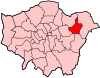
 Barking and Dagenham shown within Greater London | |
| Sovereign state | United Kingdom |
| Constituent country | England |
| Region | London |
| Ceremonial county | Greater London |
| Historic county | Essex |
| Created | 1 April 1965 |
| Admin HQ | 1 Town Hall Square, Barking |
| Government | |
| • Type | London borough council |
| • Body | Barking and Dagenham London Borough Council |
| • Leadership | Cllr Darren Rodwell (Labour) |
| • Mayor | Cllr Peter Chand |
| • London Assembly | Unmesh Desai (Labour) AM for City and East |
| • MPs | Jon Cruddas (Labour) Margaret Hodge (Labour) |
| Area | |
| • Total | 13.93 sq mi (36.09 km2) |
| Area rank | 290th (of 309) |
| Population (mid-2019 est.) | |
| • Total | 212,906 |
| • Rank | 85th (of 309) |
| • Density | 15,000/sq mi (5,900/km2) |
| • Ethnicity[1] | 49.5% White British 0.9% White Irish 0.1% White Gypsy or Irish Traveller 7.8% Other White 1.4% White & Black Caribbean 1.1% White & Black African 0.7% White & Asian 1% Other Mixed 4% Indian 4.3% Pakistani 4.1% Bangladeshi 0.7% Chinese 2.8% Other Asian 15.4% Black African 2.8% Black Caribbean 1.7% Other Black 0.5% Arab 1% Other |
| Time zone | UTC (GMT) |
| • Summer (DST) | UTC+1 (BST) |
| Postcodes | |
| Area code(s) | 020 |
| ONS code | 00AB |
| GSS code | E09000002 |
| Police | Metropolitan Police |
| Website | Council Website |

The London Borough of Barking and Dagenham (![]() pronunciation (help·info)) is a London borough in East London.[2] It lies around 9 miles (14.4 km) east of Central London. It is an Outer London borough and the south is within the London Riverside section of the Thames Gateway; an area designated as a national priority for urban regeneration. At the 2011 census it had a population of 187,000, the majority of which are within the Becontree estate. The borough's three main towns are Barking, Chadwell Heath and Dagenham. The local authority is Barking and Dagenham London Borough Council. Barking and Dagenham was one of six London boroughs to host the 2012 Summer Olympics.[3]
pronunciation (help·info)) is a London borough in East London.[2] It lies around 9 miles (14.4 km) east of Central London. It is an Outer London borough and the south is within the London Riverside section of the Thames Gateway; an area designated as a national priority for urban regeneration. At the 2011 census it had a population of 187,000, the majority of which are within the Becontree estate. The borough's three main towns are Barking, Chadwell Heath and Dagenham. The local authority is Barking and Dagenham London Borough Council. Barking and Dagenham was one of six London boroughs to host the 2012 Summer Olympics.[3]
History[]
The borough was formed in 1965 by the London Government Act 1963 as the London Borough of Barking. The constituent parts were almost all of the Municipal Borough of Barking and the greater part of the Municipal Borough of Dagenham. At the time of the amalgamation the combined population of Barking and Dagenham was around 180,000,[4] the northern tip of Dagenham having been incorporated into Redbridge and a small area of Barking in Newham. The borough was renamed Barking and Dagenham in 1980.[5] In 1994 the part of the Becontree estate in Redbridge was transferred to Barking and Dagenham. The area covered by Mayesbrook Park in the Borough was once part of the historic Manor of Jenkins, seat of the Fanshawe family.
Historic records of the London Borough of Barking and Dagenham and predecessor bodies the Borough of Barking and the Borough of Dagenham are held at the Barking and Dagenham Archive Service, Valence House Museum.
Boundaries[]
The borough borders the London Borough of Havering to the east with the River Rom forming part of the boundary. It borders the London Borough of Newham to the west with the River Roding forming much of the border. To the south is the River Thames which forms the borough's boundary with the London Borough of Bexley and the Royal Borough of Greenwich. To the north the borough forms a thin protrusion between Havering and the London Borough of Redbridge in order to encompass Chadwell Heath. 530 hectares within the borough are designated as part of the Metropolitan Green Belt.
Geography[]
The borough's major districts include Barking, Becontree and Dagenham. It borders five other London boroughs: Newham, Redbridge, Havering, and Greenwich and Bexley to the south of the Thames.
Much of the housing of the borough was constructed by the London County Council during the interwar period of 1921–1939.[4] Major settlement of the area, mostly escaping slum conditions in the East End of London, occurred during this period when the new motor and chemical industries such as the Ford Motor Company plant at Dagenham were set up.[4] Since the decline of these industries in the 1980s, employment has shifted towards service sector jobs. There are large areas of logistics and warehouse development around the A13 road. Much of the borough is within the London Riverside area of the Thames Gateway zone and is the site of considerable house building and other development, such as Beam Park. A £500 million budget has been earmarked for redevelopment of the borough's principal district of Barking.[6]
Demographics[]
| Year | Pop. | ±% |
|---|---|---|
| 1801 | 1,937 | — |
| 1811 | 2,647 | +36.7% |
| 1821 | 3,110 | +17.5% |
| 1831 | 3,746 | +20.5% |
| 1841 | 4,151 | +10.8% |
| 1851 | 4,804 | +15.7% |
| 1861 | 5,983 | +24.5% |
| 1871 | 7,162 | +19.7% |
| 1881 | 8,341 | +16.5% |
| 1891 | 16,658 | +99.7% |
| 1901 | 25,080 | +50.6% |
| 1911 | 37,759 | +50.6% |
| 1921 | 67,708 | +79.3% |
| 1931 | 121,410 | +79.3% |
| 1941 | 143,122 | +17.9% |
| 1951 | 168,724 | +17.9% |
| 1961 | 164,639 | −2.4% |
| 1971 | 160,656 | −2.4% |
| 1981 | 148,973 | −7.3% |
| 1991 | 146,154 | −1.9% |
| 2001 | 163,944 | +12.2% |
| 2011 | 185,911 | +13.4% |
| Source: A Vision of Britain through time | ||
Religion in London Borough of Barking and Dagenham (2018)[7]
In 1801, the civil parishes that form the modern borough had a total population of 1,937; and the area was characterised by farming, woodland and the fishing fleet at Barking. This last industry employed 1,370 men and boys by 1850, but by the end of the century had ceased to exist; replaced by train deliveries of fresh fish from the East Coast ports.[8] The population rose slowly through the 19th century, as the district became built up; and new industries developed around Barking.
The population rose dramatically between 1921 and 1931, when the London County Council developed the Becontree Estate. This public housing development of 27,000 homes housed over 100,000 people, split between the then urban district councils of Ilford, Dagenham and Barking. People were rehoused from the slums of the East End.[9] In 1931, the Ford Motor Company relocated to a 500 acres (2.0 km2) site at Dagenham, and in 1932 the District line was extended to Upminster; bringing further development to the area.
After World War II, further public housing projects were built to rehouse the many Londoners made homeless in the Blitz. As industry declined during the 1960s, the population entered a long decline, but has now begun to rise again with new housing developments on brownfield sites. In 2013 Barking and Dagenham has England's highest fertility rate: 2.58.[10]
At the time of the 2011 census, 49.5% of the borough's community identified themselves as white British. Barking and Dagenham has been strongly affected by immigration, with the white British population having dropped 30.6% from 2001 to 2011 - the second largest decrease in the country, behind neighbouring Newham. The population of non-UK born residents increasing by 205%.[11] The largest decrease of White British occurred in the Longbridge ward (79.8% in 2001 to 35% in 2011), and the Abbey ward, which contains the main Barking area (from 46.2% to 15.8%). The smallest decrease was in the Eastbrook ward.[12] The largest minority communities were of Black and Asian heritage.
Barking and Dagenham had by far the largest decrease of the 65+ population, having dropped almost 20% between 2001 and 2011. There were 69,700 households in the borough in 2011, up 3.6% from 2001. The borough also had the largest proportion of school-age (5-19) population of all the local authorities in England and Wales, 21.4%, at the 2011 census. The borough's pre-school (0-4) population rose by 49.1% from 2001 to 2011, by far the largest increase in London.[13]
The following table shows the ethnic group of respondents in the 2001 and 2011 census in Barking and Dagenham.
Ethnicity[]
| Ethnic Group | 2001[14] | 2011[15] | ||
|---|---|---|---|---|
| Number | % | Number | % | |
| White: British | 132,566 | 80.86% | 91,949 | 49.46% |
| White: Irish | 2,753 | 1.68% | 1,730 | 0.93% |
| White: Gypsy or Irish Traveller | 182 | 0.10% | ||
| White: Other | 4,348 | 2.65% | 14,525 | 7.81% |
| White: Total | 139,667 | 85.19% | 108,386 | 58.30% |
| Asian or Asian British: Indian | 3,681 | 2.25% | 7,436 | 4.00% |
| Asian or Asian British: Pakistani | 3,055 | 1.86% | 8,007 | 4.31% |
| Asian or Asian British: Bangladeshi | 673 | 0.41% | 7,701 | 4.14% |
| Asian or Asian British: Chinese | 775 | 0.47% | 1,315 | 0.71% |
| Asian or Asian British: Other Asian | 877 | 0.53% | 5,135 | 2.76% |
| Asian or Asian British: Total | 9,061 | 5.53% | 29,594 | 15.92% |
| Black or Black British: African | 7,284 | 4.44% | 28,685 | 15.43% |
| Black or Black British: Caribbean | 3,434 | 2.09% | 5,227 | 2.81% |
| Black or Black British: Other Black | 722 | 0.44% | 3,228 | 1.74% |
| Black or Black British: Total | 11,440 | 6.98% | 37,140 | 19.98% |
| Mixed: White and Black Caribbean | 1,420 | 0.87% | 2,669 | 1.44% |
| Mixed: White and Black African | 572 | 0.35% | 2,128 | 1.14% |
| Mixed: White and Asian | 534 | 0.33% | 1,246 | 0.67% |
| Mixed: Other Mixed | 550 | 0.34% | 1,835 | 0.99% |
| Mixed: Total | 3,076 | 1.88% | 7,878 | 4.24% |
| Other: Arab | 973 | 0.52% | ||
| Other: Any other ethnic group | 1,940 | 1.04% | ||
| Other: Total | 700 | 0.43% | 2,913 | 1.57% |
| Black, Asian, and minority ethnic: Total | 24,277 | 14.81% | 77,525 | 41.70% |
| Total | 163,944 | 100.00% | 185,911 | 100.00% |
Governance[]
The borough is covered by two parliamentary constituencies: Barking and Dagenham and Rainham (first contested in 2010). The borough is within the City and East London Assembly constituency, returning Unmesh Desai as the directly elected Assembly Member.
Prior to Brexit in 2020, Barking and Dagenham was part of the London constituency in the European Parliament.
Barking and Dagenham London Borough Council has a mayor, who is elected at the council annual general meeting by councillors. The officeholder must be a serving councillor, although the role of mayor is non-political. The mayor chairs council meetings and performs ceremonial duties in the borough.[16]
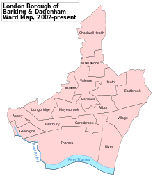
There are 17 wards in the borough, each returning 3 councillors, making 51 in total. As of the Barking and Dagenham London Borough Council election in 2018, all 51 council seats are held by the Labour Party.
Twin cities[]
London Borough of Barking and Dagenham is twinned with:
 Witten, North Rhine-Westphalia, Germany
 Tczew, Pomeranian Voivodeship, Poland[17]
Education[]
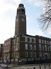
There are many schools and further education facilities in the borough. Situated near the Town Hall, the Barking Learning Centre is a learning facility providing a range of courses leading to recognised qualifications. It also includes a library with free public internet access, the council's first One Stop Shop, conference and meeting space, a gallery and a café. A study in 2017 found that nearly half of Barking & Dagenham's 19 year olds lack Level 3 qualifications (A Level equivalent) which was the highest figure in London.[18]
CU London, a Higher Education institute owned and governed by Coventry University, started offering courses to students in September 2017.[19] Situated in the former Dagenham Civic Centre, they offer a range of subjects across Foundation, HNC, HND and degree level.[20]
The University of East London formerly had a campus in the borough, however this has now closed with all campuses now being located in the neighbouring borough of Newham.
Transport[]
In March 2011, the main forms of transport that residents used to travel to work were: driving a car or van, 22.5% of all residents aged 16–74; underground, metro, light rail, tram, 7.5%; bus, minibus or coach, 7.5%; train, 7.3%; on foot, 3.7%; passenger in a car or van, 1.7%; work mainly at or from home, 1.3%.[21]
Rail[]
Barking and Dagenham is served by both the London Underground and National Rail networks. On the London Underground, the Borough is served by both the Hammersmith & City Line, which terminates at Barking railway station, and the District Line.
National Rail c2c services call at Dagenham Dock and Barking railway stations. All c2c trains terminate at London Fenchurch Street, whilst to the east, trains serve Grays, Southend and Shoeburyness in Essex. Barking railway station is served by the London Overground with frequent services to Gospel Oak in the London Borough of Camden.[22] The Gospel Oak to Barking Line will be extended to Barking Riverside with an expected completion date in 2021. The Elizabeth Line will serve Chadwell Heath railway station, which straddles the border between Barking & Dagenham and Redbridge, when works are completed.[23]
Whilst the Hammersmith & City Line terminates at Barking, the District Line calls at Barking, Upney, Becontree, Dagenham Heathway and Dagenham East in the Borough. Both lines cross London's Zone 1 and the City of London.[22]
Bus[]
Several London Buses serve the Borough. Night buses N15 and N86 travel into Central London, Stratford, Romford and Harold Hill every night.[24]
Cycling[]
Cycle Superhighway 3 begins in Barking, to the south of Greatfields Park, linking the Borough to Canary Wharf, the City of London and the City of Westminster via a bike freeway, most of which is segregated from other road traffic. TfL plan to extend the cycle network to Barking Riverside in the future, for which the first consultations closed in winter 2019.[25]
Roads[]
Two major A-roads cross the Borough: the A12 and A13.
The A12 has one junction in the Borough, to the north of Chadwell Heath. To the west, the A12 carries traffic through Newbury Park towards the North Circular, Stratford and Central London. To the east, the A12 heads through Romford towards the M25 and south and east Essex.
The A13 is named Alfred's Way as it enters the Borough to the west. Crossing Barking and Dagenham, the dual carriageway can be accessed via several grade-separated junctions. Leaving the Borough to the west via the A13 will lead to the Docklands and the City of London. To the east, the A13 passes Rainham and the M25 before traffic heads into south Essex.
Other A-roads cross the Borough, including the A118, A124, and , although these roads are smaller and generally carry less traffic.
Local media[]
Time 107.5 FM broadcasts from Romford and covers Barking, Dagenham and surrounding areas and brings local people up to date news.
Bedrock [26] is the local Hospital radio service available on-line and broadcasts a range of health related information focused around the local Hospitals; King George Hospital and Queen's Hospital.
, a hyperlocal news service distributes news, weather, travel, sport and entertainment updates on Facebook Watch.
London Fire Brigade[]
The London Borough of Barking and Dagenham has two fire stations within its boundary: Barking and Dagenham.[27] Barking fire station operates two pumping appliances, a bulk foam unit and a command unit. The support units that are operated here will cover a large selection of station grounds and areas. Dagenham fire station operates two pumping appliances and a hydraulic platform.
Of the two stations; Dagenham is the busier, attending over 2,000 incidents in 2006/2007.[28]
Coat of arms[]
The coat of arms of the borough displays the Curfew tower of Barking Abbey in its crest.
Freedom of the Borough[]
The following people and military units have received the Freedom of the Borough of Barking and Dagenham.
This list is incomplete; you can help by . (March 2021) |
Individuals[]
- George Shaw: 1992.[29]
Military Units[]
- The Royal Anglian Regiment: February 2010.[30][31]
See also[]
- List of people from Barking and Dagenham
References[]
- ^ 2011 Census: Ethnic group, local authorities in England and Wales, Office for National Statistics (2012). See Classification of ethnicity in the United Kingdom for the full descriptions used in the 2011 Census.
- ^ Map 5A.1 - London's sub-regions The London Plan (Greater London Authority, 2008) accessed 13 November 2009
- ^ “Happiness in Business: How being happy affects business success" Archived 8 December 2015 at the Wayback Machine, Company Check, 26 August 2015
- ^ Jump up to: a b c Metropolitan Essex since 1919: Suburban growth, A History of the County of Essex: Volume 5 (1966), pp. 63-74 accessed: 16 October 2007
- ^ Past Mayors. Archived 26 September 2007 at the Wayback Machine
- ^ Project UK-Barking: urban development (Operis) Archived 12 May 2006 at the Wayback Machine accessed 16 October 2007
- ^ "Population by Religion, Borough". Office for National Statistics (ONS). Retrieved 10 August 2020.
- ^ "The borough of Barking". British History Online. Retrieved 26 January 2007.
- ^ The Becontree Housing Estate Archived 16 June 2007 at the Wayback Machine (LB Barking & Dagenham) accessed 25 February 2009
- ^ Easton, Mark (23 July 2013). "An average baby?" – via www.bbc.co.uk.
- ^ "Archived copy" (PDF). Archived from the original (PDF) on 26 February 2014. Retrieved 2 July 2013.CS1 maint: archived copy as title (link)
- ^ http://britishdemocraticparty.org/the-ethnic-cleansing-of-london-part-1/[bare URL]
- ^ "Archived copy" (PDF). Archived from the original (PDF) on 21 October 2014. Retrieved 6 June 2014.CS1 maint: archived copy as title (link)
- ^ "KS006 - Ethnic group". NOMIS. Retrieved 30 January 2016.
- ^ "Ethnic Group by measures". NOMIS. Retrieved 8 January 2016.
- ^ The Mayor Archived 12 May 2010 at the Wayback Machine (LB Barking and Dagenham) accessed 6 April 2010
- ^ Town Twinning. Barking and Dagenham Archived 16 June 2007 at the Wayback Machine
- ^ "London's Poverty Profile". Trust for London. Retrieved 8 January 2018.
- ^ Rasiah, Janine. "Sign up to study at Coventry University's Dagenham Civic Centre campus". Barking and Dagenham Post. Retrieved 20 June 2019.
- ^ "Full-time degree courses | CU London". www.coventry.ac.uk. Retrieved 20 June 2019.
- ^ "2011 Census: QS701EW Method of travel to work, local authorities in England and Wales". Office for National Statistics. Retrieved 23 November 2013. Percentages are of all residents aged 16-74 including those not in employment. Respondents could only pick one mode.
- ^ Jump up to: a b London Borough of Barking and Dagenham. "Chapter 2: Local Transport Context" (PDF). London Borough of Barking and Dagenham. Retrieved 22 March 2019.
- ^ "Go-ahead for London Overground Barking Riverside extension". International Railway Journal. 4 August 2017. Retrieved 22 March 2019.
- ^ "Bus routes & borough reports - Transport for London". tfl.gov.uk. Retrieved 22 March 2019.
- ^ "Ilford – Barking Riverside future route". lcc.org.uk. Retrieved 22 March 2019.
- ^ "Bedrock (Hospital Radio)". Bedrock (Hospital Radio).
- ^ London Fire Brigade - Barking and Dagenham Profile Archived 29 February 2008 at the Wayback Machine
- ^ London Fire Brigade - Barking and Dagenham Profile Archived 29 February 2008 at the Wayback Machine
- ^ https://www.barkinganddagenhampost.co.uk/news/tributes-to-george-shaw-7798318[bare URL]
- ^ "Let's salute the Freemen of the Borough!". Barking and Dagenham Post.
- ^ "Archived copy". Archived from the original on 4 March 2016. Retrieved 17 October 2015.CS1 maint: archived copy as title (link)
External links[]
Coordinates: 51°33′N 0°07′E / 51.550°N 0.117°E

| show Authority control |
|---|
- London Borough of Barking and Dagenham
- London boroughs
- Local authorities adjoining the River Thames
- 1965 establishments in the United Kingdom