Long Island, Kansas
Long Island, Kansas | |
|---|---|
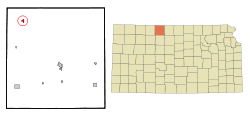 Location within Phillips County and Kansas | |
 | |
| Coordinates: 39°56′50″N 99°32′5″W / 39.94722°N 99.53472°WCoordinates: 39°56′50″N 99°32′5″W / 39.94722°N 99.53472°W | |
| Country | United States |
| State | Kansas |
| County | Phillips |
| Founded | 1870s |
| Platted | 1873 |
| Incorporated | 1904 |
| Area | |
| • Total | 0.41 sq mi (1.07 km2) |
| • Land | 0.41 sq mi (1.07 km2) |
| • Water | 0.00 sq mi (0.00 km2) |
| Elevation | 2,070 ft (630 m) |
| Population | |
| • Total | 134 |
| • Estimate (2019)[3] | 121 |
| • Density | 294.40/sq mi (113.61/km2) |
| Time zone | UTC-6 (CST) |
| • Summer (DST) | UTC-5 (CDT) |
| ZIP code | 67647 |
| Area code | 785 |
| FIPS code | 20-42600 [4] |
| GNIS ID | 0471754 [5] |

Long Island is a city in Phillips County, Kansas, United States. As of the 2010 census, the city population was 134.[6]
History[]
The first post office was established at Long Island in May 1872.[7] Long Island was laid out in 1873.[8]
Geography[]
Long Island is located at 39°56′50″N 99°32′5″W / 39.94722°N 99.53472°W (39.947283, -99.534673).[9] According to the United States Census Bureau, the city has a total area of 0.44 square miles (1.14 km2), all land.[10]
Demographics[]
| Historical population | |||
|---|---|---|---|
| Census | Pop. | %± | |
| 1910 | 291 | — | |
| 1920 | 286 | −1.7% | |
| 1930 | 242 | −15.4% | |
| 1940 | 257 | 6.2% | |
| 1950 | 247 | −3.9% | |
| 1960 | 229 | −7.3% | |
| 1970 | 195 | −14.8% | |
| 1980 | 187 | −4.1% | |
| 1990 | 170 | −9.1% | |
| 2000 | 155 | −8.8% | |
| 2010 | 134 | −13.5% | |
| 2019 (est.) | 121 | [3] | −9.7% |
| U.S. Decennial Census | |||
2010 census[]
As of the census[2] of 2010, there were 134 people, 60 households, and 38 families residing in the city. The population density was 304.5 inhabitants per square mile (117.6/km2). There were 77 housing units at an average density of 175.0 per square mile (67.6/km2). The racial makeup of the city was 96.3% White and 3.7% from other races. Hispanic or Latino of any race were 3.7% of the population.
There were 60 households, of which 20.0% had children under the age of 18 living with them, 55.0% were married couples living together, 8.3% had a male householder with no wife present, and 36.7% were non-families. 35.0% of all households were made up of individuals, and 15% had someone living alone who was 65 years of age or older. The average household size was 2.23 and the average family size was 2.89.
The median age in the city was 49.3 years. 20.9% of residents were under the age of 18; 7.5% were between the ages of 18 and 24; 14.9% were from 25 to 44; 35.1% were from 45 to 64; and 21.6% were 65 years of age or older. The gender makeup of the city was 54.5% male and 45.5% female.
2000 census[]
As of the census[4] of 2000, there were 155 people, 67 households, and 45 families residing in the city. The population density was 352.8 people per square mile (136.0/km2). There were 73 housing units at an average density of 166.1 per square mile (64.1/km2). The racial makeup of the city was 97.42% White and 2.58% African American. Hispanic or Latino of any race were 0.65% of the population.
There were 67 households, out of which 25.4% had children under the age of 18 living with them, 62.7% were married couples living together, 1.5% had a female householder with no husband present, and 32.8% were non-families. 31.3% of all households were made up of individuals, and 14.9% had someone living alone who was 65 years of age or older. The average household size was 2.31 and the average family size was 2.91.
In the city, the population was spread out, with 23.2% under the age of 18, 9.7% from 18 to 24, 23.9% from 25 to 44, 23.2% from 45 to 64, and 20.0% who were 65 years of age or older. The median age was 40 years. For every 100 females, there were 109.5 males. For every 100 females age 18 and over, there were 105.2 males.
The median income for a household in the city was $29,250, and the median income for a family was $32,321. Males had a median income of $27,083 versus $17,813 for females. The per capita income for the city was $14,722. None of the families and 5.9% of the population were living below the poverty line.
Education[]
Long Island is served by USD 212 Northern Valley Schools.[11]
Long Island schools were closed through school unification. The Long Island High School mascot was Long Island Leopards.[12]
References[]
- ^ "2019 U.S. Gazetteer Files". United States Census Bureau. Retrieved July 24, 2020.
- ^ Jump up to: a b "U.S. Census website". United States Census Bureau. Retrieved 2012-07-06.
- ^ Jump up to: a b "Population and Housing Unit Estimates". United States Census Bureau. May 24, 2020. Retrieved May 27, 2020.
- ^ Jump up to: a b "U.S. Census website". United States Census Bureau. Retrieved 2008-01-31.
- ^ "US Board on Geographic Names". United States Geological Survey. 2007-10-25. Retrieved 2008-01-31.
- ^ "2010 City Population and Housing Occupancy Status". U.S. Census Bureau. Retrieved September 18, 2011.[dead link]
- ^ "Kansas Post Offices, 1828-1961". Kansas Historical Society. Archived from the original on 9 October 2013. Retrieved 22 June 2014.
- ^ Kansas State Historical Society (1916). Biennial Report of the Board of Directors of the Kansas State Historical Society. Kansas State Printing Plant. pp. 261.
- ^ "US Gazetteer files: 2010, 2000, and 1990". United States Census Bureau. 2011-02-12. Retrieved 2011-04-23.
- ^ "US Gazetteer files 2010". United States Census Bureau. Archived from the original on 2011-02-20. Retrieved 2012-07-06.
- ^ "Northern Valley Schools". USD 212. Retrieved 7 January 2017.
- ^ "Long Island Hands Prairie View Loss", The Salina Journal, 5 February 1964, p.12.
Further reading[]
External links[]
- Long Island - Directory of Public Officials
- USD 212, local school district
- Long Island City Map, KDOT
| hide Municipalities and communities of Phillips County, Kansas, United States | ||
|---|---|---|
| Cities |  | |
| Unincorporated communities | ||
| Ghost towns | ||
| Footnotes | †This populated place is designated a Census-Designated Place (CDP) by the United States Census Bureau. | |
| ||
| Authority control |
|
|---|
- Cities in Kansas
- Cities in Phillips County, Kansas