Lot 52, Prince Edward Island
Lot 52, Prince Edward Island | |
|---|---|
Township | |
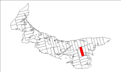 Map of Prince Edward Island highlighting Lot 52 | |
| Coordinates: 46°15′N 62°40′W / 46.250°N 62.667°WCoordinates: 46°15′N 62°40′W / 46.250°N 62.667°W | |
| Country | Canada |
| Province | Prince Edward Island |
| County | Kings County |
| Parish | St. George's Parish |
| Area | |
| • Total | 31.73 sq mi (82.18 km2) |
| Population (2006)[1] | |
| • Total | 823 |
| • Density | 26/sq mi (10.0/km2) |
| Time zone | UTC-4 (AST) |
| • Summer (DST) | UTC-3 (ADT) |
| Canadian Postal code | C0A |
| Area code(s) | 902 |
| NTS Map | 011L02 |
| GNBC Code | BAESM |

Lot 52 is a township in Kings County, Prince Edward Island, Canada. It is part of St. George's Parish. Lot 52 was awarded to Stuart, William, and Stair Douglas in the 1767 land lottery.[2]
References[]
- ^ a b Stats Canada 2001
- ^ Clark, Andrew Hill (1959). Three Centuries and the Island. Toronto Press. pp. Appendix B.
| Subdivisions | |
|---|---|
| Cities | |
| Towns | |
| Rural municipalities |
|
| Resort municipalities | |
| Unincorporated communities | |
| Townships | |
| |
This Prince Edward Island location article is a stub. You can help Wikipedia by . |
Categories:
- Townships of Prince Edward Island
- Geography of Kings County, Prince Edward Island
- Prince Edward Island geography stubs