Luling, Texas
Luling, Texas | |
|---|---|
City | |
 Museum, Downtown Luling | |
 | |
| Coordinates: 29°40′50″N 97°38′44″W / 29.68056°N 97.64556°WCoordinates: 29°40′50″N 97°38′44″W / 29.68056°N 97.64556°W | |
| Country | |
| State | |
| Counties | Caldwell, Guadalupe |
| Government | |
| • Type | Council-Manager |
| • Mayor | John Wells (pro-tem) |
| • City Council | Jackie Campbell John Wells John Bell James Nickells Woody Cox |
| • City Manager | Boskyler Harmoner |
| Area | |
| • Total | 5.55 sq mi (14.38 km2) |
| • Land | 5.51 sq mi (14.27 km2) |
| • Water | 0.04 sq mi (0.11 km2) |
| Elevation | 410 ft (125 m) |
| Population | |
| • Total | 5,411 |
| • Estimate (2019)[5] | 5,869 |
| • Density | 1,065.15/sq mi (411.22/km2) |
| Time zone | UTC-6 (Central (CST)) |
| • Summer (DST) | UTC-5 (CDT) |
| ZIP code | 78648 |
| Area code(s) | 830 Exchange: 875 |
| FIPS code | 48-45096 |
| GNIS feature ID | 1340735[4] |
| Website | www |

Luling /ˈluːlɪŋ/ is a city in Caldwell and Guadalupe counties, Texas, United States, along the San Marcos River.[4] The population, as of the 2010 census, was 5,411,[2] and the population was estimated at 5,954 in 2018.[6]
Services[]
The Caldwell County portion of Luling is part of the Austin metropolitan area.[7]
Education[]
| School name | Grades taught | Students enrolled [8] |
|---|---|---|
| Rosenwald Primary | Head start | 190 |
| Luling Primary | PK-K -1 | 231 |
| Leonard Shanklin Elementary | 2 - 5 | 310 |
| Gilbert Gerdes Junior High | 6 - 8 | 302 |
| Luling High School | 9 - 12 | 432 |
History[]
The town was named after a New York banker, Charles Luling. He was a personal friend of Thomas Wentworth Pierce, and provided the financing for the railroad as well the purchase of the land that became Luling.[9]
Luling was founded in 1874 as a railroad town[10] and became a rowdy center for the cattle drivers on the Chisholm Trail. Contempt of the law by the cowboys helped Luling become known as the "toughest town in Texas". After the great cattle drives ended in the late 1880s, Luling quieted down to a town of about 500 and cotton ruled the local economy. Perhaps due to arrival of immigrants, including a sizeable Jewish population,[further explanation needed] in the late-19th century, Luling began a long, slow, period of growth, and by 1925 the population reached 1,500.[11]
One of the most significant events in Luling's history was the discovery of oil by Edgar B. Davis.[10] Davis mortgaged everything he owned to finance drilling operations around Luling. On August 9, 1922, the Rafael Rios No. 1 well struck oil at 2,161 feet (659 m), producing 150 barrels per day (24 m3/d). To repay his loans, Davis contracted 2 million barrels (320,000 m3) each to Atlantic Oil and Magnolia Oil at $.50 a barrel, plus another 2 million barrels (320,000 m3) to Magnolia at $.75 per barrel.[12]
Davis' discovery opened up an oilfield 12 miles (19 km) long and 2 miles (3 km) wide. The economy quickly moved from the railroad and agriculture to oil. The population of the town rapidly increased to over 5,000. By 1924, the Luling Oil Field was producing over 15 million barrels (2,400,000 m3) of oil per year, and oil formed much of Luling's economy for the next 60 years.[12]
As oil grew in importance in the 1930s and 1940s, the railroads that helped form the town declined and largely pulled out of Luling.
Geography[]
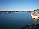
Luling is located in southern Caldwell County, 47 miles (76 km) south of Austin. The city limits extend south along Texas State Highway 80 across the San Marcos River into Guadalupe County, reaching as far as Interstate 10 Exit 628. Via I-10, San Antonio is 57 miles (92 km) to the west and Houston is 141 miles (227 km) to the east.
According to the United States Census Bureau, Luling has a total area of 5.50 square miles (14.2 km2). 5.46 square miles (14.1 km2) of it is land, and 0.04 square miles (0.10 km2), or 0.67%, is water.[2]
Climate[]
The climate in this area is characterized by hot, humid summers and generally mild to cool winters. According to the Köppen Climate Classification system, Luling has a humid subtropical climate, abbreviated "Cfa" on climate maps.[13]
Demographics[]
| Historical population | |||
|---|---|---|---|
| Census | Pop. | %± | |
| 1880 | 1,114 | — | |
| 1890 | 1,792 | 60.9% | |
| 1900 | 1,349 | −24.7% | |
| 1910 | 1,404 | 4.1% | |
| 1920 | 1,502 | 7.0% | |
| 1930 | 5,970 | 297.5% | |
| 1940 | 4,437 | −25.7% | |
| 1950 | 4,297 | −3.2% | |
| 1960 | 4,412 | 2.7% | |
| 1970 | 4,719 | 7.0% | |
| 1980 | 5,039 | 6.8% | |
| 1990 | 4,661 | −7.5% | |
| 2000 | 5,080 | 9.0% | |
| 2010 | 5,411 | 6.5% | |
| 2019 (est.) | 5,869 | [5] | 8.5% |
| U.S. Decennial Census[14] | |||
As of the 2010 census, there were 5,411 people, 1,907 households, and 1,315 families residing in Luling. The population density was 991.6 people per square mile (382.8/km2). There were 2,115 housing units at an average density of 391.7/sq mi (150.0/km2). The racial makeup of the city was 70.8% White, 8.5% African American, 0.4% Native American, 0.5% Asian, 16.7% some other race, and 3.1% from two or more races. Hispanics or Latinos of any race were 52.6% of the population.[15]
There were 1,907 households, out of which 37.6% had children under the age of 18 living with them, 45.4% were headed by married couples living together, 17.4% had a female householder with no husband present, and 31.0% were non-families. 26.6% of all households were made up of individuals, and 14.2% were someone living alone who was 65 years of age or older. The average household size was 2.75, and the average family size was 3.36.[15]
In the city, 27.3% of the population were under the age of 18, 6.3% were from 20 to 24, 24.6% from 25 to 44, 22.5% from 45 to 64, and 16.7% were 65 years of age or older. The median age was 35.5 years. For every 100 females, there were 87.9 males. For every 100 females age 18 and over, there were 85.1 males.[15]
For the period 2011–2015, the estimated median annual income for a household in the city was $39,157, and the median income for a family was $46,379. The per capita income for the city was $21,927. About 17.2% of families and 20.3% of the population were below the poverty line, including 30.3% of those under age 18 and 14.5% of those age 65 or over.[16]
Culture[]


The Luling Watermelon Thump is held each year during the last full weekend in June. It is a big celebration for the locals and draws many people from out of town as well. A favorite activity associated with the 'Thump' is the watermelon seed spitting contest.[17]
Luling is also home to Night In Old Luling, held in October. It features games, food, booths, and a scarecrow contest.
Some of the oil jacks along the main streets of Luling are decorated with whimsical characters, such as a girl eating a watermelon.[17]
The Luling Dry Tri. is an annual event held in September. It is an athletic contest comprising three consecutive events: biking 12 miles, running 3.23 miles and paddling 6 miles. A no swim triathlon (Dry Tri) where anyone may participate either solo, as a two-person tag-team or three-person relay team. The event benefits several local groups, including the Luling Police and Fire Departments, and the Luling High School Cross Country Team.[18]
Notable people[]
- Michael Dorn, actor
- Marshall W. Mason, Broadway director
- Bo Burris, NFL player
- Emory Bellard, American college football coach
- Tamron Hall, anchor for MSNBC
- Obert Logan, NFL football player for the Dallas Cowboys and New Orleans Saints
- Riley Odoms, NFL football player for the Denver Broncos
- Craig Mager, NFL football player for the Denver Broncos
- Jennie Everton Clarke, founder of the Belle Haven Orphan home
References[]
- ^ "2019 U.S. Gazetteer Files". United States Census Bureau. Retrieved August 7, 2020.
- ^ Jump up to: a b c "Geographic Identifiers: 2010 Demographic Profile Data (G001): Luling city, Texas". U.S. Census Bureau, American Factfinder. Retrieved March 24, 2017.[dead link]
- ^ "Geographic Names Information System". United States Geological Survey. Retrieved 2008-01-31.
- ^ Jump up to: a b U.S. Geological Survey Geographic Names Information System: Luling
- ^ Jump up to: a b "Population and Housing Unit Estimates". United States Census Bureau. May 24, 2020. Retrieved May 27, 2020.
- ^ "Population and Housing Unit Estimates". Retrieved September 16, 2019.
- ^ "Revised Delineations of Metropolitan Statistical Areas, Micropolitan Statistical Areas, and Combined Statistical Areas, and Guidance on Uses of the Delineations of These Areas" (PDF). Office of Management and Budget. 28 February 2013. Archived (PDF) from the original on 21 January 2017.
- ^ "2011-12 Academic Excellence Indicator System Campus Reports". Texas Education Agency. Archived from the original on 15 February 2014. Retrieved 14 March 2014.
- ^ Deeds of Caldwell County, Texas. Galveston Newspaper (1874)
- ^ Jump up to: a b Smyrl, Vivian Elizabeth. "Luling, TX". Handbook of Texas Online. Texas State Historical Association. Retrieved 14 March 2014.
- ^ "Luling, TX". Encyclopedia of Southern Jewish Communities. Archived from the original on 14 March 2014. Retrieved 14 March 2014.
- ^ Jump up to: a b "Davis, Edgar Byram". Handbook of Texas Online. Texas State Historical Association. Retrieved 14 March 2014.
- ^ "Luling, Texas Köppen Climate Classification". Retrieved 14 March 2014.
- ^ "Census of Population and Housing". Census.gov. Retrieved June 4, 2015.
- ^ Jump up to: a b c "Profile of General Population and Housing Characteristics: 2010 Census Summary File 1 (DP-1): Luling city, Texas". U.S. Census Bureau, American Factfinder. Archived from the original on February 13, 2020. Retrieved March 24, 2017.
- ^ "Selected Economic Characteristics: 2011-2015 American Community Survey 5-Year Estimates (DP03): Luling city, Texas". U.S. Census Bureau, American Factfinder. Archived from the original on February 13, 2020. Retrieved March 24, 2017.
- ^ Jump up to: a b Malewitz, Jim (28 February 2014). "Missing Out on the Latest Texas Oil Boom, One Town Repurposes Its Leftovers". The New York Times. Retrieved 14 March 2014.
- ^ Ferguson, Sandy. "Luling Dry Tri". Retrieved 14 March 2014.
External links[]
| Wikimedia Commons has media related to Luling, Texas. |
 Luling, Texas travel guide from Wikivoyage
- City of Luling official website
- Luling Chamber of Commerce
| show Municipalities and communities of Caldwell County, Texas, United States |
|---|

| show Municipalities and communities of Guadalupe County, Texas, United States |
|---|

| show Austin–Round Rock–San Marcos |
|---|

| show Authority control |
|---|
- Cities in Caldwell County, Texas
- Cities in Guadalupe County, Texas
- Cities in Texas
- Cities in Greater Austin
- Populated places established in 1874
- 1874 establishments in Texas