Lumber Bridge, North Carolina
Lumber Bridge, North Carolina | |
|---|---|
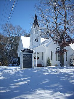 a view of Lumber Bridge after a rare snowfall | |
 Lumber Bridge, North Carolina Location within the state of North Carolina | |
| Coordinates: 34°53′25″N 79°4′14″W / 34.89028°N 79.07056°WCoordinates: 34°53′25″N 79°4′14″W / 34.89028°N 79.07056°W | |
| Country | United States |
| State | North Carolina |
| County | Robeson |
| Area | |
| • Total | 0.68 sq mi (1.75 km2) |
| • Land | 0.67 sq mi (1.74 km2) |
| • Water | 0.01 sq mi (0.01 km2) |
| Elevation | 194 ft (59 m) |
| Population (2010) | |
| • Total | 94 |
| • Estimate (2019)[2] | 88 |
| • Density | 131.34/sq mi (50.70/km2) |
| Time zone | UTC-5 (Eastern (EST)) |
| • Summer (DST) | UTC-4 (EDT) |
| ZIP code | 28357 |
| Area code(s) | 910 |
| FIPS code | 37-39680[3] |
| GNIS feature ID | 0989126[4] |

Lumber Bridge is a town in Robeson County, North Carolina, United States. The population was 94 at the 2010 census.
The town was incorporated by the North Carolina General Assembly in 1891. Believed to date from 1776, the original land grant was part of the holdings of Levey Glass. The town's name comes from the hand-hewn wooden bridge over the Little Marsh Swamp.[5]
Geography[]
Lumber Bridge is located at 34°53′25″N 79°4′14″W / 34.89028°N 79.07056°W (34.890398, -79.070658).[6]
According to the United States Census Bureau, the town has a total area of 0.7 square miles (1.7 km2), of which 0.7 square mile (1.7 km2) is land and 1.49% is water.
Demographics[]
| Historical population | |||
|---|---|---|---|
| Census | Pop. | %± | |
| 1900 | 181 | — | |
| 1910 | 165 | −8.8% | |
| 1920 | 202 | 22.4% | |
| 1930 | 214 | 5.9% | |
| 1940 | 196 | −8.4% | |
| 1950 | 154 | −21.4% | |
| 1960 | 100 | −35.1% | |
| 1970 | 117 | 17.0% | |
| 1980 | 171 | 46.2% | |
| 1990 | 109 | −36.3% | |
| 2000 | 118 | 8.3% | |
| 2010 | 94 | −20.3% | |
| 2019 (est.) | 88 | [2] | −6.4% |
| U.S. Decennial Census[7] | |||
As of the 2010 United States Census, there were 94 people living in the town. The racial makeup of the town was 75.5% White, 16.0% Black, 4.3% Native American, 1.1% Asian and 3.2% were Hispanic or Latino of any race.
As of the census[3] of 2000, there were 118 people, 42 households, and 33 families living in the town. The population density was 179.6 people per square mile (69.0/km2). There were 47 housing units at an average density of 71.5 per square mile (27.5/km2). The racial makeup of the town was 82.20% White, 11.02% African American, 5.93% Native American, and 0.85% from two or more races. Hispanic or Latino of any race were 0.85% of the population.
There were 42 households, out of which 28.6% had children under the age of 18 living with them, 66.7% were married couples living together, 7.1% had a female householder with no husband present, and 21.4% were non-families. 19.0% of all households were made up of individuals, and 14.3% had someone living alone who was 65 years of age or older. The average household size was 2.64 and the average family size was 3.00.
In the town, the population was spread out, with 22.0% under the age of 18, 8.5% from 18 to 24, 23.7% from 25 to 44, 28.8% from 45 to 64, and 16.9% who were 65 years of age or older. The median age was 43 years. For every 100 females, there were 118.5 males. For every 100 females age 18 and over, there were 95.7 males.
The median income for a household in the town was $40,938, and the median income for a family was $41,875. Males had a median income of $25,313 versus $24,500 for females. The per capita income for the town was $12,513. There were 21.4% of families and 35.3% of the population living below the poverty line, including 50.0% of under eighteens and 14.3% of those over 64.
References[]
- ^ "2019 U.S. Gazetteer Files". United States Census Bureau. Retrieved July 27, 2020.
- ^ a b "Population and Housing Unit Estimates". United States Census Bureau. May 24, 2020. Retrieved May 27, 2020.
- ^ a b "U.S. Census website". United States Census Bureau. Retrieved 2008-01-31.
- ^ "US Board on Geographic Names". United States Geological Survey. 2007-10-25. Retrieved 2008-01-31.
- ^ "Lumber Bridge History". Robeson County Office of Economic Development. Retrieved February 26, 2017.
- ^ "US Gazetteer files: 2010, 2000, and 1990". United States Census Bureau. 2011-02-12. Retrieved 2011-04-23.
- ^ "Census of Population and Housing". Census.gov. Retrieved June 4, 2015.
Municipalities and communities of Robeson County, North Carolina, United States | ||
|---|---|---|
| City |  | |
| Towns | ||
| Township | ||
| CDPs | ||
| Unincorporated communities | ||
| Footnotes | ‡This populated place also has portions in an adjacent county or counties | |
| ||
- Towns in Robeson County, North Carolina
- Towns in North Carolina