M90 motorway
This article's tone or style may not reflect the encyclopedic tone used on Wikipedia. (August 2013) |
 | |
|---|---|
 | |
| Route information | |
| Part of | |
| Length | 36 mi (58 km) |
| Existed | 1964–present |
| History | Constructed 1964–2017[1] |
| Major junctions | |
| From | Junction 1a of the M9 |
M9 motorway A823(M) motorway | |
| To | Perth (two ends; one east 56°22′58″N 3°24′23″W / 56.3827°N 3.4065°W, one at Broxden Junction 56°23′18″N 3°29′13″W / 56.3882°N 3.4869°W) |
| Location | |
| Primary destinations | Edinburgh, Edinburgh Airport, Forth Road Bridge, Dunfermline, Kinross, Perth |
| Road network | |
|
| |

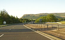
The M90 is a motorway in Scotland, UK. It runs from Junction 1A of the M9 motorway, south of the Queensferry Crossing,[2] to Perth. The motorway passes by the Scottish towns of Dunfermline and Kinross . The M90 is the furthest north motorway in the United Kingdom. The northernmost point is a spur into the western suburbs of Perth at Broxden. A small part of the M90 (across the Friarton Bridge to the southeast of Perth) was originally numbered as the M85 motorway.
History[]
The first section of the M90 opened in 1964 to coincide with the opening of the Forth Road Bridge and Masterton junction (Junction 2). The next section, the Crossgates – Kelty and Cowdenbeath Bypass, opened on 1 December 1969,[3] the stretch between Kinross and the Milnathort Bypass, opened in December 1971.[citation needed]
The following two sections were due to begin construction around 1973/74, but were put on hold because of the oil crisis. The section from Arlary (Junction 8 with the A91) to Arngask was opened in March 1977; Arngask (Glenfarg) to Muirmont opened in August 1980,[1] connecting with the completed Friarton Bridge (which was originally numbered M85, and opened in 1976[4]) and Perth Bypass to Broxden.
As part of the Queensferry Crossing scheme, the M90 was extended southwards across the Firth of Forth over a new cable-stayed bridge in 2017. A short stretch of A90 dual carriageway connects the two parts of M90 - the short M90 section from the M9 and the much longer M90 section that crosses the Queensferry Crossing and extends north to the outskirts of Perth. This short length of A90 dual carriageway was required at this point as Motorway regulations would have prevented certain classes of traffic from using this section of road.[5][6]
Details[]
The M90 leaves the east-west M9 in the vicinity of Kirkliston and heads north. The motorway is interrupted by a short stretch of A90 from where the A90 from Edinburgh joins the M90. The road continues as the A90 until it reaches the junction to the south of the Queensferry Crossing - the A90 becomes the M90 again at that point. The crossing opened as part of the motorway on 30 August 2017; the bridge is configured as a dual two lane carriageway and has a speed limit of 70 mph.[7]
Previously, the M90's most substantial engineering feature was the Friarton Bridge in Perth, a tall concrete pillared structure which traverses the River Tay. The bridge carries eastbound traffic from Broxden towards Dundee and along the Firth of Tay.
The road constitutes most of the southerly part of the A90 corridor from Edinburgh, through Perth, Dundee and Aberdeen to Peterhead along Scotland's North Sea coast.
A large part of the northern section of the motorway follows the route of the former main railway line between Perth and Edinburgh via Glenfarg, Kinross and the Forth Bridge, which was closed in 1970 despite this not being recommended by the Beeching report. It is not obvious when first driving along the road but close inspection of the 1:25,000 scale Ordnance Survey maps of the route illustrates this.[8][9]
Another unusual feature of the M90 is that the Kinross and Milnathort Bypass, the 8-mile (13 km) section of the M90 between Fruix and Arlary, was the first motorway in Britain to be constructed using unreinforced concrete pavements.[10] Both the south-bound & north-bound Carriageways have since been overlaid by tarmac. The use of Unreinforced Concrete Paving on Carriageways in Scotland is now very rare.
Near to its northern terminus, the motorway splits into two branches. The construction of this three-way interchange required the removal of about 900,000 cubic metres of material, mostly rock. The motorway bends through more than 90 degrees, on a compound curve partly of 520.8 m and partly of 694.5 m radius. One branch heads in a north-easterly direction, flowing into the A90 at its end, numbered junction 11. (This branch was formerly the M85 motorway, until the A85 was renumbered as A90.) The other branch forms part of the western bypass of Perth, and meets the A9 at its end, numbered junction 12.[11] The gradient is 4.57% uphill and 5.65% downhill on this section. The slip roads forming this branch merge with shared priority to allow HGVs to maintain momentum on the steep upgrade. The Broxden to Muirmont slip road at the centre of the interchange has a radius of 136.4 m, necessitating maximum superelevation of 7%.
The M90 forms part of the Euroroute E15 which runs from Inverness to Algeciras, but which is not signposted within the UK.
Issues[]
The M90 lacks hard shoulders for an 8-mile (13 km) section. In this section there are emergency lay-bys at 1⁄4-mile (400 m) intervals instead.
The M90 here has another of the tightest corners on the UK motorway network, for which some traffic can be forced to slow down. The corner cuts through the northern side of the Ochil Hills and has a curve radius of 694.5 m (a recommended minimum of 914 m was standard practice at the time of construction). This corner also coincides with one of the steepest sections of the motorway, for which north-bound heavy goods vehicles (HGVs) are sign-posted to stay in a low gear and often brake continuously through the turn. South-bound HGVs are normally substantially reduced in speed as they make the incline.
Junctions[]
| M90 motorway | ||
| Northbound exits | Junction | Southbound exits |
| Inverness, Stirling, Glasgow A9 Crianlarich (A85) Perth A93 |
J12 on W spur |
Start of motorway (W spur) |
| Road continues as A90 to Dundee, Aberdeen and Forfar | E spur | Perth A85, Inverness A9 Non-motorway traffic |
| Perth, Crieff A85 | Start of motorway (E spur) | |
| Branches split | J11 | Branches join |
| Perth, Stirling, Glasgow (A9) | J10 | Perth, Stirling, Pitlochry (A9) |
| Bridge of Earn, Aberargie A912 | J9 | Bridge of Earn, Aberargie A912 |
| Cupar, St Andrews A91 | J8 | No exit |
| No exit | J7 | Stirling A91 Milnathort A911 |
| Kinross, Milnathort A977 Kinross services |
J6 | Kinross, Crook of Devon A977 Kinross services |
| Cleish, Crook of Devon B9097 | J5 | Cleish, Ballingry B9097 |
| Kelty, Ballingry A909 | J4 | Kelty, Lochgelly A909 |
| Dunfermline A907 | J3 | Dunfermline A907, Kirkcaldy, Glenrothes A92 |
| Kirkcaldy, Glenrothes A92 | J2A | No exit |
| Dunfermline, Rosyth A823 (M) | J2 | Dunfermline, Rosyth A823(M) |
| Kincardine A985 Dalgety Bay, Inverkeithing A921 |
J1C | Inverkeithing A921 Kincardine, Glasgow A985 |
| Rosyth, North Queensferry B981 | J1B | Rosyth, North Queensferry B981 |
| Queensferry Crossing | ||
| A90 becomes M90 | J1A | Kirkliston, Queensferry A904 |
| Kirkliston, Queensferry A904 | Road continues as A90 to Dalmeny | |
| Road continues as A90 to Queensferry | J1 | Edinburgh A90 |
| No exit | A90 becomes M90 | |
| Start of motorway | M9 J1A | Glasgow, Edinburgh (M8) Kincardine, Stirling M9 |
See also[]
References[]
- ^ Jump up to: a b "Archived copy". Archived from the original on 25 July 2013. Retrieved 28 May 2013.CS1 maint: archived copy as title (link)
- ^ "FRC Bus Lane Map". Transport Scotland. Archived from the original on 29 October 2014. Retrieved 29 October 2014.
- ^ http://www.edinburgh-gazette.co.uk/issues/18827/pages/870/page.pdf
- ^ Giles, Graeme (18 January 1994). "End of the road for the M85 motorway". Perthshire Advertiser. Retrieved 14 April 2021.
- ^ "Scotland gets it first Managed Motorway". 27 November 2012. Archived from the original on 6 April 2015. Retrieved 18 March 2013.
- ^ "Archived copy". Archived from the original on 7 June 2013. Retrieved 24 July 2013.CS1 maint: archived copy as title (link)
- ^ Carrell, Severin; agency (30 August 2017). "Queensferry Crossing across the Firth of Forth opens to traffic". The Guardian. ISSN 0261-3077. Retrieved 30 July 2020.
- ^ MultiMap.com (April 2007). "Map Source".
- ^ RailScot (April 2007). "RailScot".
- ^ "M90 Inverkeithing to Perth and M85 Perth by-pass". The Motorway Archive. Archived from the original on 8 August 2016. Retrieved 18 December 2015.
- ^ M90 J12 Broxden, sabre-roads.org.uk (retrieved 2013-01-16)
External links[]
Route map:
| ( • help)
|
- CBRD Motorway Database - M90
- The Motorway Archive - M90
- Pathetic Motorways - M90
- Pathetic Motorways - M85
| hide | ||||||
|---|---|---|---|---|---|---|
| Great Britain |  | |||||
| Northern Ireland | ||||||
| Former | ||||||
| Unbuilt | ||||||
| Junctions ( |
| |||||
| Related articles | ||||||
| ||||||
- Motorways in Scotland
- Transport in Fife
- Transport in Perth and Kinross