M18 motorway (Great Britain)
 | ||||
|---|---|---|---|---|
 | ||||
| Route information | ||||
| Part of | ||||
| Maintained by Highways England | ||||
| Length | 26.5 mi (42.6 km) | |||
| Existed | 1967–present | |||
| History | Constructed 1967–79 | |||
| Major junctions | ||||
| South end | Thurcroft 53°22′52″N 1°16′43″W / 53.3811°N 1.2785°W | |||
M1 motorway A1(M) motorway M180 motorway M62 motorway | ||||
| North end | Rawcliffe 53°40′57″N 0°58′03″W / 53.6825°N 0.9676°W | |||
| Location | ||||
| Primary destinations | Sheffield, Rotherham, Doncaster, Leeds | |||
| Road network | ||||
| ||||


The M18 is a motorway in Yorkshire, England. It runs from the east of Rotherham to Goole and is approximately 26 miles (42 km) long. A section of the road forms part of the unsigned Euroroute E13.
Route[]
The M18 runs in a north east/south west direction from junction 32 of the M1 motorway to junction 35 of the M62 motorway. It passes east of Rotherham, southeast of Doncaster and Armthorpe, and west of Thorne. It meets the A1(M) at junction 2 (A1(M) junction 35)--known as the Wadworth Interchange—and the M180 motorway at junction 5. Access to Doncaster is provided from junctions 3 (A6182) and 4 (A630)
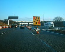
The middle half of the M18 is a two lane dual carriageway, and carries relatively low volumes of traffic. However, the M1 to A1(M) section and M180 to M62 section are much busier with three lanes in each direction, and there is a small three lane section northbound between junctions 2 and 3. It passes over the Wadworth Viaduct at junction 2. To the north it then crosses the East Coast Main Line, and until its closure and the dismantling of the pit head gear, a large colliery could be seen to the south at Rossington.
History[]
- Junction 1 to Junction 2 opened in 1967
- Junction 5 to Junction 6 opened in 1972
- Junction 6 to Junction 7 opened in 1975
- Junction 4 to Junction 5 opened in 1977
- Junction 2 to Junction 4 opened in 1979
The M18 was originally to be part of the M1, but it was decided to route the M1 towards Leeds instead of Doncaster, and the routing of what would have been the M1 east of Sheffield became the M18.[1] In order to provide better access to Doncaster town centre and the new Great Yorkshire Way to Doncaster Sheffield Airport, the section of the M18 between junctions 2 and 3 northbound was upgraded to 3 lanes, between 20 June 2014 and 12 June 2015.[2]
Junctions[]
Data from driver location signs are used to provide distance and carriageway identifier information.[3] The location sequence is a continuation of the M1 location sequence.
| M18 motorway junctions | |||||
| miles | km | Southbound exits (B carriageway) | Junction | Northbound exits (A carriageway) | Coordinates |
|---|---|---|---|---|---|
| 156.8 | 252.4 | The SOUTH, London, Nottingham Sheffield, Leeds M1 |
M1, J32 | Start of motorway | 53°23′51″N 1°16′06″W / 53.39740°N 1.26823°W |
| 158.5 | 255.1 | Rotherham A631 | J1 | Rotherham A631 | 53°25′25″N 1°15′05″W / 53.42365°N 1.25133°W |
| 163.8 | 263.6 | Newark, Leeds A1(M) | J2 | The NORTH, The SOUTH A1(M) | 53°28′46″N 1°08′54″W / 53.47941°N 1.14833°W |
| 165.9 | 267.1 | Doncaster A6182 | J3 | Doncaster A6182 Doncaster Sheffield |
53°29′19″N 1°06′55″W / 53.48861°N 1.11520°W |
| 171.8 | 276.5 | Doncaster A630 | J4 | Doncaster A630 | 53°32′23″N 1°01′19″W / 53.53970°N 1.02199°W |
| 175.8 | 283.0 | Scunthorpe, Grimsby, Doncaster Sheffield Doncaster North services |
J5 Services |
Scunthorpe, Grimsby, Doncaster Sheffield Doncaster North Services |
53°35′29″N 0°59′14″W / 53.59144°N 0.98722°W |
| 177.8 | 286.2 | Thorne A614 | J6 | Thorne A614 | 53°37′07″N 0°58′40″W / 53.61863°N 0.97770°W |
| 182.7 | 294.0 | Start of motorway | J7 | The NORTH (A1(M)), Leeds Hull, York, Goole M62 |
53°40′39″N 0°57′56″W / 53.67759°N 0.96568°W |
Notes
| |||||
| 1.000 mi = 1.609 km; 1.000 km = 0.621 mi | |||||
See also[]
References[]
- ^ "The Motorway Archive. M1/M18. Crick to Doncaster". Iht.org. Archived from the original on 12 August 2009. Retrieved 31 December 2011.
- ^ "M18 Junctions 2 to 3 northbound improvement". Highways England. Retrieved 20 March 2016.
- ^ Traffic England Live Traffic Condition Map Archived 10 February 2012 at the Wayback Machine Highways Agency – Locations extracted from Traffic Camera Popup identifier text
External links[]
Route map:
| ( • help)
|
| Wikimedia Commons has media related to M18 motorway (England). |
- CBRD Motorway Database – M18
- Hotels and restaurants along the motorway.
- Motorway Archive – M1 to A1(M)
- Motorway Archive – A1(M) to M62

| show |
|---|
| Authority control: National libraries |
|---|
- Motorways in England
- Roads in Yorkshire
- Roads in Doncaster