A26 road
 | |
|---|---|
 | |
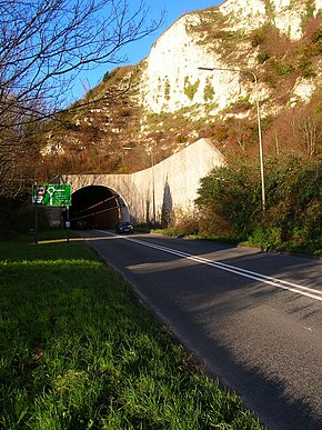 A26 Cuilfail Tunnel in Lewes | |
| Major junctions | |
| North east end | Maidstone |
| |
| South west end | Newhaven |
| Location | |
| Primary destinations | Tunbridge Wells, Tonbridge, Maidstone, Lewes |
| Road network | |
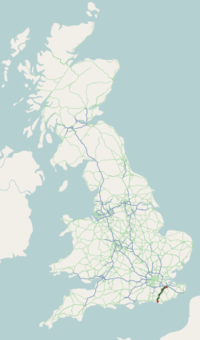
The A26 road is a primary route in the southeast of England, going from Maidstone to Newhaven through the counties of Kent and East Sussex. The road is almost entirely single carriageway with one lane on each side, although some of the road is three lanes, with the middle lane switching sides for overtaking and right turns.
The road runs for a total distance of some 50 miles (80 kilometres) and provides access to the North Kent area and its industrial base with the ferry port of Newhaven. In consequence it has a large Heavy Goods Vehicle usage.
History[]
The A26 was originally classified in 1922, and went from Maidstone to Brighton, along part of what is now the A27.[1] The part of the road going from Lewes was later reclassified to the A27 between 1947 and1951[2][3] The road was later extended along the B2109, after 1969.[4]
Route[]
Maidstone to Tonbridge[]
The road starts on the A20, in Maidstone, and then heads west to the A228, going past Barming, Barming Heath, Teston, Wateringbury, and Mereworth.
It then turns south-west and towards Tonbridge, passing Hadlow and Higham wood on its way there.
Once it gets to Tonbridge it combines with the A2014 and heads west, until meeting the B2260, where it again starts going south-west.[5][6]
Tonbridge to Maresfield[]
Heading south-west from Tonbridge, the A26 crosses the A21, and heads towards Crowborough, passing through Bidborough, Southborough, Royal Tunbridge Wells, Eridge Green, and Boarshead.
The road then passes through Crowborough, going past the B2100, and then goes towards Maresfield, where it is interrupted by the A22.[5][6]
Ridgewood to Newhaven[]
Again heading south-west, the road meets with the A2029 in Lewes after passing Little Horsted, and leaves Lewes heading south via Cuilfail Tunnel until it is interrupted again, this time by the A27.
After a short stretch of road where it is merged with the A27 it heads south, ending on the A259 in Newhaven, after passing Tarring Neville and South Heighton.[5][6]
Distinguishing features[]
When entering Lewes from the direction of Uckfield, one is met with a view of the chalk cliffs at the very edge of the South Downs. Following this you will enter the Cuilfail Tunnel, constructed in 1983, which leaves at the roundabout The Culfail Spiral, a sculpture created by Peter Randall-Page.
References[]
- ^ "SABRE - Maps". www.sabre-roads.org.uk. Retrieved 11 March 2021.
- ^ "SABRE - Maps". www.sabre-roads.org.uk. Retrieved 11 March 2021.
- ^ "View map: Sussex LIV.SW - Ordnance Survey Six-inch England and Wales, 1842-1952". maps.nls.uk. Retrieved 9 April 2021.
- ^ "SABRE - Maps". www.sabre-roads.org.uk. Retrieved 11 March 2021.
{{cite web}}: CS1 maint: url-status (link) - ^ a b c "A26". OpenStreetMap. Retrieved 11 February 2021.
- ^ a b c "A26 - Roader's Digest: The SABRE Wiki". www.sabre-roads.org.uk. Retrieved 12 February 2021.
External links[]
![]() Media related to A26 road (England) at Wikimedia Commons
Media related to A26 road (England) at Wikimedia Commons
A roads in Zone 2 of the Great Britain road numbering scheme | ||
|---|---|---|
| South West | |
|---|---|
| Area 3 (South) | |
| Area 4 (South East) | |
| Area 5 (DBFO) (M25 links) | |
| East | |
| Area 7 (East Midlands) | |
| Area 9 (West Midlands) | |
| North West | |
| Area 12 (Yorks/Lincs) | |
| Area 14 (North East) | |
| Other DBFO | |
| Toll roads | |

- Roads in England
- Transport in East Sussex
- Roads in Kent
- Road tunnels in England