Mandailing Natal Regency
Mandailing Natal Regency
(Kabupaten Mandailing Natal) | |
|---|---|
 Coat of arms | |
 | |
| Country | Indonesia |
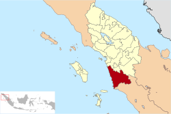
| Province | North Sumatra |
| Regency seat | Panyabungan |
| Government | |
| • Regent | Dahlan Hasan Nasution |
| • Vice Regent | Muhammad Jafar Sukhairi Nasution |
| • Chairman of Council of Representatives | Erwin Efendi Lubis (Gerindra) |
| • Vice Chairmen of Council of Representatives | Harminsyah Batubara (Partai Demokrat) and Erwin Efendi Nasution (Golkar) |
| Area | |
| • Total | 6,620.70 km2 (2,556.27 sq mi) |
| Population (2020 Census)[1] | |
| • Total | 472,886 |
| • Density | 71/km2 (180/sq mi) |
| Time zone | UTC+7 (WIB) |
| Website | www |
Mandailing Natal, abbreviated as Madina, is a regency in North Sumatra Province of Indonesia. It covers an area of 6,620.70 square kilometres and it had a population of 403,894 people at the 2010 census[2] and 472,886 at the 2020 Census.[3] The capital lies at Panyabungan.
Administration[]
At the 2010 Census, the regency was divided into eighteen districts (kecamatan). Subsequently, five additional districts (indicated by asterisks in the table below) have been created by the division of existing districts. The twenty-three districts are tabulated below with their areas and their population at the 2010 Census [4] and the 2020 Census[5] The table also includes the locations of the district administrative centres, the number of administrative villages (desa and kelurahan) in each district and its post code.
| Name | Area in km2 |
Pop'n Census 2010[4] |
Pop'n Census 2020[6] |
Administrative centre |
No. of vill. |
Post code |
|---|---|---|---|---|---|---|
| Batahan | 497.07 | 17,524 | 22,509 | Pasar Batahan | 18 | 22988 |
| Sinunukan * | 192.64 | 15,375 | 21,527 | Sinunukan III | 14 | 22986 |
| Batang Natal | 651.52 | 22,575 | 25,333 | Muara Soma | 31 | 22983 |
| Lingga Bayu | 192.68 | 22,453 | 27,576 | Simpang Gambir | 20 | 22982 |
| Ranto Baek * | 152.72 | 11,259 | 14,085 | Manisak | 17 | 22984 |
| Kotanopan | 325.15 | 26,264 | 27,871 | Pasar Kotanopan | 37 | 22994 |
| Ulu Pungkut | 295.19 | 4,250 | 4,674 | Huta Godang | 12 | 22999 |
| Tambangan | 158.60 | 11,471 | 10,913 | Laru Lombang | 20 | 22996 |
| Lembah Sorik Marapi | 34.73 | 15,605 | 10,968 | Pasar Maga | 9 | 22993 |
| Puncak Sorik Marapi * | 55.54 | 7,954 | 8,975 | Sibanggor | 11 | 22995 |
| Muara Sipongi | 135.70 | 9,670 | 12,528 | Pasar Muara Sipongi | 16 | 22998 |
| Pakantan * | 93.60 | 2,146 | 2,222 | Pakantan | 8 | 22997 |
| Panyabungan | 259.77 | 77,449 | 90,049 | Panyabungan | 39 | 22915 -22919 |
| Panyabungan Selatan (South Panyabungan) | 87.60 | 9,410 | 10,323 | Tano Bato | 11 | 22952 |
| Panyabungan Barat (West Panyabungan) | 87.22 | 8,911 | 10,677 | Longat | 10 | 22911 |
| Panyabungan Utara (North Panyabungan) | 63.73 | 19,991 | 22,573 | Mompang | 14 | 22979 |
| Panyabungan Timur (East Panyabungan) | 397.87 | 12,307 | 14,214 | Gunung Baringin | 15 | 22912 |
| Huta Bargot * | 116.21 | 5,715 | 8,748 | Bangun Sejati | 12 | 22978 |
| Natal | 935.37 | 27,292 | 33,897 | Pasar Natal | 30 | 22987 |
| Muara Batang Gadis | 1,435.02 | 15,416 | 22,322 | Singkuang | 14 | 22989 |
| Siabu | 345.36 | 47,364 | 53,286 | Siabu | 28 | 22976 |
| Bukit Malintang | 68.74 | 10,894 | 12,771 | Bukit Malintang | 11 | 22977 |
| Naga Juang * | 58.69 | 3,650 | 4,845 | Banua Simanosor | 7 | 22975 |
| Totals | 6,620.70 | 403,894 | 472,886 | Panyabungan | 404 |
National Park[]


see Batang Gadis National Park
References[]
- ^ Badan Pusat Statistik, Jakarta, 2021.
- ^ Seta,William J. Atlas Lengkap Indonesia dan Dunia (untuk SD, SMP, SMU, dan Umum). Pustaka Widyatama. p. 9. ISBN 979-610-232-3.
- ^ Badan Pusat Statistik, Jakarta, 2021.
- ^ a b Biro Pusat Statistik, Jakarta, 2011.
- ^ Badan Pusat Statistik, Jakarta, 2021.
- ^ Badan Pusat Statistik, Jakarta, 2021.

This North Sumatra location article is a stub. You can help Wikipedia by . |

- North Sumatra geography stubs
- Regencies of North Sumatra