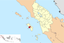
West Nias Regency
This article may be expanded with text translated from the corresponding article in Indonesian. (December 2008) Click [show] for important translation instructions.
|
West Nias Regency
(Kabupaten Nias Barat) | |
|---|---|
 Seal | |
 | |
| Country | Indonesia |
| Province | North Sumatra |
| Regency seat | Lahömi |
| Government | |
| • Regent | Khenoki Waruwu |
| • Vice Regent | Era Era Hia |
| • Chairman of Council of Representatives | Evolut Zebua (PDI-P) |
| • Vice Chairmen of Council of Representatives | Haogömanö Gulö (People's Conscience Party) and Tolosökhi Halawa (Nasdem) |
| Area | |
| • Total | 520.34 km2 (200.90 sq mi) |
| Population (2020 Census)[1] | |
| • Total | 89,994 |
| • Density | 170/km2 (450/sq mi) |
| Time zone | UTC+7 (WIB) |
| Website | niasbaratkab.go.id |
West Nias Regency (Indonesian: Kabupaten Nias Barat) is a regency in North Sumatra province of Indonesia. The regency seat is Lahomi. It covers the western portion of Nias Island. The Regency covers an area of 520.34 km2, and had a population of 81,807 at the 2010 Census[2] and 89,994 at the 2020 Census.[3] This regency was founded in 2008 by UU (Law) No.46 Tahun (Year) 2008; formerly, the area was part of Nias Regency.
Borders[]
West Nias Regency is bordered by:[4]
- North: Tugala Oyo District of North Nias Regency;
- South: Lolowa'u District of South Nias Regency;
- East: Botomuzoi, Hili Serangkai, Gido, and Ma'u Districts of Nias Regency;
- West: Indian Sea.
Administration[]
The regency is divided into eight districts (kecamatan), tabulated below with their areas (in km2) and their populations at the 2010 Census [2] and the 2020 Census.[5] The table also includes their administrative centres and the number of villages (rural desa and urban kelurahan) within each district, and its post code.
| Name | Area in km2 |
Pop'n Census 2010[2] |
Pop'n Census 2020[6] |
Admin centre |
Number of villages |
Post code |
|---|---|---|---|---|---|---|
| Sirombu (a) | 118.79 | 9,478 | 13,077 | Tetesua | 25 | 22863 |
| Lahomi | 88.39 | 7,548 | 10,454 | Sitolubanua | 11 | 22864 |
| Ulu Moro'o | 28.58 | 7,666 | 6,702 | Lawelu | 5 | 22862 |
| Lolofitu Moi | 53.84 | 13,674 | 10,384 | Lolofitu | 8 | 22875 |
| Mandrehe Utara (North Mandrehe) |
39.56 | 7,920 | 9,062 | Lahagu | 12 | 22813 |
| Mandrehe | 77.59 | 18,697 | 22,077 | Fadoro | 20 | 22862 (b) |
| Mandrehe Barat (West Mandrehe) |
61.29 | 7,384 | 8,243 | Lasarafaga | 14 | 22812 |
| Moro'o | 52.30 | 9,440 | 9,995 | Hilifadolo | 10 | 22862 |
| Totals | 520.34 | 81,807 | 89,994 | Lahomi | 105 |
Notes: (a) Sirombu District includes the eleven offshore Hinako Islands. (b) except the village of Hayo, with a post code of 22867.
References[]

Coordinates: 1°03′35″N 97°35′10″E / 1.0597°N 97.5861°E

This North Sumatra location article is a stub. You can help Wikipedia by . |
- Regencies of North Sumatra
- North Sumatra geography stubs