North Nias Regency
This article may be expanded with text translated from the corresponding article in Indonesian. (December 2008) Click [show] for important translation instructions.
|
North Nias Regency
(Kabupaten Nias Utara) | |
|---|---|
 Coat of arms | |
 | |
| Country | Indonesia |
| Province | North Sumatra |
| Regency seat | Lotu |
| Government | |
| • Regent | Amizaro Waruwu |
| • Vice Regent | Yusman Zega |
| • Chairman of Council of Representatives | Sukanto Waruwu (Golkar) |
| • Vice Chairmen of Council of Representatives | Noferman Zega (National Mandate Party) and Fatizaro Hulu (Gerindra) |
| Area | |
| • Total | 1,242.14 km2 (479.59 sq mi) |
| Population (2020 Census)[1] | |
| • Total | 147,274 |
| • Density | 120/km2 (310/sq mi) |
| Time zone | UTC+7 (WIB) |
| Website | niasutarakab.go.id |
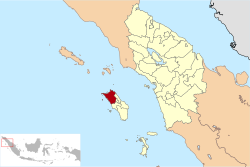
Nias Utara (North Nias) Regency is a regency in North Sumatra province of Indonesia. It comprises the northern portion of Nias Island and has an area of 1,242.14 km2. It had a population of 127,244 at the 2010 Census[2] and 147,274 at the 2020 Census.[3] The administrative capital is Lotu.
Administration[]
The regency is divided into eleven districts (kecamatan), tabulated below with their areas (in km2) and their 2010 Census[4] and 2020 Census[5] populations. The table also includes the locations of the district administrative centres, the number of administrative villages (rural desa and urban kelurahan) in each district, and its post code.
| Name | Area in km2 |
Pop'n Census 2010[6] |
Pop'n Census 2020[7] |
Admin centre |
Number of villages |
Post code |
|---|---|---|---|---|---|---|
| Tugala Oyo | 84.18 | 6,094 | 6,873 | Desa Teolo | 8 | 22860 |
| Alasa | 197.55 | 18,939 | 20,836 | Ombolato Alasa | 14 | 22861 |
| Alasa Talumuzoi | 76.39 | 6,495 | 7,071 | Hilimbowo Kare | 6 | 22814 |
| Namohalu Esiwa | 120.54 | 12,158 | 14,838 | Namohalu | 11 | 22816 (a) |
| Sitolu Ori | 76.29 | 11,409 | 13,447 | Hilisaloo | 6 | 22852 |
| Tuhemberua | 48.59 | 10,377 | 13,044 | Silimabanua | 8 | 22852 |
| Sawo (b) | 67.79 | 9,604 | 11,071 | Sawo | 10 | 22852 |
| Lotu | 115.98 | 11,139 | 13,614 | Hilidundra | 13 | 22856 |
| Lahewa Timur (East Lahewa) |
128.66 | 9,863 | 10,224 | Lukhulase | 7 | 22858 |
| Afulu (c) | 150.95 | 10,492 | 11,771 | Afulu | 9 | 22857 |
| Lahewa (d) | 175.22 | 20,674 | 24,485 | Pasar Lahewa | 21 | 22853 |
| Totals | 1,242.14 | 127,244 | 147,274 | Lotu | 113 |
Notes: (a) except the village of Sisobahili, with a post code of 22817. (b) including offshore Pulau Sarangbaung. (c) including offshore Pulau Wunga. (d) including 17 offshore islands.
References[]

Coordinates: 1°19′49″N 97°19′11″E / 1.3304°N 97.3196°E

This North Sumatra location article is a stub. You can help Wikipedia by . |
- Regencies of North Sumatra
- North Sumatra geography stubs