Mankayan
Mankayan | |
|---|---|
| Municipality of Mankayan | |
 Lepanto Mines Airstrip | |
 Flag  Seal | |
| Motto(s): North to the Future of Benguet | |
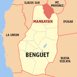 Map of Benguet with Mankayan highlighted | |
OpenStreetMap  | |
 Mankayan Location within the Philippines | |
| Coordinates: 16°52′N 120°47′E / 16.87°N 120.78°ECoordinates: 16°52′N 120°47′E / 16.87°N 120.78°E | |
| Country | Philippines |
| Region | Cordillera Administrative Region |
| Province | Benguet |
| District | Lone district |
| Founded | 1955 |
| Barangays | 12 (see Barangays) |
| Government | |
| • Type | Sangguniang Bayan |
| • Mayor | Frenzel A. Ayong |
| • Vice Mayor | Joseph Denver B. Tongacan |
| • Representative | Nestor B. Fongwan |
| • Electorate | 20,852 voters (2019) |
| Area | |
| • Total | 130.48 km2 (50.38 sq mi) |
| Elevation | 1,338 m (4,390 ft) |
| Highest elevation | 2,214 m (7,264 ft) |
| Lowest elevation | 666 m (2,185 ft) |
| Population (2020 census) [3] | |
| • Total | 37,233 |
| • Density | 290/km2 (740/sq mi) |
| • Households | 8,062 |
| Economy | |
| • Income class | 1st municipal income class |
| • Poverty incidence | 9.34% (2015)[4] |
| • Revenue | ₱175,268,339.49 (2020) |
| • Assets | ₱334,594,585.92 (2020) |
| • Expenditure | ₱170,584,450.59 (2020) |
| • Liabilities | ₱28,917,760.34 (2020) |
| Service provider | |
| • Electricity | Benguet Electric Cooperative (BENECO) |
| Time zone | UTC+8 (PST) |
| ZIP code | 2608 |
| PSGC | |
| IDD : area code | +63 (0)74 |
| Native languages | Kankanaey Ibaloi Ilocano Tagalog |

Mankayan, officially the Municipality of Mankayan (Kankanaey: Ilin di Mankayan; Ilocano: Ili ti Mankayan; Tagalog: Bayan ng Mankayan), is a 1st class municipality in the province of Benguet, Philippines. According to the 2020 census, it has a population of 37,233 people. [3]
The municipality is known as a mining town, being the location of several mines, including the Lepanto Consolidated Mining Company.[5][6]
Etymology[]
The name "Mankayan" is derived from Nancayan, the Hispanic term of the native name of the place, Nangkayang (which means "high up in the mountain").[5][6]
History[]
Pre-colonial period[]
Nangkayang was once a heavily forested area. The natives of the surrounding settlements of Panat and Bag-ongan mined gold through the labon system, after its reported discovery in a river. Copper was later discovered by the end of the 16th century in Kamangga-an (location of present-day Lepanto).[6]
Spanish period[]
By the 1800s, the Spanish colonial government sent expeditions to survey the mines. On February 3, 1850, an expedition led by engineer Don Antonio Hernandez confirmed the presence of copper in Mankayan.
In 1852, Lepanto was established by the Spanish as a comandancia politico-militar,[6][7] composed of several rancherias which included Mankayan.[5]
Seven different mines were discovered in the Mankayan-Suyoc region during Admiral Pedro Durán de Monforte's 1667 expedition, and Simón de Anda's administration (1770-1776) mentioned Igorot copperware. In 1833, Galvey sent ore samples from Gambang ("copper"), Suyoc, and Mankayan, to the governor. The first Spanish mining claim on the Cordillera was made by Tomás Balbas y Castro on 26 March 1856,[8] and established a mining company called the Sociedad Minero-Metalurgica Cantabro Filipino de Mancayan.[5] The company ceased operations in 1875.[6]
American period[]
Under the American rule, Mankayan remained under the jurisdiction of Lepanto, and later Lepanto-Bontoc until the latter's dissolution. Mankayan was later annexed to the sub-province of Benguet as a municipal district in 1913.[5][6]
The in Mankayan began in 1933, with American establishing the on September 26, 1936.[5][6]
Second World War[]
In 1942, following the outbreak of the war, the Lepanto Consolidated Mining Company, together with the , were taken over by the Japanese , which renamed the mines into "Mitsui Mankayan Copper Mines". The Mitsui Company controlled the mines until 1945.[5][6][9]
Post-war era[]
After the war, the Lepanto Consolidated Mining Company resumed the mining operations.[5][6]
Mankayan was converted from a municipal district into a regular municipality on June 16, 1955, by virtue of Republic Act 1302.[10][11]
In 2018, in order to preserve the highly artistic gangsa-making intangible heritage of the Mankayan elders, the cultural masters of the town converged and began teaching the younger generations the process and importance of gangsa-making to their way of life, effectively preserving indigenous gong culture in the town.[12]
Geography[]
Mankayan is on the north-western tip of Benguet. It is bordered by Bakun on the west, Buguias on the southeast, Tadian and Bauko on the east, and Cervantes on the north-west.
According to the Philippine Statistics Authority, the municipality has a land area of 130.48 square kilometres (50.38 sq mi) [13] constituting 4.71% of the 2,769.08-square-kilometre- (1,069.15 sq mi) total area of Benguet.
Barangays[]
Mankayan is politically subdivided into 12 barangays.[14]
| PSGC | Barangay | Population | ±% p.a. | |||
|---|---|---|---|---|---|---|
| 2020 [3] | 2010 [15] | |||||
| 141111001 | Balili | 17.6% | 6,537 | 6,236 | 0.49% | |
| 141111002 | Bedbed | 2.8% | 1,058 | 864 | 2.11% | |
| 141111003 | Bulalacao | 8.6% | 3,205 | 3,349 | −0.45% | |
| 141111004 | Cabiten | 5.7% | 2,129 | 1,854 | 1.43% | |
| 141111005 | Colalo | 3.4% | 1,268 | 1,232 | 0.30% | |
| 141111006 | Guinaoang | 6.0% | 2,249 | 1,855 | 2.00% | |
| 141111008 | Paco | 15.4% | 5,744 | 6,035 | −0.51% | |
| 141111009 | Palasaan | 6.3% | 2,358 | 2,348 | 0.04% | |
| 141111010 | Poblacion | 6.9% | 2,572 | 3,084 | −1.85% | |
| 141111011 | Sapid | 8.6% | 3,218 | 3,271 | −0.17% | |
| 141111012 | Tabio | 10.4% | 3,855 | 3,792 | 0.17% | |
| 141111013 | Taneg | 4.7% | 1,760 | 1,666 | 0.57% | |
| Total | 37,233 | 35,586 | 0.47% | |||
Climate[]
| Climate data for Mankayan, Benguet | |||||||||||||
|---|---|---|---|---|---|---|---|---|---|---|---|---|---|
| Month | Jan | Feb | Mar | Apr | May | Jun | Jul | Aug | Sep | Oct | Nov | Dec | Year |
| Average high °C (°F) | 20 (68) |
22 (72) |
23 (73) |
25 (77) |
24 (75) |
24 (75) |
23 (73) |
23 (73) |
23 (73) |
23 (73) |
22 (72) |
21 (70) |
23 (73) |
| Average low °C (°F) | 13 (55) |
14 (57) |
15 (59) |
17 (63) |
18 (64) |
18 (64) |
18 (64) |
18 (64) |
18 (64) |
17 (63) |
16 (61) |
15 (59) |
16 (61) |
| Average precipitation mm (inches) | 35 (1.4) |
46 (1.8) |
63 (2.5) |
117 (4.6) |
402 (15.8) |
400 (15.7) |
441 (17.4) |
471 (18.5) |
440 (17.3) |
258 (10.2) |
94 (3.7) |
68 (2.7) |
2,835 (111.6) |
| Average rainy days | 9.9 | 11.1 | 13.9 | 18.9 | 26.0 | 27.3 | 28.9 | 28.5 | 26.1 | 19.7 | 14.5 | 12.8 | 237.6 |
| Source: Meteoblue [16] | |||||||||||||
Demographics[]
| Year | Pop. | ±% p.a. |
|---|---|---|
| 1903 | 118 | — |
| 1918 | 2,977 | +24.01% |
| 1939 | 6,865 | +4.06% |
| 1948 | 5,742 | −1.97% |
| 1960 | 13,812 | +7.59% |
| 1970 | 21,780 | +4.65% |
| 1975 | 24,123 | +2.07% |
| 1980 | 25,684 | +1.26% |
| 1990 | 32,889 | +2.50% |
| 1995 | 34,699 | +1.01% |
| 2000 | 34,502 | −0.12% |
| 2007 | 34,563 | +0.02% |
| 2010 | 35,586 | +1.07% |
| 2015 | 35,953 | +0.20% |
| 2020 | 37,233 | +0.69% |
| Source: Philippine Statistics Authority [17] [15] [18][19] | ||
In the 2020 census, Mankayan had a population of 37,233. [3] The population density was 290 inhabitants per square kilometre (750/sq mi).
Economy[]
| Poverty Incidence of Mankayan | |
| Source: Philippine Statistics Authority[20][21][22][23][24][25] | |
Education[]
Public schools[]
As of 2014, Mankayan has 35 public elementary schools and 9 public secondary schools.[26][27][28]
|
|
References[]
- ^ Municipality of Mankayan | (DILG)
- ^ "2015 Census of Population, Report No. 3 – Population, Land Area, and Population Density" (PDF). Philippine Statistics Authority. Quezon City, Philippines. August 2016. ISSN 0117-1453. Archived (PDF) from the original on May 25, 2021. Retrieved July 16, 2021.
- ^ a b c d Census of Population (2020). "Cordillera Administrative Region (CAR)". Total Population by Province, City, Municipality and Barangay. PSA. Retrieved 8 July 2021.
- ^ https://psa.gov.ph/sites/default/files/City%20and%20Municipal-level%20Small%20Area%20Poverty%20Estimates_%202009%2C%202012%20and%202015_0.xlsx; publication date: 10 July 2019; publisher: Philippine Statistics Authority.
- ^ a b c d e f g h "Municipality of Mankayan". Province of Benguet (official website). Retrieved 6 January 2015.
- ^ a b c d e f g h i "Municipality of Mankayan, Benguet". Department of the Interior and Local Government - Cordillera Administrative Region (official website). 29 April 2013. Archived from the original on 6 February 2015. Retrieved 6 January 2015.
- ^ "History: Benguet Province". Province of Benguet (official website). Archived from the original on 19 October 2014. Retrieved 6 January 2015.
- ^ Scott, William (1974). The Discovery of the Igorots. Quezon City: New Day Publishers. pp. 57–60, 245–246. ISBN 9711000873.
- ^ Bagamaspad, Anavic; Hamada-Pawid, Zenaida (1985). A People's History of Benguet. Baguio Printing & Publishing Company, Inc. p. 299.
- ^ "R.A. No. 1302: An Act to Convert the Municipal District of Mankayan, Sub-province of Benguet, Mountain Province, into a Municipality". Chan Robles Virtual Law Library. Retrieved 6 January 2015.
- ^ "R.A. No. 1302: An Act to Convert the Municipal District of Mankayan, Sub-province of Benguet, Mountain Province, into a Municipality". PhilippineLaw.info. Retrieved 6 January 2015.
- ^ http://pia.gov.ph/news/articles/1004356
- ^ "Province: Benguet". PSGC Interactive. Quezon City, Philippines: Philippine Statistics Authority. Retrieved 12 November 2016.
- ^ "Municipal: Mankayan". PSGC Interactive. Quezon City, Philippines: Philippine Statistics Authority. Retrieved 8 January 2016.
- ^ a b Census of Population and Housing (2010). "Cordillera Administrative Region (CAR)". Total Population by Province, City, Municipality and Barangay. NSO. Retrieved 29 June 2016.
- ^ "Mankayan: Average Temperatures and Rainfall". Meteoblue. Retrieved 21 March 2020.
- ^ Census of Population (2015). "Cordillera Administrative Region (CAR)". Total Population by Province, City, Municipality and Barangay. PSA. Retrieved 20 June 2016.
- ^ Censuses of Population (1903–2007). "Cordillera Administrative Region (CAR)". Table 1. Population Enumerated in Various Censuses by Province/Highly Urbanized City: 1903 to 2007. NSO.
- ^ "Province of Benguet". Municipality Population Data. Local Water Utilities Administration Research Division. Retrieved 17 December 2016.
- ^ "Poverty incidence (PI):". Philippine Statistics Authority. Retrieved 28 December 2020.
- ^ https://psa.gov.ph/sites/default/files/NSCB_LocalPovertyPhilippines_0.pdf; publication date: 29 November 2005; publisher: Philippine Statistics Authority.
- ^ https://psa.gov.ph/sites/default/files/2003%20SAE%20of%20poverty%20%28Full%20Report%29_1.pdf; publication date: 23 March 2009; publisher: Philippine Statistics Authority.
- ^ https://psa.gov.ph/sites/default/files/2006%20and%202009%20City%20and%20Municipal%20Level%20Poverty%20Estimates_0_1.pdf; publication date: 3 August 2012; publisher: Philippine Statistics Authority.
- ^ https://psa.gov.ph/sites/default/files/2012%20Municipal%20and%20City%20Level%20Poverty%20Estima7tes%20Publication%20%281%29.pdf; publication date: 31 May 2016; publisher: Philippine Statistics Authority.
- ^ https://psa.gov.ph/sites/default/files/City%20and%20Municipal-level%20Small%20Area%20Poverty%20Estimates_%202009%2C%202012%20and%202015_0.xlsx; publication date: 10 July 2019; publisher: Philippine Statistics Authority.
- ^ "Masterlist of Public Elementary Schools for the School year 2012- 2013". Department of Education (Philippines), July 15, 2013. Archived from the original (XLSX) on 4 March 2016. Retrieved 28 December 2014.
- ^ a b "Masterlist of Secondary Schools (School Year 2013- 2014)". Department of Education (Philippines), July 4, 2013. Archived from the original (XLSX) on 1 July 2014. Retrieved 20 November 2014.
- ^ a b "Masterlist of Public Schools SY 2013-2014". Department of Education (Philippines), 22 October 2014. Archived from the original (XLSX) on 21 April 2016. Retrieved 28 December 2014.
External links[]
Places adjacent to Mankayan | ||||||||||||||||
|---|---|---|---|---|---|---|---|---|---|---|---|---|---|---|---|---|
| ||||||||||||||||
La Trinidad (capital) | |
| Municipalities | |
| Highly urbanized city |
|
| Barangays | |
- Municipalities of Benguet
- Populated places on the Abra River
- Mining communities in the Philippines