Mascotte, Florida
Mascotte, Florida | |
|---|---|
City | |
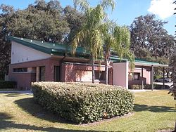 City hall | |
 Location in Lake County and the state of Florida | |
| Coordinates: 28°34′35″N 81°53′18″W / 28.57639°N 81.88833°WCoordinates: 28°34′35″N 81°53′18″W / 28.57639°N 81.88833°W | |
| Country | |
| State | |
| County | |
| Government | |
| • Mayor | Mike Sykes |
| Area | |
| • Total | 18.05 sq mi (46.74 km2) |
| • Land | 12.38 sq mi (32.08 km2) |
| • Water | 5.66 sq mi (14.67 km2) |
| Elevation | 135 ft (41 m) |
| Population (2010) | |
| • Total | 5,101 |
| • Estimate (2019)[4] | 6,315 |
| • Density | 509.93/sq mi (196.88/km2) |
| Time zone | UTC-5 (Eastern (EST)) |
| • Summer (DST) | UTC-4 (EDT) |
| ZIP code | 34753 |
| Area code | 352 |
| FIPS code | 12-43425[2] |
| GNIS feature ID | 0286499[3] |
| Website | www |

Mascotte is a city in Lake County, Florida, United States. The population was 5,101 at the 2010 census. As of 2018, the population recorded by the U.S. Census Bureau is 5,873.[5] It is part of the Orlando–Kissimmee–Sanford Metropolitan Statistical Area.
Geography[]

According to the United States Census Bureau, the city has a total area of 2.8 square miles (7.3 km2), of which 2.4 square miles (6.2 km2) is land and 0.4 square miles (1.0 km2) (13.83%) is water.
History[]
The town is named for a small ship that was used to haul tobacco from Cuba during the Spanish–American War. That ship appears on the seal of the city of Tampa and Mascotte. There are numerous photos of Mascotte in service between Tampa, Key West and Havana, 1886 through 1924, until sold north.[6]
Demographics[]
| Historical population | |||
|---|---|---|---|
| Census | Pop. | %± | |
| 1930 | 260 | — | |
| 1940 | 239 | −8.1% | |
| 1950 | 440 | 84.1% | |
| 1960 | 702 | 59.5% | |
| 1970 | 966 | 37.6% | |
| 1980 | 1,112 | 15.1% | |
| 1990 | 1,761 | 58.4% | |
| 2000 | 2,687 | 52.6% | |
| 2010 | 5,101 | 89.8% | |
| 2019 (est.) | 6,315 | [4] | 23.8% |
| U.S. Decennial Census[7] | |||
As of the census[2] of 2013, there were 5,251 people, 803 households, and 634 families residing in the city. The population density was 1,106.2 inhabitants per square mile (426.9/km2). There were 858 housing units at an average density of 353.2 per square mile (136.3/km2). The racial makeup of the city was 67.03% White, 4.21% African American, 0.67% Native American, 0.48% Asian, 23.67% from other races, and 3.94% from two or more races. Hispanic or Latino of any race were 43.92% of the population.
There were 803 households, out of which 47.4% had children under the age of 18 living with them, 56.5% were married couples living together, 10.6% had a female householder with no husband present, and 21.0% were non-families. 12.6% of all households were made up of individuals, and 3.4% had someone living alone who was 65 years of age or older. The average household size was 3.33 and the average family size was 3.56.
In the city, the age distribution of the population shows 33.2% under the age of 18, 12.1% from 18 to 24, 33.1% from 25 to 44, 16.0% from 45 to 64, and 5.6% who were 65 years of age or older. The median age was 28 years. For every 100 females, there were 120.6 males. For every 100 females age 18 and over, there were 131.4 males.
The median income for a household in the city was $38,558, and the median income for a family was $40,483. Males had a median income of $24,139 versus $18,750 for females. The per capita income for the city was $12,346. About 10.8% of families and 15.7% of the population were below the poverty line, including 18.6% of those under age 18 and 10.4% of those age 65 or over.
References[]
- ^ "2019 U.S. Gazetteer Files". United States Census Bureau. Retrieved July 2, 2020.
- ^ Jump up to: a b "U.S. Census website". United States Census Bureau. Retrieved 2008-01-31.
- ^ "US Board on Geographic Names". United States Geological Survey. 2007-10-25. Retrieved 2008-01-31.
- ^ Jump up to: a b "Population and Housing Unit Estimates". United States Census Bureau. May 24, 2020. Retrieved May 27, 2020.
- ^ "Population and Housing Unit Estimates". Retrieved September 19, 2019.
- ^ Steamships of the Two Henrys, by Edward A. Mueller
- ^ "Census of Population and Housing". Census.gov. Retrieved June 4, 2015.
External links[]
| Wikimedia Commons has media related to Mascotte, Florida. |
| show Municipalities and communities of Lake County, Florida, United States |
|---|

| show Authority control |
|---|
- Cities in Lake County, Florida
- Greater Orlando
- Cities in Florida